2021 Greenbrier Trail – Day 3 – Journey Complete

We woke up a bit earlier today so that we could get wheels-down shortly after sunrise. We needed to ride about 55-60 miles, plus drive about 4 1/2 hours back home. Riding on this surface is much slower than the road, plus we are trying to enjoy the scenery, not race home. So after doing morning prayer, I finished the normal ritual of sunblock, chamois cream, loading up on some calories, and packing up for the journey home.

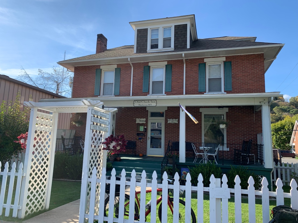
Our stay at the Old Clark Inn was very nice. I highly recommend staying there if you overnight in Marlinton. It is an old inn dating back to the early 1900s, but it is well maintained and the owners do a good job of making it a nice home-away-from-home. They cater to cyclists with secure storage as well.

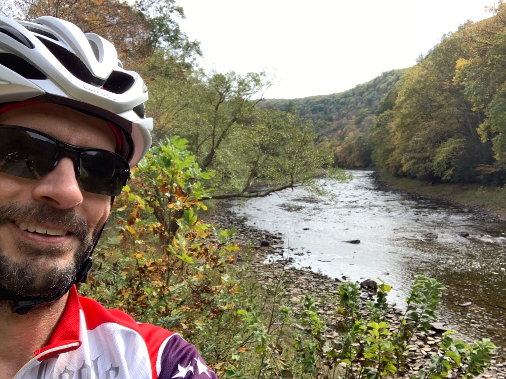
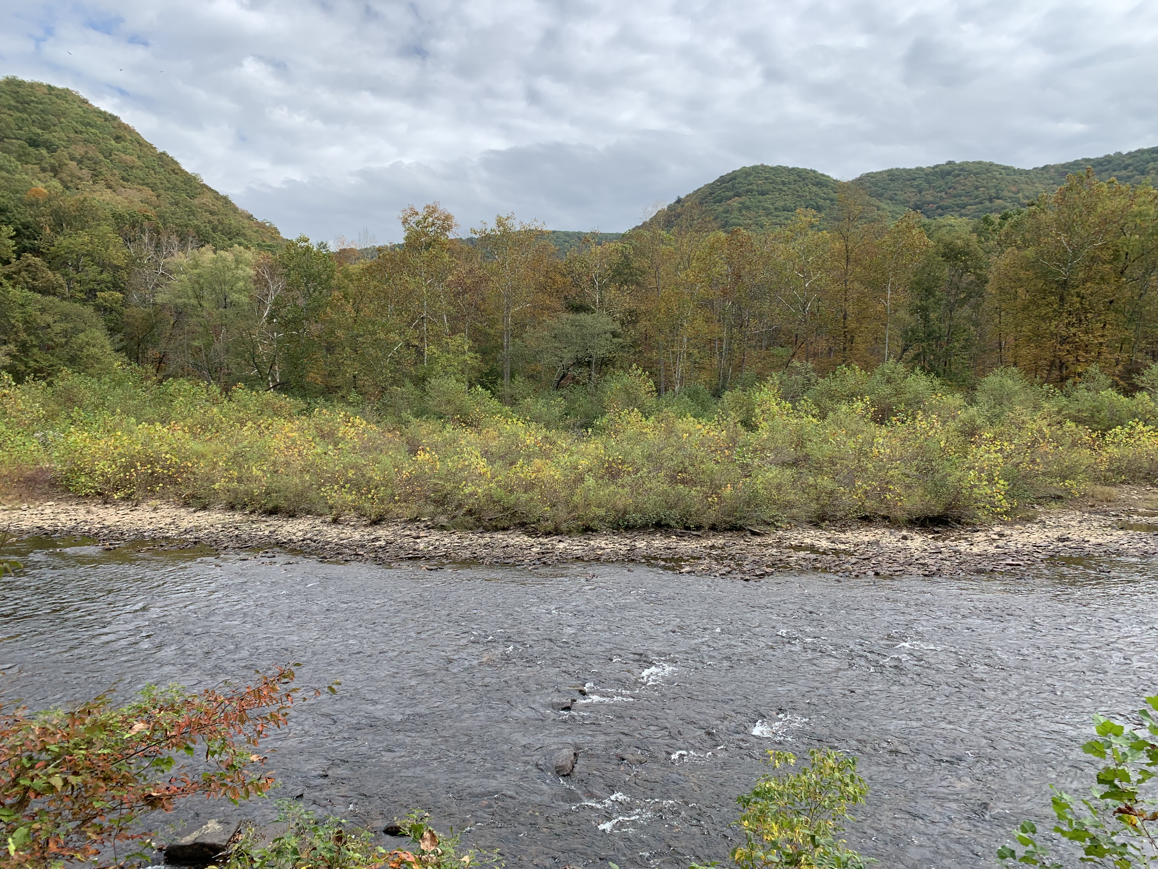
The weather today was faaaantastic. Cool and overcast. The morning fog kept us company for over 20 miles. The sun finally peeked out towards the end of the day and made it a bit warmer, but for the most part, it was just a beautiful fall day.

We saw many cabins and a few nicer homes along the river. Nearly every building was raised up on stilts or built upon a poured-concrete pedestal / garage about 10-15′ tall. This area had a massive flood in 1985 and again some time in the early 1990s, so the homes are raised to try to be flood proofed. In one of the pictures below you can see a flood mark on an older building we saw on a farm. I think this farm may be the only set of buildings we saw that were not on a raised foundation.

Plugging along, we took a break about every 12-15 miles to stretch the legs and our rear ends. One such stop was just outside a prison. I decided it was a good photo op for my bike.

Two of my favorite things commonly found on rail trails are bridges and tunnels. Only two tunnels on the GRT, but they were long enough to be fun. Most of the bridges were very short though.

On day 1, we discovered that there isn’t anyplace to get food between Lewisburg and Marlinton. So last night we picked up some Subway sandwiches to carry with us today. We held off eating until we reached Renick. We pulled off into a park pavilion to rest and eat our sandwiches.

The rest of the ride was beautiful and uneventful as we reached the south end of the trail. Many leaves were down and made for a nice soft-yet-crunchy surface. Each of us had to stop a few times when bunches of leaves would get caught under the fenders or in the gears to clear them. This trail is heavily tree-lined with a nice canopy for most of it. Even with lots of the leaves down, the canopy was pretty. I imagine it would be nicely shady and comfortable when the trees are full. We were a bit surprised that we did not see many cyclists the last three days. Perhaps it was lighter traffic since we rode mid-week.

We parked our car up at the Super8 in Lewisburg. On the way down from Lewisburg on day 1, we were treated to some really nice downhills into the valley. That meant today would finish with a big climb up from the valley. It was about 2 miles of steady climbing, ranging from about 4%-12% grade and rising about 750 feet. I generally like climbing, but I could tell that Joe was having some anxiety about the climb as we got closer to the end of the trail. Climbing with a fully-loaded touring bike is much harder than with a road bike, but I was still looking forward to a little challenge at the end.

We reached the southern end of the trail and rested for a bit. Joe and I talked over the options – I could leave him there and ride the last 5 miles to pick up the car, or he could ride with me. He decided to give it a shot and we both did great. It was a very pretty view from the top looking back at the mountains and realizing we had been at the river level just a few minutes earlier.

A few more surface miles took us back to the Super8 and our waiting car. The desk manager was kind enough to let us use a private area to change our clothes and clean up a little bit before getting in the car to drive home. A quick dinner stop at Arby’s was the only stop we made before getting home. It was great to get home and see my wife, my daughter, and Sophie, my best-buddy dog who was so happy to see me.

On the ride home, Joe and I compared our thoughts about the trail. First, the pros:

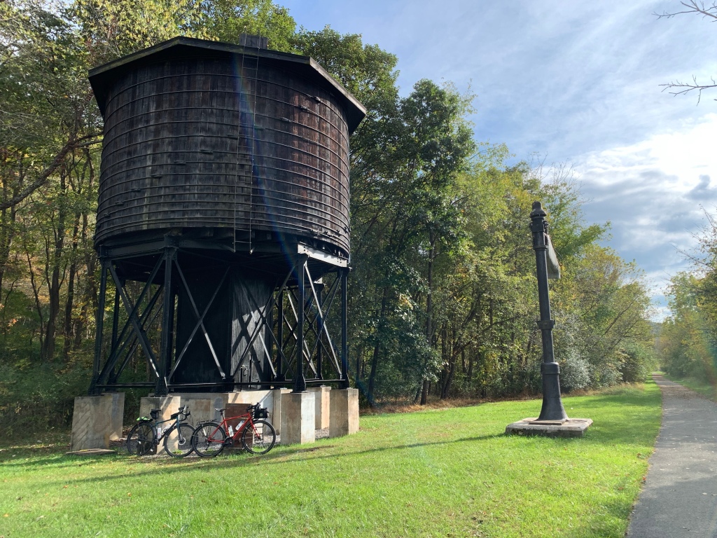
  • The GRT is a really great trail. Smooth, well maintained, and gorgeous scenery. The surface is good and you can probably ride it on 32MM or bigger tires without any trouble. The crushed limestone is well packed and we saw very few muddy patches. If you wanted to camp, there are several primitive camp sites and a few shelters where you could probably pitch a 1-man tent or bivy sack. Some of the sites also had pit-toilets and water pumps.

Some other considerations or cons:

  • There are very few towns along the trail. In the first fifty miles, we only saw one or two water pumps and only one mini-mart that was about .7 miles off the trail on a climb up the valley (Renick). The only major towns are Lewisburg and Cass at the two ends, and Marlinton about 50 miles north from Lewisburg. In between, it is just you and the trail and a few camp sites. There is also very little cell phone coverage. We really only had coverage in Lewisburg, and a mile or two near Renick and Marlinton. What that means is that if you were to have a major mechanical or medical issue, you could be 25+ miles from getting help. I recommend making sure you have enough spare equipment (tires, tubes, patch kit, chain tool, first-aid kit, etc…) to be self-sufficient because you probably won’t be able to call for help.
  • We didn’t see much opportunity for water on the southern 50 miles. We both used up our two water bottles during that section. If it had been a hot day, that could have been a problem. I recommend taking more water and make sure to take advantage of the pumps if you have room to refill your water.
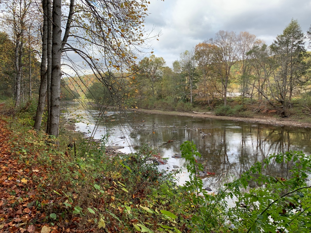
  • We didn’t see many opportunities to get down to the river itself. I kinda wanted to take my shoes off and dip my feet in the water. I didn’t get a chance to do that. On a hot day, that would have been refreshing.

Overall, I gave the trail a 7/10, Joe said 6.5/10. For me, it needs more services (food, water) and towns to adventure into. I very much enjoyed our three days. This trail feels very similar to the Great Allegheny passage in the area near Ohiopyle state park, but not as many places to explore.

Stats for the ride:

  • Miles: 164.75, including the ride to/from Lewisburg to the trailhead
  • Hours in the saddle: 15 Hours, 23 Minutes
  • Energy Bars: a few. Maybe 6?
  • Chicken wings: 1 dozen – 6 on Weds and 6 on Thurs. They were mighty tasty.
  • Beer: 1 glass. It was good, but I wasn’t in the mood for any more.

I hope to find a new adventure next year for a bike tour – probably more than three days. This was really a nice short tour with Joe and hopefully we’ll do it again soon. Riding solo is nice, but so is riding with good friends and enjoying the scenery.

Peace, Dcn. Matt

2021 Greenbrier Trail – Day 2

Last night we arrived in Marlinton and had a quiet evening. After dinner, we settled in and I was asleep before 10.

We took a relaxed time getting ready again today. We had a light breakfast at the Inn and then set off. It was a chilly start with heavy fog setting in the valley. It felt really great and we had nice weather all day long.

Our route today took us north to the end of the trail in Cass, about 25+ miles, then we returned to Marlinton for the evening. We totaled just shy of 50 miles.

The surface along the whole length of the trail was consistently good. Crushed limestone and very few soft spots.

The fog stayed with us for quite a while and made for a beautiful morning.

The Greenbrier River is very low. It is currently low enough that you could walk across it just about anywhere you wanted to. We talked to someone along the trail who said that it usually runs low in October. It is still pretty, but I think Joe and I agreed that it probably would be a bit nice with some more water running.

The colors of the leaves were a bit brighter on this section of the trail.

We arrived in Cass just after 11:30. It was good timing as they were beginning to board the 12:00 train to Bald Knob. Joe and I had talked about riding the train, but it is a 4.5 hour round trip and $75. We decided that 4.5 hours would put our return too late to ride back to Marlinton, plus the $75 seemed a bit steep. So instead, we just watched the train until it pulled away.

The Cass train is a chug train that was used to haul lumber out of this area. The train route is steep so the engine is designed to be able to drive a high torque system in the wheels.

After eating lunch in Cass, we turned around and pointed back to Marlinton. I also noticed that my Garmin radar unit was missing from my bike. The aluminum bracket that was attached to my rack must have fatigued enough to break off on the ride this morning. So somewhere between Marlinton and Cass is a Garmin radar unit. Sadly, although we kept our eyes open, we didn’t see it along the trail. That’s an expensive loss.

We’ve only seen a couple of longer bridges on the length of the trail. Here’s one of them.

As we approached Marlinton, the sun was showing on the mountain ahead and made a pretty view. The picture didn’t really do it justice.

After arriving back at the Inn, we got cleaned up and went in search of dinner. Joe still had leftovers from last night to eat tonight. Since I needed something, we walked to a Subway near by. I got 2 sandwiches: one for tonight and one for tomorrow. Joe got one for tomorrow as well. There really isn’t anything between Marlinton and Lewisburg to get food, so we decided to carry food for lunch tomorrow.

After dinner and some conversation, we went in search of a beer next door. We added some chicken wings for good measure. I have a feeling I’ll come back heavier than I left.

We will set off early in the morning to get back to Lewisburg. We’ll have about 55-60 miles tomorrow to get back to our car and then drive 4.5 hours back home. So we’ll get some good rest and be on our way.

Peace, Dcn. Matt

2021 Greenbrier Trail – Day 1

Back in 2010 I made my first bike trip, riding with my daughter across New York State on the Erie Canal. On that trip I discovered that I really enjoyed traveling by bike. There’s something really great about seeing the world at the pace of a bicycle, and it feels like most bike routes go through some very beautiful parts of the country.

Since then, I have done a bike trip each year (except 2012, I think?). I also find that having a trip to look forward to keeps me in shape and gives me a goal for the year. This year, I didn’t have a trip planned until recently. Instead I had been dedicating my training towards a challenging ride in the Sequatchie valley of Tennessee: Cycle Sequatchie Century and 3 Mountain Challenge. That ride was a couple of weekend ago and it was beautiful. I enjoyed the training, but I still wanted to try to find a relaxing multi-day trip by bike. The multi-day trips are like a rolling retreat.

A few weeks ago, I asked my trusty riding buddy, Joe, if he wanted to do a short trip. We decided to do a short 3-day bike trip on the Greenbrier River Trail. It isn’t a very long trail, nor is it many days, but we decided it would be a fun trip. The Greenbrier is nestled along the river and stretches from Lewisburg, WV to Cass, WV. Only about 75 miles, so we’re going out and back for a 150 mile round trip over 3 days.

We drove down from Lexington to Lewisburg and stayed last night at the Super 8. Let’s just say it was cost effective and you got what you paid for.

Nestled in for the evening. Bike never out of sight…

The trail starts about 5-6 miles from the hotel. We decided to leave the car and ride to the trailhead. Since Lewisburg is out of the valley, we had a nice ride on a country road that largely descended down. Coming back up might be a bit more challenging at the end of day three. I’m guessing it was about a 5-7% grade with some 10%+ sections. Much easier going down than up.

The weather today was absolutely perfect. We started with temps in the mid 50s and fog, but within a short time, the temperatures were in the mid/upper 60s and overcast. You can’t ask for better riding weather than that.

The beginning of the day

The trail is well marked and we had no trouble finding the south most trailhead. The surface is crushed limestone and is very well maintained. It is similar to the Great Allegheny Passage.

We chose this week partially because it is supposed to be very colorful foliage this week. There are quite a few leaves down along the trail, but not as much vibrant color as I had been hoping for. For nearly the entire ride we had the soft crunching of leaves beneath our wheels.

I love tunnels on bike trails

The trail description mentions 2 tunnels and lots of bridges. This was the only tunnel we saw today. It was long enough to need a headlamp, but not very long. This tunnel had a lot of wooden trusses set up near the north end to keep it stable.

One of only a couple large bridges

I only recall seeing 2 or 3 major bridges. The rest are all tiny 10-20’ long bridges over creeks that fed the river.

We took a very leisurely pace today. Our destination today was Marlinton, WV. This is about the only real town we’ve seen since leaving Lewisburg. We decided to book two nights here. We’ll venture north to Cass, about 25 miles, and then return here tomorrow evening.

We are staying at the Old Clark Inn. It is a nice older home that has been converted into hotel rooms. It is clean and comfortable.

After getting in and cleaned up, we went in search of dinner. We didn’t have a real lunch on the trail because we didn’t see anywhere to get lunch. We had some energy bars and muffins from the hotel that we carried with us. We also didn’t see anywhere to get water. If you come to ride the Greenbrier, make sure to bring enough water for the day.

We ate at a place called Alfredo’s. The food was good. I forgot to take my usual pictures of dinner. Oh well, just imagine me eating a pizza (without cheese, of course) and some chicken wings. Mmmm…

Joe’s been getting over a cold (no, not covid – he got tested). He not been feeling well this evening, so we may scale back our plans for tomorrow to allow him to get some rest. We’ll see how he feels in the morning.

Our plan for tomorrow is to head north to Cass, about 25 miles, then return. If we’re feeling good when we get to Cass, there is a really neat radio telescope about 9 miles by road north of Cass. I’d love to go check it out!

So until tomorrow, may the Lord bless you and keep you.

Peace, Dcn. Matt

Here’s a “relive” of our trail today.