2018 C&O / Gap Tour : Epilogue

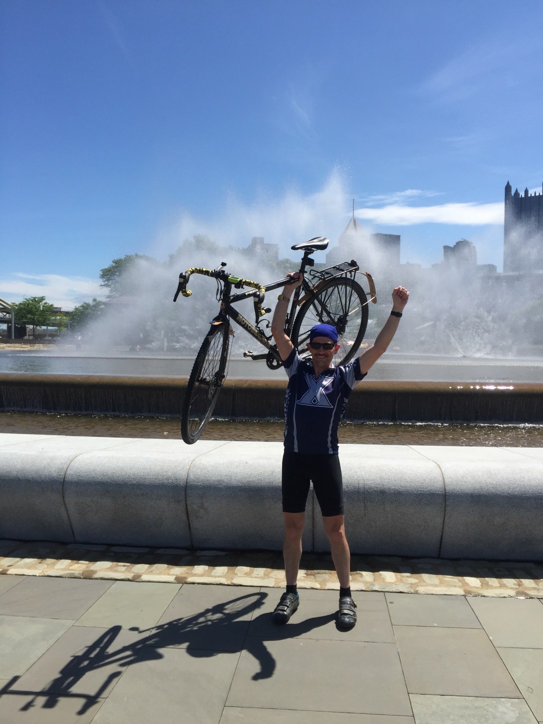
A little over a week ago, we finished up our tour from DC to Washington on the C&O Canal and Great Allegheny Passage.  I’m just adding a few parting thoughts about our adventure.

Some stats:

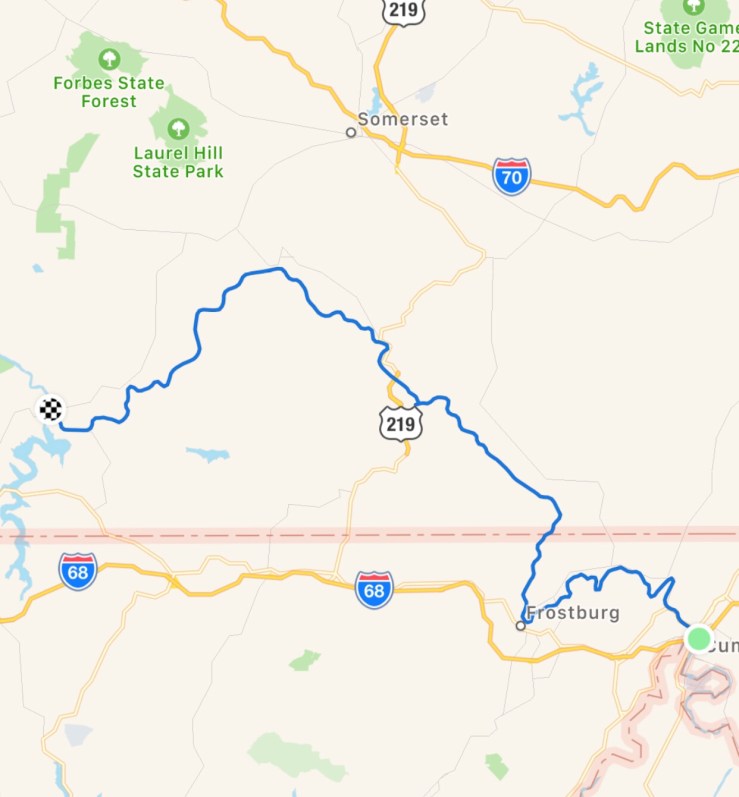
  • 372.61 Miles, mostly off-road
  • Total Time on the bike (moving time):  32 hours, 15 Minutes, 44 Seconds
  • 155,083 complete pedal rotations, give or take a few. (310,166 left/right pedal steps)
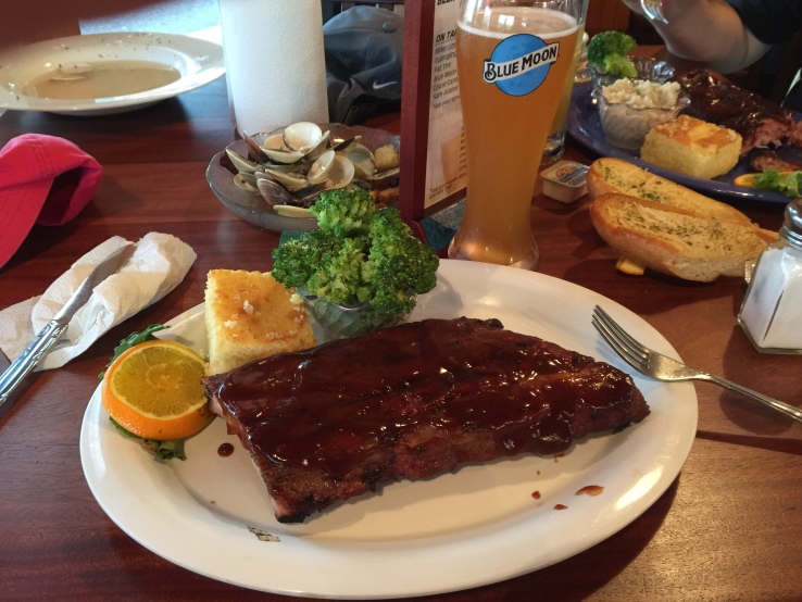
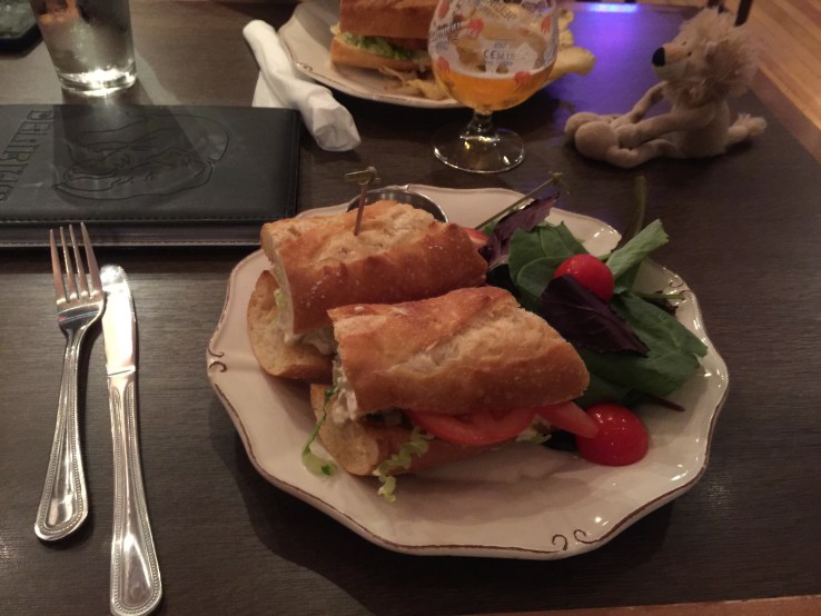
  • Meals with french fries: 2.  Meals with bacon: 3.


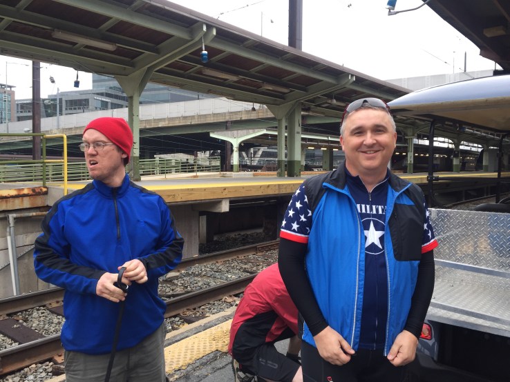
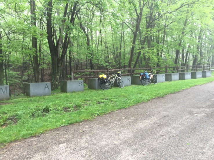
This is the fifth trip that Joe and I have made together.  Usually we’ve found a new route to try, but this time we decided to go back and do the C&O/GAP again.  We rode it together 3 years ago going from west to east (Pittsburgh to DC).  That time, we did it in 6 days, which didn’t leave much time for sight seeing or side trips.  It also made for three very long days on the C&O.

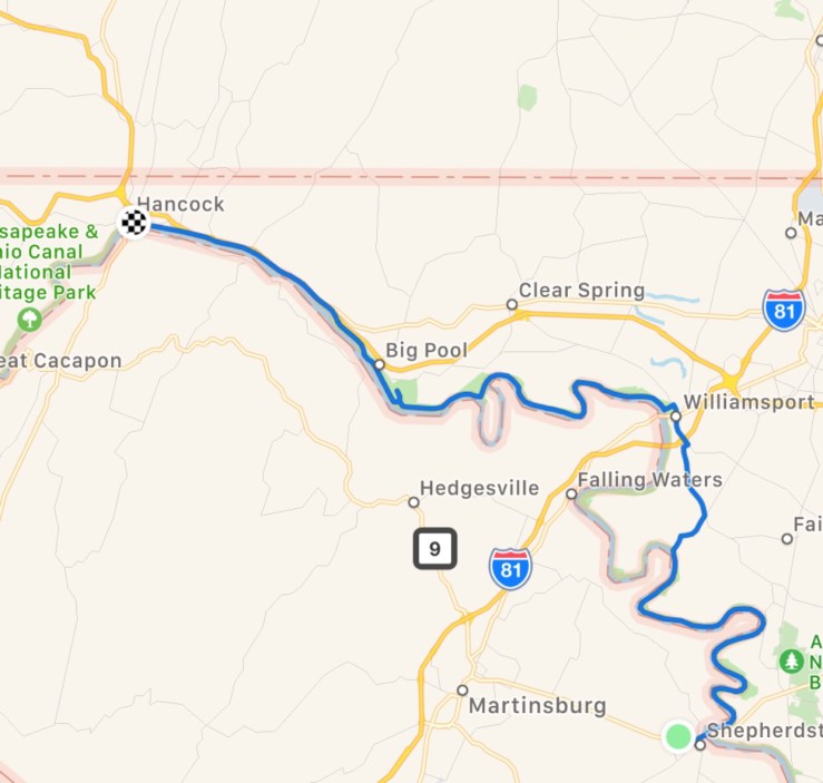
When we picked our trip for this year, we considered a few different bike routes.  There are some on our bucket list that would take longer to ride, or are farther from home.  We narrowed the list down to trips we could get to/from in a day and complete in a week or less.  Looking back, we both really enjoyed the 2015 trip, but we wanted to see a little more of the history along the C&O.  Given that we were very familiar with the course, it also made the planning easy.  So… we chose to do this course again, but start from the DC end.

Every time we do one of these trips, people ask me some common questions.  Here are some answers:

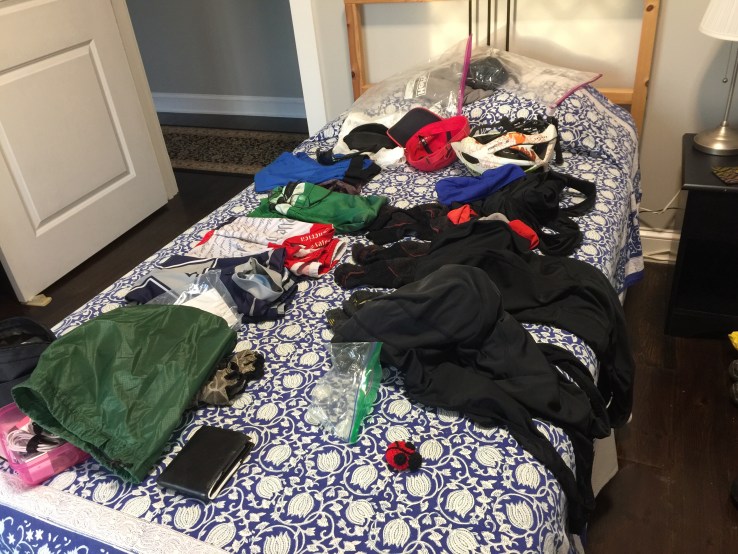
  1. How much did you train?  I recommend at least 500+ miles of training, with at least 2 or 3 back-to-back 50 mile rides.  Build up slowly if you’re not already a cyclist.  I had about 700 miles under me this season, and I stayed in shape over the winter using a spin bike.  Last year, I had about 1,000 miles before our trip and it really helped.
  2. What do you do if it rains?  We put on raincoats and keep going.  We’ve never been caught in a torrential storm.  I suppose it could happen, and we carry enough clothing to keep us safe in the event that we need to seek temporary shelter.
  3. Why do you like this?  It doesn’t sound fun to me! Some people like to run, camp, hike, lay on a beach, or take a cruise.  I really enjoy seeing the outdoors and I enjoy cycling.  When we are riding, there is a lot of time just to let the mind and spirit unwind.  It is like a rolling retreat for me.
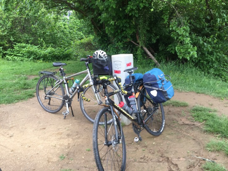
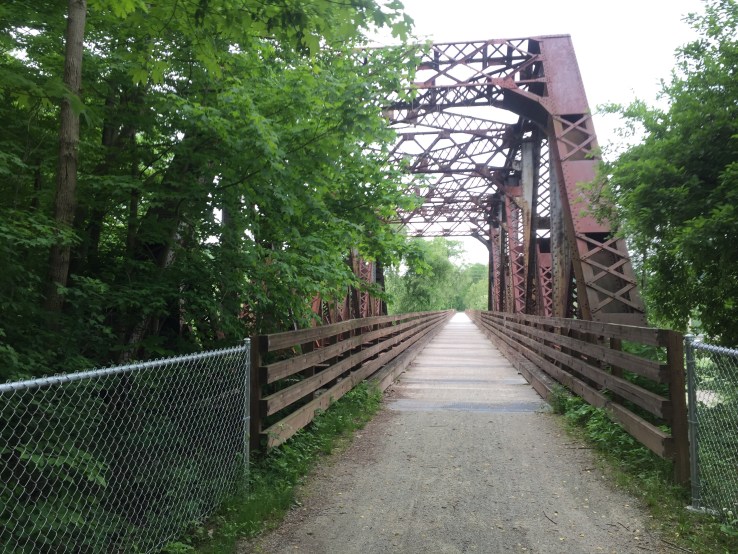
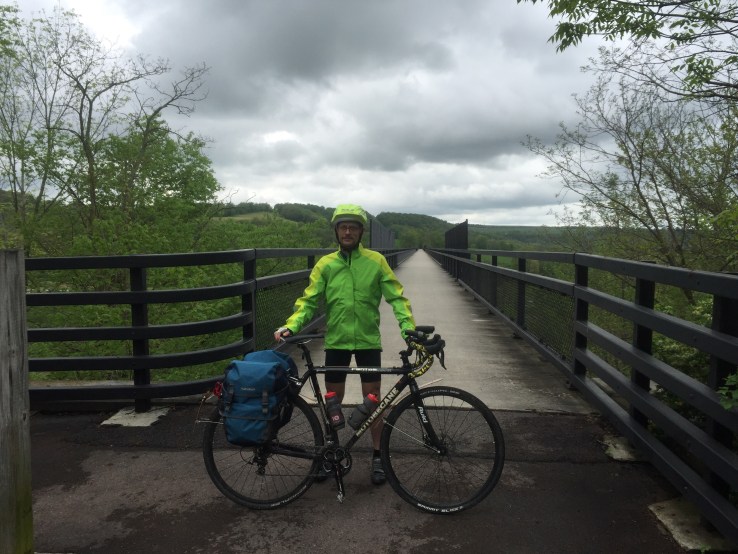
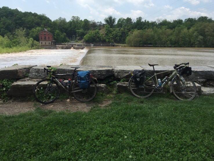
  4. What kind of bike is that you’re riding?  I use a converted cyclocross bike because it is a bit more heavy duty than a road bike.  I strongly suggest 34mm or wider tires and fenders.  When dealing with mud, you’ll want them.  The GAP is more forgiving, but the C&O definitely requires at least some decent tread on the tires.  This is certainly not a trail for a road bike.  You might get away with it on the GAP, but definitely not on the C&O.


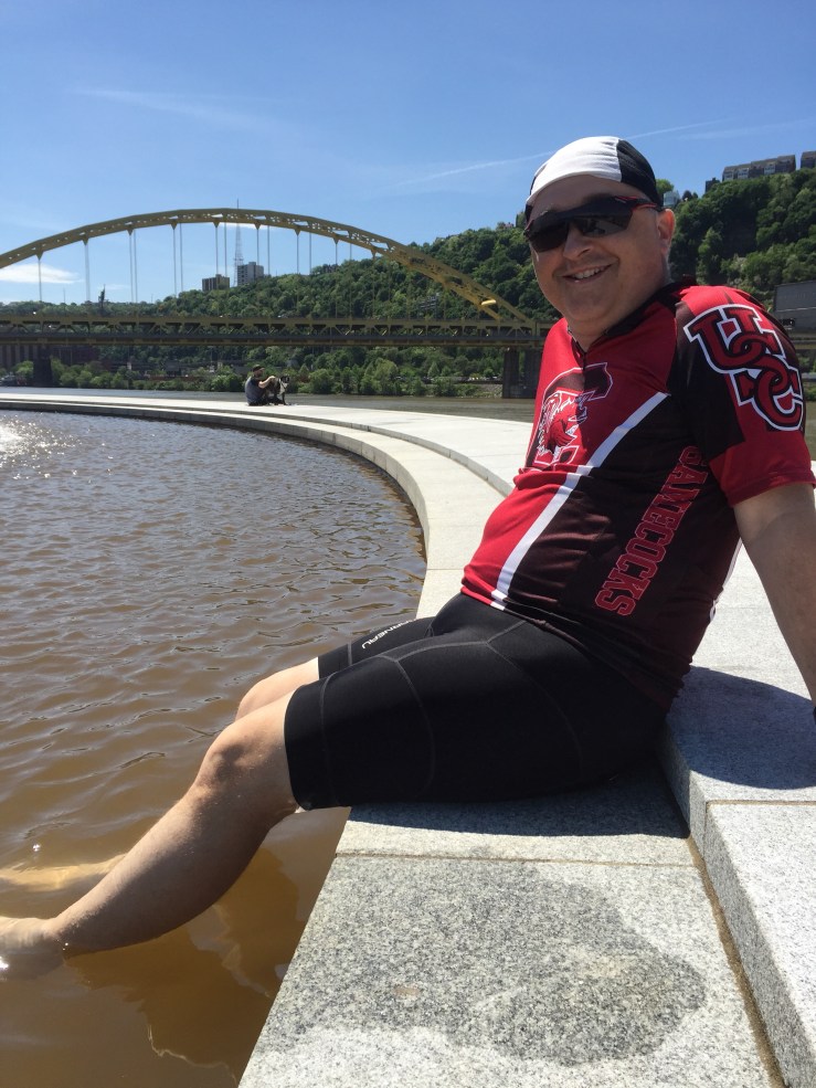
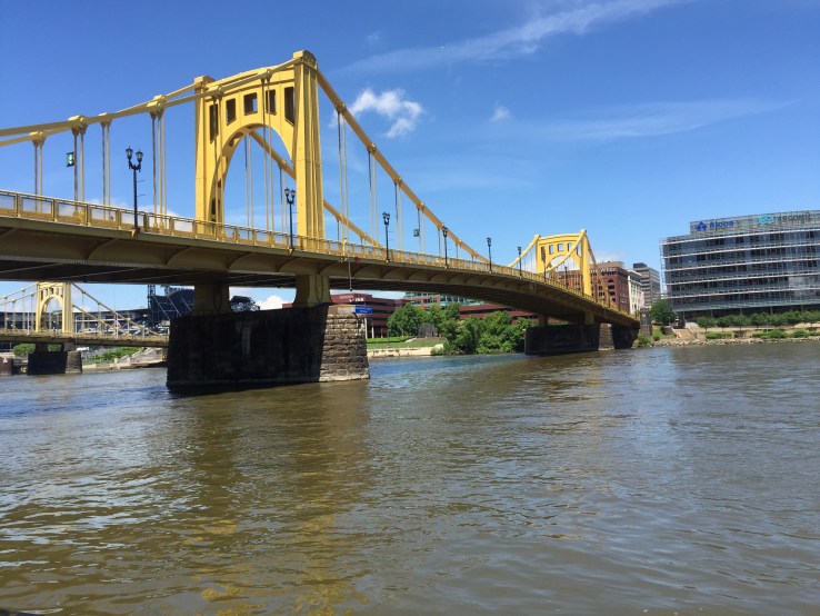
My thoughts on the overall trip: I enjoyed this trip very much.  We had a great time together, and we saw some neat places.  I enjoy the people we meet the most.  We had a few people we crossed paths with several times throughout the trip.  It was fun to compare notes.

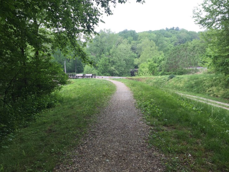
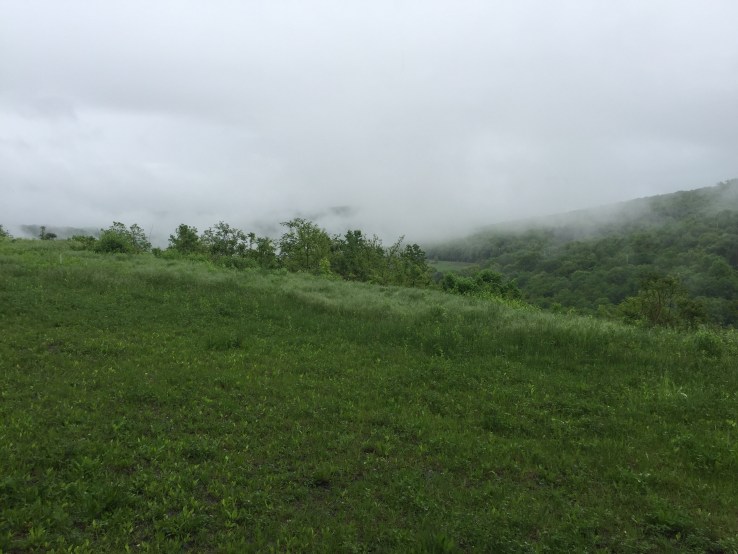
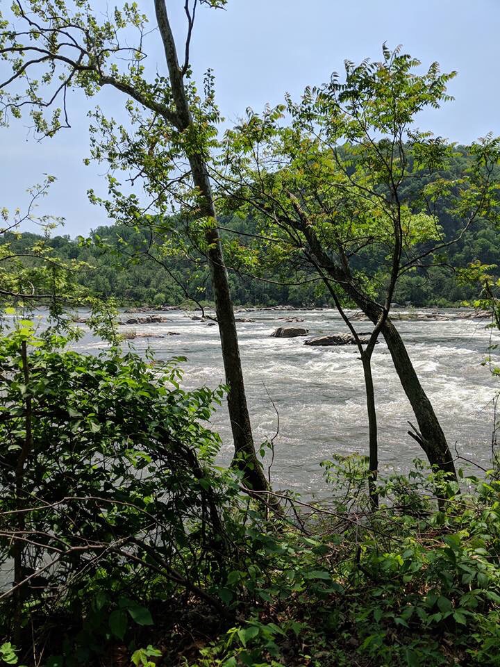
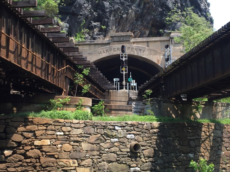
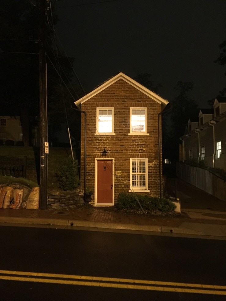
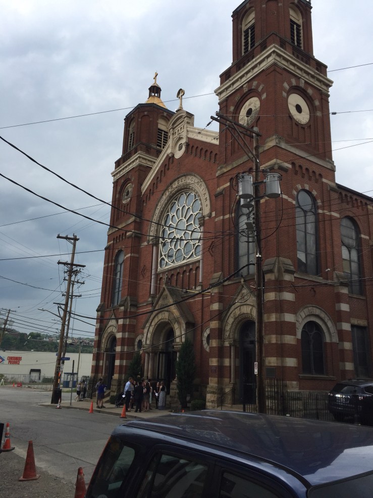
The C&O is not high on my list of good trails.  The surface is very muddy and bumpy.  There are some neat places along the trail: Harpers Ferry, Shepherdstown, and so on.  But it is pretty sparse.  The Potomac is a beautiful complement to the trip since you’re next to it for almost the entire ride.  This year the conditions were very muddy, especially the area between Hancock MD and Cumberland MD.  That 60 miles was really rough.  That made for a very long day with not much to break up the hours in the saddle.

We also saw that the National Parks District had several shutdowns on the C&O just one day after we went through.  The rains caused a lot of damage on the path and washouts.  Back when the C&O was in operation, some flooding is what ultimately brought it to a halt by breaching the canal.  I can see how that would happen.

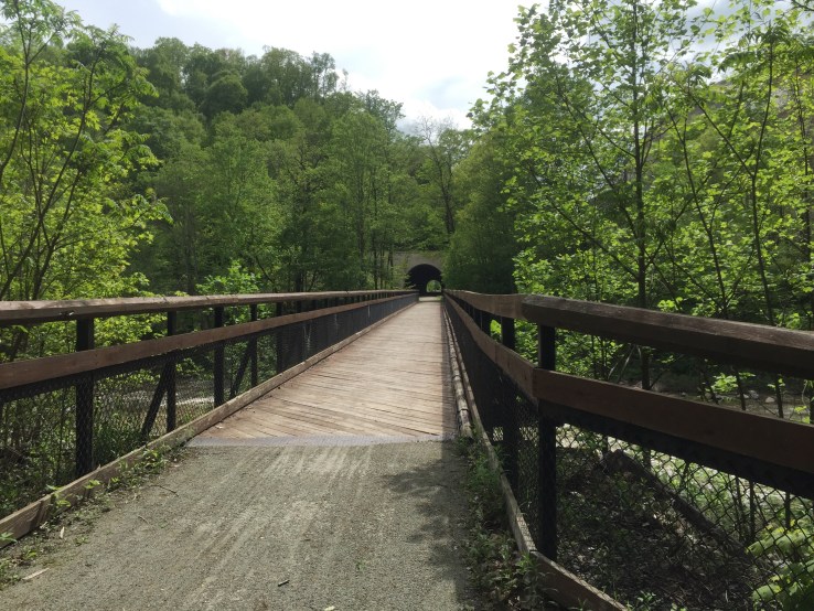
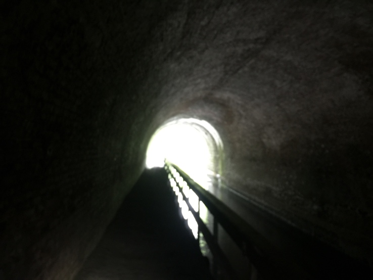
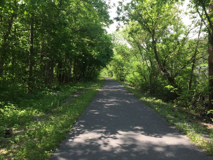
The GAP was in great shape, though.  We had more rain on that section, but the trail surface drains well.  We didn’t see much of any mud and our equipment stayed relatively clean.  The GAP trail town alliance does a very good job of building up the micro economies in the towns, providing food and shelter along the GAP.

I don’t know if I’ll ride the C&O again any time soon.  If you like trail riding, it should be on your bucket list.  After riding it 3 times now, I can say it doesn’t rate in my top 5 trails I’ve been on by itself.  Combined with the GAP, it does make for a very nice week-long bike trip.

If you’re interested in learning more about either the C&O or GAP, feel free to drop me a note and I’d be happy to talk you about it.  You can also find more information here:

Great Allegheny Passage trail: Web Site
C&O Canal from the National Parks: Web Site

We’re not sure where we’ll go in 2019.  If you have any good suggestions, let me know!


Peace,

Deacon Matt

2018 C&O / Gap Tour Day 7: West Newton PA to Pittsburgh – We Made It!

37.9 miles.

Plus a 6 hour drive home.

Today was a much shorter day. We planned it this way so we could drive home to Lexington after we finished up today.

We left the rectory at Holy Family and started our trip out of town from West Newton. It was a little sad to say goodbye because we felt so at home there.

This last part of the trail is one of my favorites. There are lots of neat things to see and there is enough change going on to hold your interest. In 30 miles you go from small towns, past lots of little water falls, some old coal mining history, industrial areas, the outskirts of of the city, a bunch of nice bridges over the rivers and train tracks, and finally down into the heart of Pittsburgh. That’s a lot to see in such a short distance.

Here’s a neat example of one of the water falls. This particular one is full of iron so it runs red.

This one, a little farther down runs white due to some sort of aluminum runoff. I made a very short video so you can see it. In a picture, it looks like a regular waterfall. But in the video you can see that it looks more like a milky color.

We also passed this really neat little cemetery that is where two small railroad towns used to be.

As we pedaled along, we came through McKeesport. About this point, you start to see more of the industrial beginnings of Pittsburgh. Lots of old steel bridges and structures.

The Great Allegheny Passage has some really nice bridges across the river. I’d love to know the history of some of them – I’m sure some were former railroad bridges, and some of them appear to be new structures built specifically for the GAP.

We stopped mid-bridge to take in the view of the Monongahela River with some barges being pushed along.

You can see how overcast it was early this morning. We had chilly temperatures and some light rain for about the first half of the ride.

We reached Homestead, the sight of the famous strike clashes between the union and the steel mill owners.

We were getting hungry – we had just a very light breakfast of pocket food before leaving. We cycled past the Eat ‘n Park. Joe had never seen one before, so we went in and had a good breakfast. When we went in, it was raining. When we came out, the skies were blue and the sun was shining. It was an amazing change in such a short time. The nice weather stuck with us for the rest of our trip today.

The Hot Metal bridge is just on the south-east side of the city. It gets is name from its original purpose: it used to carry molten metal across the Mon river to be processed. Now it is a bridge for cars and a separate deck for bikes & pedestrians. The bridge also gives some great views of downtown.

Here’s the first real view of downtown we were treated to. It was a beautiful day once the rain stopped!

A few more miles took us down on a few city streets and to The Point State Park. This is at the confluence of the Monongahela, Allegheny, and Ohio rivers. It also is the historical location of Fort Pitt.

Inside the park is an iconic fountain that you will often see in pictures of Pittsburgh. There is a large marker in the concrete to show the confluence, as well as the official end of the Great Allegheny Passage.

Although it had been pretty chilly earlier in the day, it was getting a bit warm, especially in the direct sun. The water of the fountain looked very tempting. I’m quite sure the parks people would frown on our behavior, but we decided to take off our shoes and soak our feet in the fountain for a few minutes. It was delightfully cold and felt great. It was nice just to soak up the end of our trip. We talked for a few minutes and just enjoyed the accomplishment.

We did it! 373 miles in 7 days. 4 states + Washington DC.

We still had to get back to our car and drive home. We took a bike path up the eastern side of the Allegheny that took us very close to St. Stanislaus parish and our car. We quickly changed our clothes and did a quick bird bath with some wet wipes before driving home.

It has been a great trip, but I was awfully glad to get home and be greeted by my wife and our two schnauzers. If you ever really want a great greeting committee, it is hard to beat a happy dog – or two.

I’ll follow up with a couple more notes for the trip in my next posting. I’m really looking forward to my own bed tonight!

Peace,

Dcn. Matt

2018 C&O / Gap Tour Day 6: Confluence PA to West Newton PA

54.3 Miles.

Our day started with a quick breakfast of “pocket food” (energy bars and a pop-tart) before leaving the hostel. It wasn’t enough for our day, but we just needed enough to get us to Ohiopyle – about 12 miles away. The Yough river was running pretty high as we crossed the bridges back to the GAP.

The weather today was cool and overcast, with a few gentle sprinkles throughout the day.

We arrived in Ohiopyle about an hour ahead of schedule, which allowed us to get a decent breakfast.

Today we were able to do something that has been on my bucket list since I was 16 years old: I visited Fallingwater, the Frank Lloyd Wright house here in Ohiopyle.

Originally we thought we would cycle the 4 miles from the trail out to Fallingwater. But when I called for tickets, the person at the desk said that it was a dangerous ride. Then Joe called a place in Ohiopyle that could give us a ride. They said the same thing. So … we paid for a shuttle out. After seeing it for ourselves during the shuttle, I am very glad we took their advice. The grade was very steep, very long, and had a narrow shoulder.

We arrived a few minutes before our scheduled tour.

Fallingwater was designed by Wright for the Kaufman family – the family who owned the Kaufman department stores in Pittsburgh. Eventually their son donated the property to a conservancy which now cares for the property and maintains it as a museum.

Fallingwater was designed to be Organic Architecture, meaning that it takes its form from its surroundings. This area is full of rocks and water falls. These were the inspirations used for the home. The rocks used for the structure were all quarried from just a few feet away from the structure.

The Kaufmans liked to vacation in the Laurel Highlands. They had Fallingwater designed to be their vacation home. There are many interesting features of the home, but perhaps the two most distinctive features are that it is built over a waterfall, and that it is cantilevered so that it is suspended over the surroundings. Even the furniture inside has been designed to be cantilevered to carry the motif throughout the structure.

I had studied this house for a project in high school and although I had forgotten many of the details, the tour was really fun for me. I’m not sure Joe had quite the same level of enthusiasm as I did, but he seemed to enjoy it as well.

We were not allowed to take pictures inside the structure.

This picture from the outside is where the stairway from their great-room descends down to the water. Just beyond the stairs (left side of the picture) the water turns into a waterfall to the forest below.

After our tour, we made quick progress back on the trail. We had some good distance to cover to arrive at West Newton.

Along the way, our next stop was Connellsville. On the East edge of town, we are greeted by these interesting silos. I’ve seen them before. The murals seem to be fading a bit with time.

We needed a good lunch before leaving town. We took a random chance at a pizza & pasta place. We both got some pasta and it was definitely a good choice. Yum.

As we left town, we passed through a park. I’ve been through here before and this sign always motivates me… we’re most of the way to the ‘burg!

We had about 26 more miles to go. Lots of miles passed uneventfully. Both of us are starting to have some tired legs, so I’m glad tomorrow is a shorter ride.

We finally made it to our home for the evening: Holy Family Parish in West Newton. We were greeted by Paula – she has been a phenomenal host.

Tomorrow we will finish out with about 35 miles to get to The Point state park – the end of the Great Allegheny Passage, at the 3-rivers confluence in Pittsburgh.

It has been a good trip, but I’m looking forward to being done and getting home.

Peace!

– Dcn. Matt

2018 C&O / Gap Tour Day 5: Cumberland MD to Confluence PA

63.4 miles today.

We started the Great Allegheny Passage today, leaving the mud of the C&O canal behind.

It was a very rainy day, but the GAP drains very well. Not very many puddles and very little mud. Glad to have the worst of the mud behind us.

As we left the Fairfield inn, the rain started and just kept with us for about the first three hours of our ride today. It was a chilly rain, but with a nice raincoat and the ride going on, we stayed plenty warm.

The first 22 miles of the GAP are a constant climb. It is not a terribly steep grade, but you climb and climb and climb. We paced around 10 MPH so it took a little over 2 hours to reach the top. The ride up is beautiful and you pass a lot of great views. Today had its own beauty because of the very low clouds in the trees and valleys. But because of the weather, we couldn’t see some of the long distance views.

Along the way up we passed Frostburg. It is a neat little town to see, but with the rain pelting down on us and a few more miles to go, we decided to keep going up to the top.

The next stop along the way is the Mason & Dixon line separating Maryland from Pennsylvania.

We met this nice couple at the Mason & Dixon line. They’re on their way to Cumberland.

This is usually one of my favorite views anywhere I’ve been on bike. On a clear day, you can see 4 states from here. Today, you could see a few trees. It was actually more beautiful than it looks in the picture, but you don’t get any feel for how high you are above the valleys below.

The next few miles of the GAP are loaded with great bridges and tunnels. This is the Big Savage Tunnel – about 3,200 feet long. It is really neat.

Eventually we reached the top: The Eastern Continental Divide.

Inside this overpass is an elevation map – you get an idea of the elevation change. We came from Cumberland, just below my hand, and went up to the top, where my finger points. In 22 miles.

Some cyclists really enjoy climbs. Joe isn’t known to be one of those kind of cyclists… but he did well today.

We were getting pretty hungry so after crossing the divide, we went into Meyersdale to the G.I. Dayroom. Yum. We stopped here once before and it was worth coming back.

A BLT with some macaroni salad, home made french fries, and pie for dessert. Got some calories, for sure.

This is John. We met John in the Pittsburgh Amtrak station. He’s riding the same general direction as we are. We’ve crossed paths with him about 10 times since we left him in DC. He’s been camping on his way across. We invited him to join us for lunch.

John’s from Cincinnati, so I gave him my contact info and perhaps we’ll meet for some riding later in the season.

Leaving Meyersdale, we made our way west. The next highlight is one of my favorite rail-trail things anywhere: the Keystone Viaduct. A former railroad bridge that has been converted for bike traffic. It is really high and really long. The views from up here are awesome.

We stopped in Rockwood to get something to drink. I love this mural they have celebrating their town’s history as a railroad town.

A couple more bridges and tunnels, including the newly opened Pinkerton Tunnel.

Eventually we arrived in Confluence PA and we’re staying at a hostel. It is very clean and pretty comfortable, but meager. Fortunately, Joe and I are the only two staying here tonight so we spread out and took over. Hoping most of our clothes dry out overnight.

Here’s the route for today. It’s all downhill from here into Pittsburgh.

Tomorrow we’ll begin by heading to Ohiopyle and then onto West Newton for the evening.

It is supposed to be very rainy and cool tomorrow again. It would be nice if the rain could hold off until evening… but we’ll take whatever we can get. It sure beats 94° from last year on the KATY!

Peace,

Dcn. Matt

2018 C&O / Gap Tour Day 4: Hancock MD to Cumberland MD

61.1 Miles.

Our day started with a modest breakfast at the B&B before heading out. We finished out a few more miles on the Western Maryland Rail Trail. I didn’t realize this, but the WMRT is being extended many more miles. It’s too bad that the C&O can’t be paved like the WMRT.

Between Hancock and Cumberland is pretty sparse. It is about 60 miles with no food choices and only water from the C&O campsite pumps. The only real place to stop is a place called “Bill’s Place” in Little Orleans. Little Orleans is a very tiny little town and Bill’s is the only place there. One fun tradition is to go to Bill’s place and sign a dollar bill. They then put them up on the ceiling and you can try to find your dollar bill next time you come through.

Last time Joe and I did the C&O we gave them dollars. Unfortunately, Bill’s was closed until 11AM and we didn’t have the time to wait. So we couldn’t take the time to find them today.

One of the neatest things on the entire C&O canal is the Paw Paw tunnel. It is a mile-long tunnel that was carved through the mountain over 14 years. The National Parks had closed the access to the tunnel last year to clear the rock walls of falling rock and repair some of the decking on the approach. The alternate route involves hiking your bike about 2 miles I’ve an old logging route with 11-14% grade (yikes!).

I had called the project office and they said that it would not be open for a while longer. I talked to some riders who have come through in the last few days and they indicated that you could squeeze past the fences and go through. I like to follow the rules, so I was pretty excited to hear that they opened the tunnel TODAY! As we approached the tunnel, I thought the news was too good to be true, so we were going to check things out. For sure, we were allowed to ride up to the tunnel and walk through, saving us about 2 hours of hiking with our bikes. Yay!

The approach to the tunnel was really beautiful this time. I’ve never seen water falls here in my previous two trips here. There has been enough rainfall to feed some amazing water falls around the entrance to the tunnel.

Approaching the tunnel there was a nice lady taking pictures. She was a photographer and offered to take our picture. You can see the waterfalls on the right and left (next to the steps).

You have to walk your bike through and you really need to have a good headlight because it is pitch dark in there. (Please do not try to ride it, the surface inside is very very rough and choppy!). This is what it looks like about 100 feet from the exit.

The next 20 miles from Paw Paw to Cumberland were just a plain ‘ol slog. Lots of mud and puddles. It was very slow going and made for very tired legs. Joe explained it best: it was like when you are driving your car in a snowstorm or rain storm. You have to be always be alert and your muscles are tense waiting for any unexpected movement of the bike. The mud makes the rear tire lose traction very easily and the bike gets out of control easily.

A few miles away from Cumberland there was a large tree down across the path. It was far too big to move and we couldn’t get around.

There were several cyclists gathered around and there was a team of people helping to lift bikes through the large branches and across to the other side. Many hands made for light work.

A few more miles of slugging through brought us into Cumberland. Tradition is that you kiss the mule’s behind when you arrive. So we did.

Cumberland is the end of the C&O canal path. This is also the start of the Great Allegheny Passage, which we will start riding tomorrow. Over the next 3 days we will climb over the continental divide and then cycle our way to Pittsburgh.

It is good to leave the C&O behind. The Potomac is a beautiful backdrop for the trail, but the surface is bumpy and muddy. After 4 days, I’m ready to move on. The GAP is a much better trail surface.

The C&O is a national park, which means it takes an act of congress (literally) to make any changes or improvements. It is too bad, because if they would resurface with crushed limestone like the GAP or even, gasp, pave it like other high-use trails, it would be a fantastic path. But as it stands, the surface makes an otherwise great trail, less than ideal.

When we arrived at the Fairfield, first business was to rinse the C&O off of our bikes and gear. My bike was so caked with mud and muck that my lowest gear didn’t work anymore and shifting wasn’t reliable. I rinsed down my legs, shoes, socks, and panniers, too. Here is the before and after:

After washing up and showering, it was time for dinner. Some steamed clams and a rack of ribs, plus the obligatory blue moon rounded out the dinner. Yum.

Time for sleep soon. I’m exhausted.

We start tomorrow morning by climbing for about 2 hours up to the continental divide. We have about 60-65 miles ahead of us tomorrow on the GAP.

Weather forecast is looking like rain all day from sunrise to sunset. I’d appreciate some prayers for weather again – they’ve been working so far!

Peace,

Dcn. Matt

2018 C&O / Gap Tour Day 3: Shepherdstown WV to Hancock MD

50.1 Miles

We started our day early. We went to bed expecting the worst: lots of rain making the trail into mud, with rain chances towards the end of our ride. We had a very pleasant ride today with only a little mud and muck. Our bikes were still pretty messy, but not nearly as bad as we had expected. The temperatures were pretty warm. It was about 91° when we finished today.

We didn’t have much sight seeing today because there really isn’t much between Shepherdstown and Hancock. We did make a side trip to see Fort Frederick, but that was about it.

The C&O parallels the Potomac and is usually only a few yards from the river. If you can afford the moments to look up, you are treated to some beautiful views.

There are two major dams that are on the Potomac in this area – Dam 4 and 5. Huge slackwater areas are behind them and the roar of water over the dams is very impressive. The dams used to support water-wheel power generation for mills, but have been converted to hydro-electric power with small generating plants. You can see the regenerating station in the top-left of the picture:

There is a really neat part of the trail that is on a concrete platform along the edge of the river. The rock walls to the right are beautiful and the water on the left is peaceful.

When we were leaving Pittsburgh, there was a young guy who was heading to DC that had just completed his trek. He warned us about a section just west of this where there was a washout with about 10″ of water to wade through. When we arrived at one of the trailheads, the parks district had put up a barricade and “trail closed” sign. No detour posted.

I have made very good use of my Garmin’s built in GPS routing. This time I told it to take me to Williamsport. We took a ~5 mile detour on surface streets to get us into downtown Williamsport. It was a good detour and actually felt pretty good to get out on the roads and away from the mud.

We stopped at the Desert Rose Cafe for a quick lunch. We’ve stopped here once before and decided to do it again because the food was good. I picked up a PB&J, chips, and a coke.

The staff here is really fun. We remembered one guy, Alex, from the last trip. We made a comment that we had been there before. Alex said “yeah, you are the guys who were here on bikes, who were not from around here and were wearing spandex, right?”… He didn’t remember us. Joe made some small retort and Alex came back with “I’m sure your wife is glad you’re on vacation this week”. Game, set, match. We laughed and laughed.

But then, he saw Joe’s ring and asked if we were clergy and the light began to flicker on. After a brief discussion about our ride mascots, he did remember us. It was a fun conversation.

After our detour around Williamsport, we were back on the canal and making our way to Fort Frederick. We saw several black snakes like this one. He watched me very intently as I cycled around him. Sit, stay… good boy.

Dam #5:

Eventually we arrived at Fort Frederick. I’ve never found it open before. No tour guides inside the park, but we did watch a 10 minute video at the visitors’ center. I hadn’t realized that the fort had fallen into complete disuse and disrepair. It was restored, or should I say reconstructed to what you see today.

Leaving the fort, we picked up the Western Maryland Rail Trail. This is a paved path that parallels the C&O for 22 miles. Glorious! This took us all the way into Hancock for the night.

Our bikes were pretty filthy by now and I couldn’t shift my front derailleur. But the B&B had a hose to clean up our gear. Here’s what a day on the C&O canal does to your bike. Just imagine if it had rained, too!

We stayed at the River Run B&B again. It’s very clean and comfortable. Susan didn’t remember us at first. She meets hundreds of new people each year, I’d guess. But after a little conversation and mentioning our ride mascots, she said “I do remember you guys – you guys are fun!”

Dinner was at a local place: Buddy & Lou’s – named after the restaurant owner’s two dogs. I had Ahi Tuna steak … and a beer of course. You have to trust me that it looked nice before I ate it. It was deeeeelicious.

Happiness is clean laundry. Yay!

It’s time for bed. Ms. Bug thinks so, too.

Tomorrow is supposed to be a very rainy day on the mushiest part of the trail. Prayers for the rain to hold off would be greatly appreciated!

Peace!

– Deacon Matt

2018 C&O / Gap Tour Day 2: Leesburg VA to Shepherdstown WV and out to Antietam

56 miles today.

Last night we got in much later than we had planned. Instead of arriving in Leesburg around dinner time, we arrived after dark. We both had our headlights and bright taillights working as we crossed the Potomac on White’s Ferry. We made our way up to route 15 and followed it in towards Leesburg. There was a very wide shoulder so it felt pretty safe … but then the shoulder disappeared! The traffic was going about 60+ MPH and I said to Joe “No way!” We needed to find another route.

Living in the digital age is pretty handy some days. We pulled out our phones and researched the streets. Joe noted that if we backtracked, there was a route that took a couple of extra miles, but looked OK. I put our AirBNB address into my Garmin Edge cycling GPS and like magic, it routed us back and roughly the same way Joe was pointing out.

As we turned onto the quiet country roads, the sun went down. Thank goodness for a strong headlight and a trusty GPS. The GPS brought us to a gate of Morven Park. It was locked. We were stressed, it was dark. We decided that trespassing was warranted. We took our bikes around the gates and cycled through the park streets. We had to exit the other side around another set of locked gates. But our little, um, maneuver took us to a very safe set of roads right to the door of our B&B. Whew. Felt good to be off the roads.

Here’s the very cute B&B we stayed in right as we left this morning. I really liked it. It was like the original Tiny House, built in 1841.

Breakfast was a good omelette. Fuel for the ride.

We returned via the same Morven Park route today. Only the park was open this time, so we didn’t break any laws getting through. Morven Park is some sort of equestrian park, like the Kentucky Horse Park. It was very pretty and made for an awesome start to the day’s ride.

Then, back over the ferry from VA to WV:

The C&O is a pretty rough trail. It varies a little in condition, but most of it looks like this:

There is a lot of mud, many puddles, ruts, and squishy sections. On an normal road ride, I average around 16-17 MPH. On the C&O, I average around 11-12 MPH for the same physical effort. The surface just sucks the energy out of you.

In several places along the canal there are Lock Houses. These are the original residences of the families that would operate the locks. Some of them can be rented for staying over. They are primitive – no water or electric.

We crossed a number of aqueducts. These are bridges that used to carry the canal water over the creeks that feed the Potomac. Several have been restored, but none of them carry water any more. You can ride through the trough of the aqueduct or walk your bike along the old mule path on the side.

I had a mishap today. When we were riding along there was a short wooden bridge. The front edge was above the trail by about an inch or two. When my front wheel hit the edge, it popped up. The deck of the bridge was very slick and when my tire came down, it slid out from under me and I went down hard. I only have a couple of bruises to show for it, but my rear fender snapped in two and my front fender got pretty banged up too. It could have been much worse.

For lunch we decided to pop into the town of Brunswick MD. We found Beans in the Belfry and got a little to eat. I wasn’t hungry yet, so I just had some really yummy hummus and warm pitas.

When we got to Harpers Ferry WV, we decided to walk over the bridge and take a few pictures. We didn’t spend any time in the town this time – we’ve stayed here before. Instead, we wanted to save our time to spend at Antietam battle field.

Harpers Ferry is at the confluence of the Potomac and Shenandoah rivers. You have to cross over on a foot bridge from the C&O to the town. It’s a really neat walk over the bridge. But note that if you want to bring your bike across, you have to climb 50+ stairs with your equipment before crossing! We did that before, but this time we decided just to leave our bikes behind.

Back on the trail, we kept on pedaling along.

We still wanted to get to Antietam. Joe is a Civil War buff and this was high on his list. But there was one catch: my GPS unit kept warning me about severe thunder storms approaching. We decided to get to the bridge to Shepherdstown and then decide whether to visit tonight or try in the morning tomorrow.

To get to Shepherdstown, you have to climb a set of switchbacks up to the bridge level. To go to Antietam, you go about 6 miles NW. We looked at the weather and it said we had about 2 hours before the storms would hit. So… we made paces to get to the battlefield.

I have not studied much about the Civil War in the past, but I knew a bit about Antietam. It was powerful to think about the thousands of men who died that day and realize that I was standing where so many people died.

It is also kind of surreal: it is so beautiful and peaceful up here. But the amount of death unleashed that day was incredible.

This is the restored Dunker Church, a focal point of the battle. It was destroyed by wind in the 1920s but was reconstructed in the same place. The place where I am standing is where Abraham Lincoln stood at one point.

Right after that picture, we started to hear thunder. It was time to go. It is too bad, there were a couple of more places I’d have liked to see… but when the GPS keeps saying “SEVERE THUNDER STORM WARNING”, you have to pay attention.

We made very good time heading about 6.5 miles back to the bridge and up to our hotel in Shepherdstown WV. As we pulled into the hotel, a couple of raindrops hit. Then as we were under the carport by the front door, the skies opened and the rains came down in buckets. Wow. Perfect timing! I credit my wife who was watching our progress on the internet and praying hard for us to be safe from the weather. Thanks, Steph!

Even though we didn’t get rained on during the ride, the C&O provides a lot of opportunity to get wet, muddy, and dirty. Here’s what my legs looked like when I took my sock off. Yuck.

After a shower with LOTS of soap and water, we went in search of dinner. Both Joe and I have been hankering for Chinese food. During a break in the rain, we walked next door to the shopping plaza to pick up some Chinese food and brought it back to the hotel. Shrimp with mixed vegetables and rice. Mmmmm….

Tomorrow we head to Hancock MD. We only have one side-trip planned to Fort Frederick. Other than that, it should be a straightforward day of 55 miles. We’re hoping that the rain stops and that the path isn’t too muddy from the rains tonight. I’m expecting to be very muddy tomorrow.

Time for bed. Peace!

2018 C&O / Gap Tour Day 1: We finally got here…

I’ll put a short blog together tonight and hopefully get some time to put an addendum together tomorrow. It is about 10:30PM here in Leesburg, VA. I need sleep.

Quick summary of the day:

  • Left St. Stanislaus at 4:30AM for Amtrak
  • Amtrak train delayed. And Delayed.
  • Had a really nice trip on the train. Food was very expensive…
  • Got to DC very late. Had a nasty lunch at McDonalds because we needed food for fuel. Yuck.
  • Had a little bit of trouble getting on the C&O and a couple of mid-cues due to detours.
  • Got to the ferry across the Potomac as it was getting dark. Headlights are good.
  • Found out that route 15 into Leesburg is NO PLACE for a bicycle! Backtracked and had to go through a horse park (shhh, don’t tell them we went around the locked gates!)
  • Arrived at about 8:45, showered and had dinner.
  • Time for bed.
  • The End.

Today’s stats: 48.6 miles

Peace!

2018 Cycling Trip Prelude – Familiar Territory

This year, we thought about several different trips and decided we would go back to a familiar route, but do it a bit differently. Joe and I will be cycling the C&O Canal + Great Allegheny Passage. We will be cycling from Washington DC to Pittsburgh on these two great off-road trails.

This will be my third trip on the C&O and fourth on the GAP. Joe and I did this route a few years ago, but in the other direction (we started in Pittsburgh last time). Our total trip will end up being somewhere between 375 and 400 miles probably.

This time, we will do it in 7 days instead of 6. This way we will have a little more time to do some sight seeing. We hope to stop by some civil war battlefields, and see the Frank Lloyd Wright house “Fallingwater” as well.

Today we drove up to Pittsburgh and were greeted at St. Stanislaus parish by Father Nichols. We’re staying overnight here and then catching a 5:00AM train to DC. We’ll then cycle back over the next 7 days to the ‘burg.

This church is gorgeous. We caught 4PM mass and then after a little conversation with Father Nichols, we went and grabbed dinner in one of the Mexican restaurants here in the Strip District of downtown Pittsburgh.

It is really raining here, and the forecast for the next few days looks wet along our ride. I don’t mind a little rain when riding, but the C&O will get really muddy and slow us down. So, prayers for good weather would be greatly appreciated! 7 days of rain could make this a long ride.

One small change this year: my traveling mascot, Mr. Hamster, won’t be with me for the first time ever on a trip. He’s still at Rose-Hulman with my daughter. So instead, Ms. Bug (a ladybug, of course) is coming along. She’s also one of my daughter’s crochet creations that she gave me a few years ago. Somehow, it seems quite odd not to have Mr. Hamster with me … but Ms. Bug will settle in nicely, I think.

Time to turn in soon. That 4AM wake up alarm will be coming far too soon. I’m going to get some reading done and hit the sack. Next Stop: Washington DC and off to Leesburg VA.

Peace!