Today’s ride started off very uneventful. We had cool temps and a nice ride leaving Medina. Our hotel was nice, albeit somewhat overpriced in my opinion.
A Big Apple in Medina.
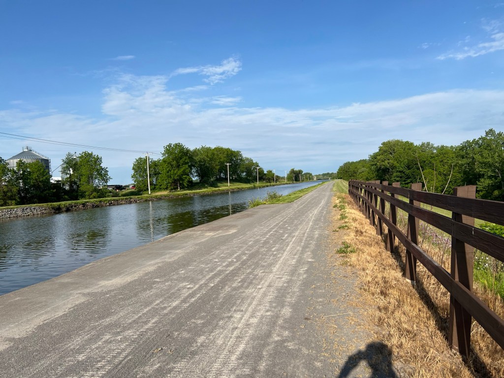
This section of the canal, including tomorrow’s ride, is probably my favorite. We pass through several old port towns and many of them still have the old-time downtown feel.
We decided that we would try to get rolling early today to give us as much time as possible in Rochester at the Strong Museum of Play. So we left Medina around 7:45 with the intention of having a real breakfast in Brockport.
Looking back over the day’s photos, I didn’t take very many pictures. We just kept rolling forward with very few stops along the way. Billy brought a drone along for the trip and he flew it to take a few pictures of us during one of our rest breaks. It was neat to see the pictures and videos of us sitting at one of the canal port stops.
<pics>
Rolling eastward was generally easy today. No major issues and we all felt great. The sun was shining and trail conditions were good. So we made good time to Brockport and pulled in for breakfast at the Brockport Diner. There was some discussion about whether Tom’s Diner in Lockport was better or the Brockport diner. I think both were good but the quality of the food in Brockport was better.
Omelette and Potatoes. Mmmm
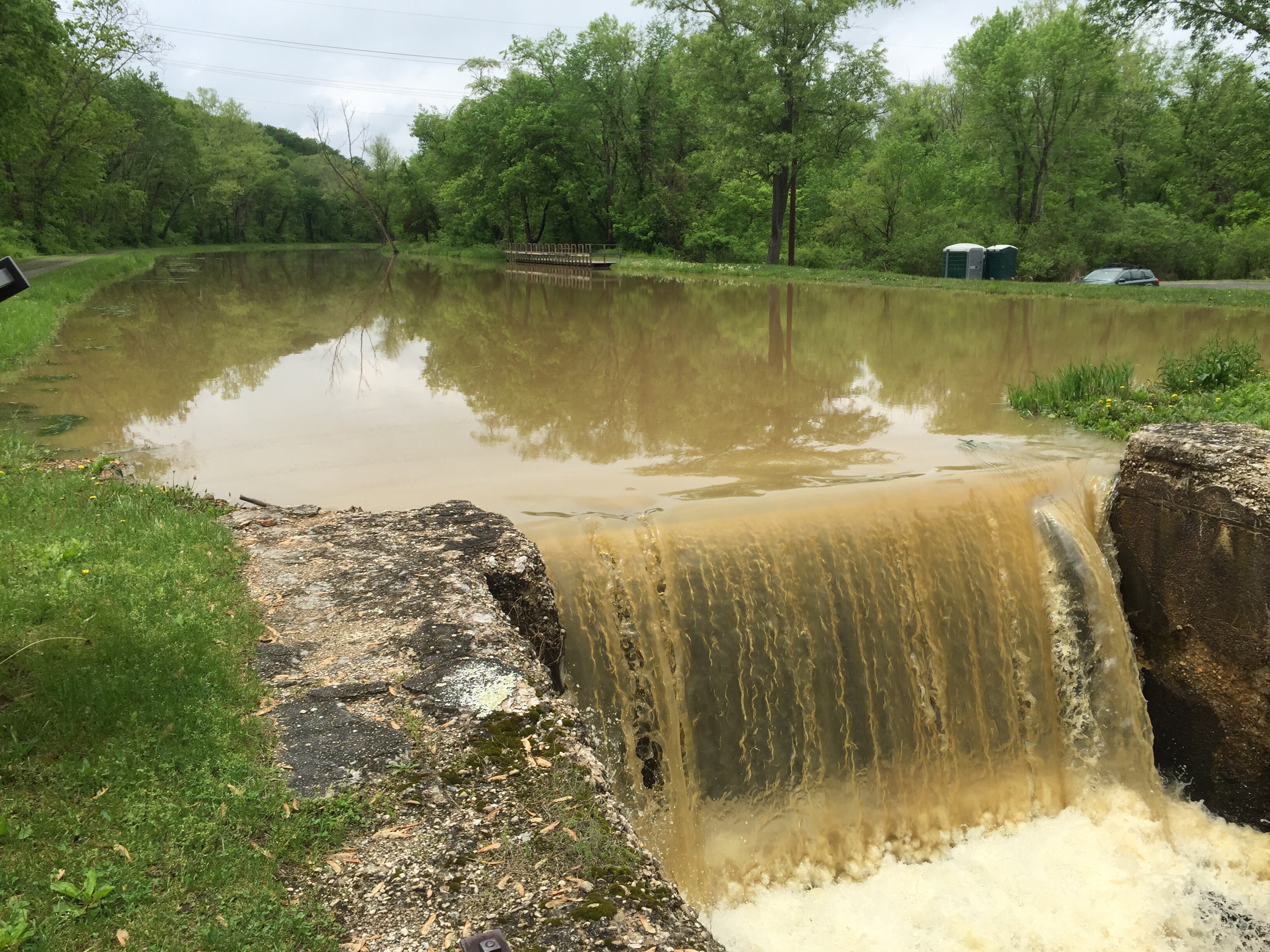
While we were eating breakfast, the rain started. It was mostly a gentle rain, but it was a little forewarning of the rest of the ride. A few miles east of Brockport, we stopped and put on our raincoats. The rain didn’t last long, but then as we approached Rochester, the rain came on heavy and hard. A little thunder could be heard in the distance and the winds picked up a bit. It didn’t feel dangerous or bad, but by the time we reached Genesee Valley Park we were all very wet, except for where the raincoats kept us dry.
We are staying in Downtown Rochester this evening, which meant departing from the Erie Canal path and going north into Downtown along the Genesee River. We passed through the University of Rochester campus, my Alma Mater, and then made our way north about 3 miles to downtown.
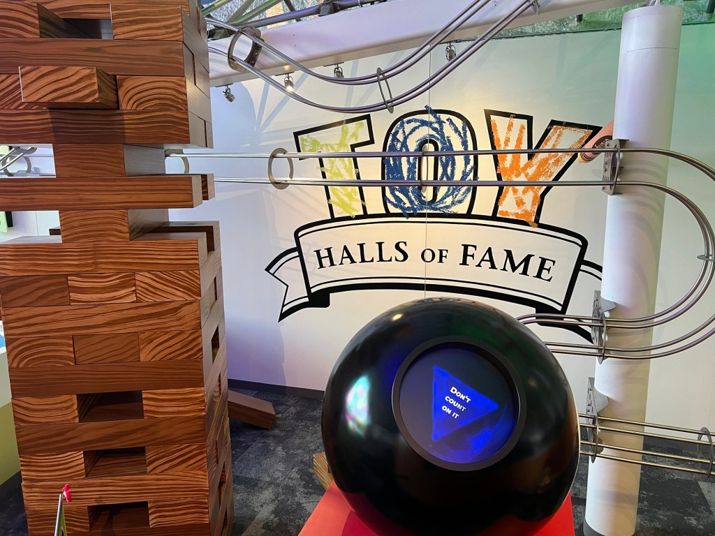
After checking into our hotel, we wandered over to the Strong Museum of Play. It is a very large museum of toys and games. We had a fun time wandering and playing lots of vintage video games and pinball machines. Sadly, they don’t have any of my games currently on display.
I did ask the giant magic 8-ball if the weather would improve tomorrow. It said “don’t count on it.” Bummer.
Will the Weather Improve?
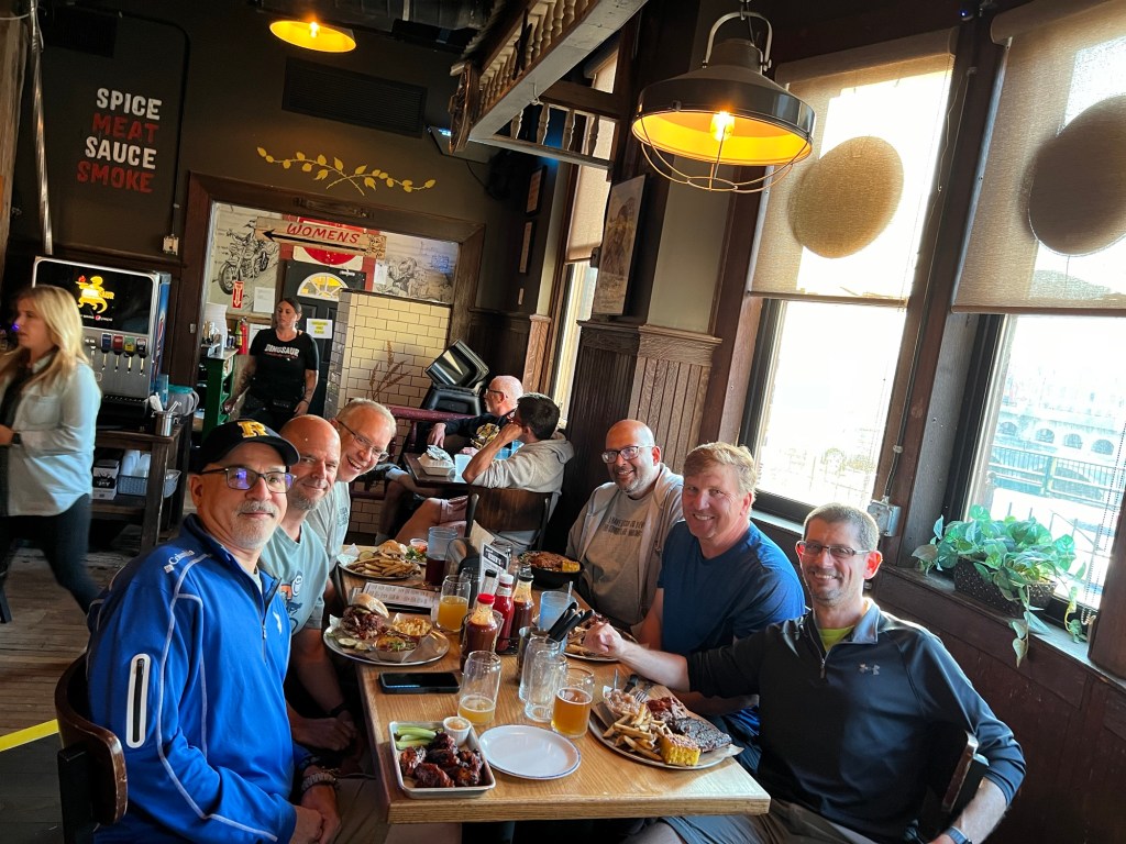
After the museum, we met up with some friends of JB who happen to also be riding the canal. We will be riding along with them for a few days now. We had dinner at the Dinosaur BBQ. It was definitely a good time and good food.
Laundry is now drying and I’m having trouble staying awake. Tomorrow will take us to Newark NY. A bit of a shorter day at 45 miles.
May the Lord bless your and keep you, may He shine His face upon you and bring you peace. – Dcn. Matt
We woke up a bit earlier today so that we could get wheels-down shortly after sunrise. We needed to ride about 55-60 miles, plus drive about 4 1/2 hours back home. Riding on this surface is much slower than the road, plus we are trying to enjoy the scenery, not race home. So after doing morning prayer, I finished the normal ritual of sunblock, chamois cream, loading up on some calories, and packing up for the journey home.
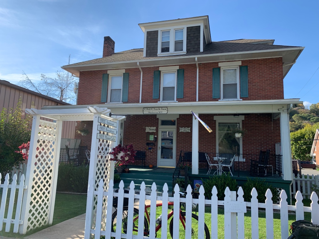
Our stay at the Old Clark Inn was very nice. I highly recommend staying there if you overnight in Marlinton. It is an old inn dating back to the early 1900s, but it is well maintained and the owners do a good job of making it a nice home-away-from-home. They cater to cyclists with secure storage as well.
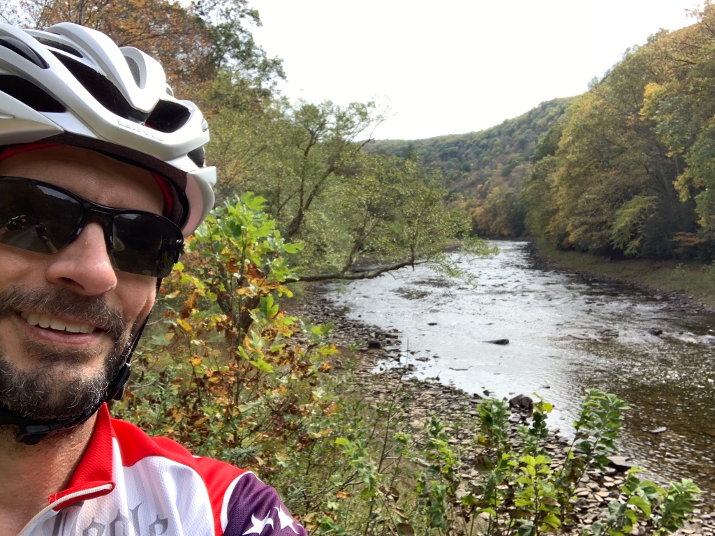
The weather today was faaaantastic. Cool and overcast. The morning fog kept us company for over 20 miles. The sun finally peeked out towards the end of the day and made it a bit warmer, but for the most part, it was just a beautiful fall day.
We saw many cabins and a few nicer homes along the river. Nearly every building was raised up on stilts or built upon a poured-concrete pedestal / garage about 10-15′ tall. This area had a massive flood in 1985 and again some time in the early 1990s, so the homes are raised to try to be flood proofed. In one of the pictures below you can see a flood mark on an older building we saw on a farm. I think this farm may be the only set of buildings we saw that were not on a raised foundation.
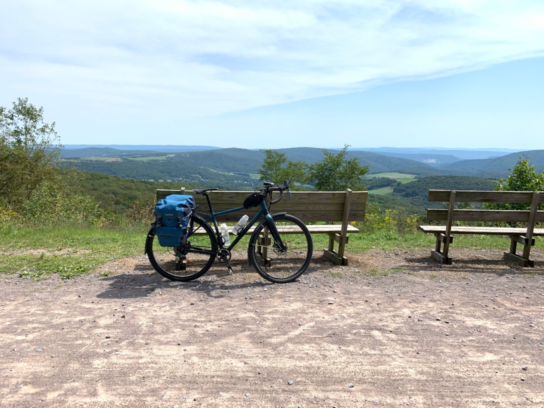
Plugging along, we took a break about every 12-15 miles to stretch the legs and our rear ends. One such stop was just outside a prison. I decided it was a good photo op for my bike.
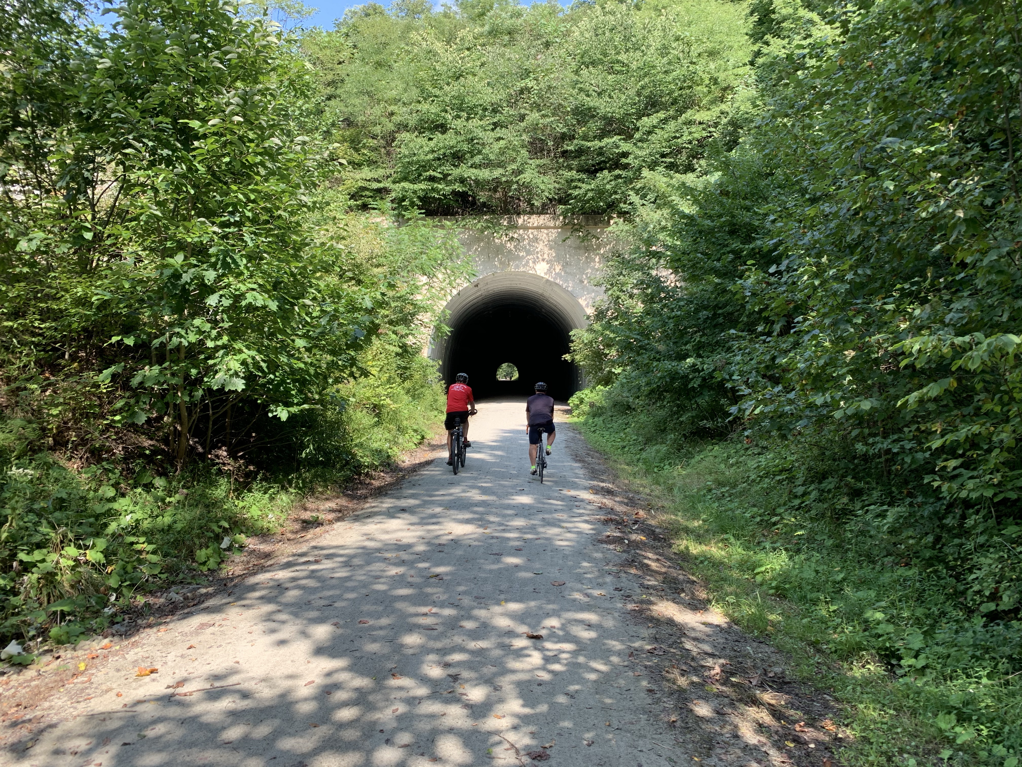
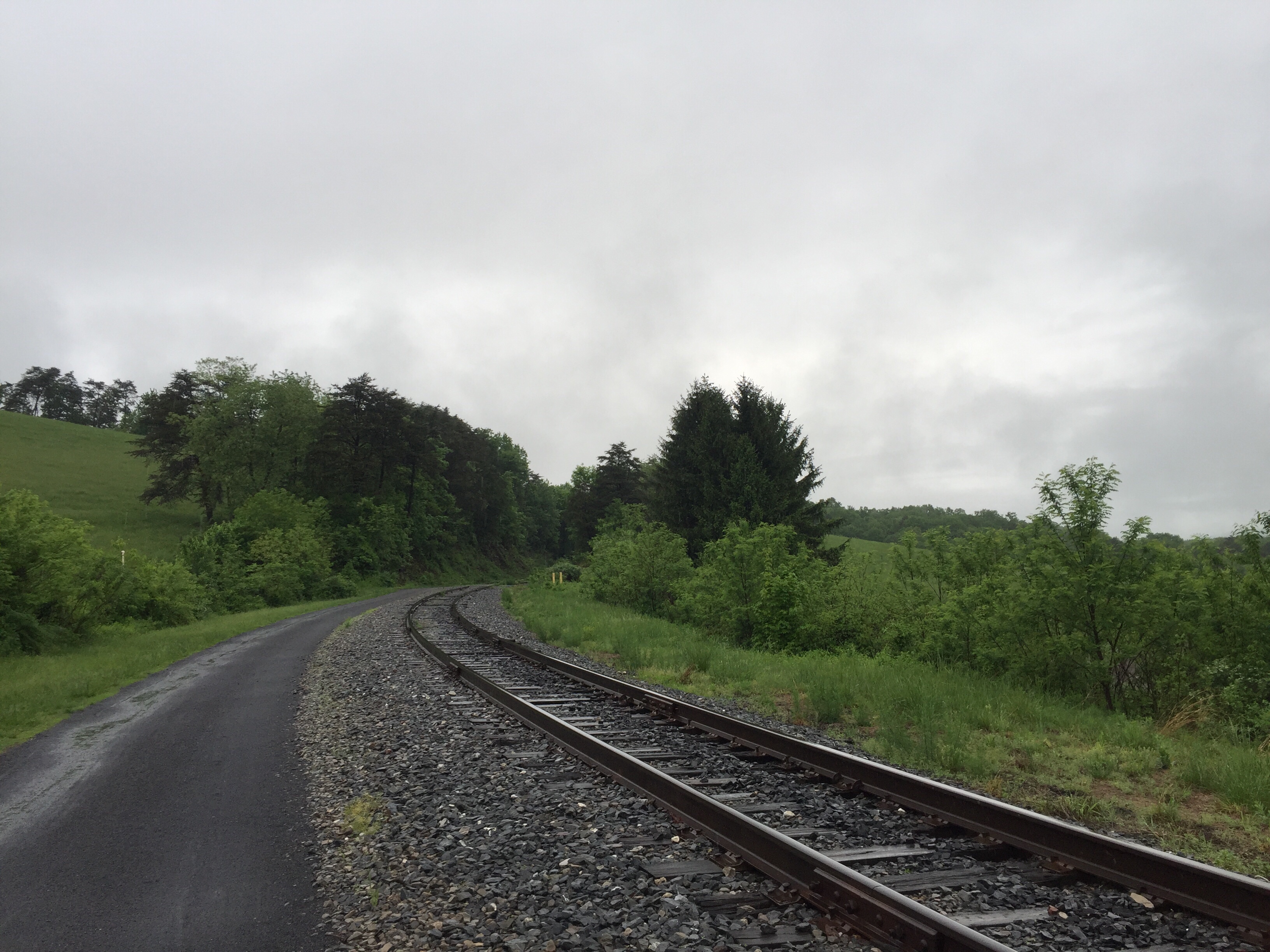
Two of my favorite things commonly found on rail trails are bridges and tunnels. Only two tunnels on the GRT, but they were long enough to be fun. Most of the bridges were very short though.
On day 1, we discovered that there isn’t anyplace to get food between Lewisburg and Marlinton. So last night we picked up some Subway sandwiches to carry with us today. We held off eating until we reached Renick. We pulled off into a park pavilion to rest and eat our sandwiches.
The rest of the ride was beautiful and uneventful as we reached the south end of the trail. Many leaves were down and made for a nice soft-yet-crunchy surface. Each of us had to stop a few times when bunches of leaves would get caught under the fenders or in the gears to clear them. This trail is heavily tree-lined with a nice canopy for most of it. Even with lots of the leaves down, the canopy was pretty. I imagine it would be nicely shady and comfortable when the trees are full. We were a bit surprised that we did not see many cyclists the last three days. Perhaps it was lighter traffic since we rode mid-week.
We parked our car up at the Super8 in Lewisburg. On the way down from Lewisburg on day 1, we were treated to some really nice downhills into the valley. That meant today would finish with a big climb up from the valley. It was about 2 miles of steady climbing, ranging from about 4%-12% grade and rising about 750 feet. I generally like climbing, but I could tell that Joe was having some anxiety about the climb as we got closer to the end of the trail. Climbing with a fully-loaded touring bike is much harder than with a road bike, but I was still looking forward to a little challenge at the end.
We reached the southern end of the trail and rested for a bit. Joe and I talked over the options – I could leave him there and ride the last 5 miles to pick up the car, or he could ride with me. He decided to give it a shot and we both did great. It was a very pretty view from the top looking back at the mountains and realizing we had been at the river level just a few minutes earlier.
A few more surface miles took us back to the Super8 and our waiting car. The desk manager was kind enough to let us use a private area to change our clothes and clean up a little bit before getting in the car to drive home. A quick dinner stop at Arby’s was the only stop we made before getting home. It was great to get home and see my wife, my daughter, and Sophie, my best-buddy dog who was so happy to see me.
On the ride home, Joe and I compared our thoughts about the trail. First, the pros:
The GRT is a really great trail. Smooth, well maintained, and gorgeous scenery. The surface is good and you can probably ride it on 32MM or bigger tires without any trouble. The crushed limestone is well packed and we saw very few muddy patches. If you wanted to camp, there are several primitive camp sites and a few shelters where you could probably pitch a 1-man tent or bivy sack. Some of the sites also had pit-toilets and water pumps.
Some other considerations or cons:
There are very few towns along the trail. In the first fifty miles, we only saw one or two water pumps and only one mini-mart that was about .7 miles off the trail on a climb up the valley (Renick). The only major towns are Lewisburg and Cass at the two ends, and Marlinton about 50 miles north from Lewisburg. In between, it is just you and the trail and a few camp sites. There is also very little cell phone coverage. We really only had coverage in Lewisburg, and a mile or two near Renick and Marlinton. What that means is that if you were to have a major mechanical or medical issue, you could be 25+ miles from getting help. I recommend making sure you have enough spare equipment (tires, tubes, patch kit, chain tool, first-aid kit, etc…) to be self-sufficient because you probably won’t be able to call for help.
We didn’t see much opportunity for water on the southern 50 miles. We both used up our two water bottles during that section. If it had been a hot day, that could have been a problem. I recommend taking more water and make sure to take advantage of the pumps if you have room to refill your water.
We didn’t see many opportunities to get down to the river itself. I kinda wanted to take my shoes off and dip my feet in the water. I didn’t get a chance to do that. On a hot day, that would have been refreshing.
Overall, I gave the trail a 7/10, Joe said 6.5/10. For me, it needs more services (food, water) and towns to adventure into. I very much enjoyed our three days. This trail feels very similar to the Great Allegheny passage in the area near Ohiopyle state park, but not as many places to explore.
Stats for the ride:
Miles: 164.75, including the ride to/from Lewisburg to the trailhead
Hours in the saddle: 15 Hours, 23 Minutes
Energy Bars: a few. Maybe 6?
Chicken wings: 1 dozen – 6 on Weds and 6 on Thurs. They were mighty tasty.
Beer: 1 glass. It was good, but I wasn’t in the mood for any more.
I hope to find a new adventure next year for a bike tour – probably more than three days. This was really a nice short tour with Joe and hopefully we’ll do it again soon. Riding solo is nice, but so is riding with good friends and enjoying the scenery.
Last night we arrived in Marlinton and had a quiet evening. After dinner, we settled in and I was asleep before 10.
We took a relaxed time getting ready again today. We had a light breakfast at the Inn and then set off. It was a chilly start with heavy fog setting in the valley. It felt really great and we had nice weather all day long.
Our route today took us north to the end of the trail in Cass, about 25+ miles, then we returned to Marlinton for the evening. We totaled just shy of 50 miles.
The surface along the whole length of the trail was consistently good. Crushed limestone and very few soft spots.
The fog stayed with us for quite a while and made for a beautiful morning.
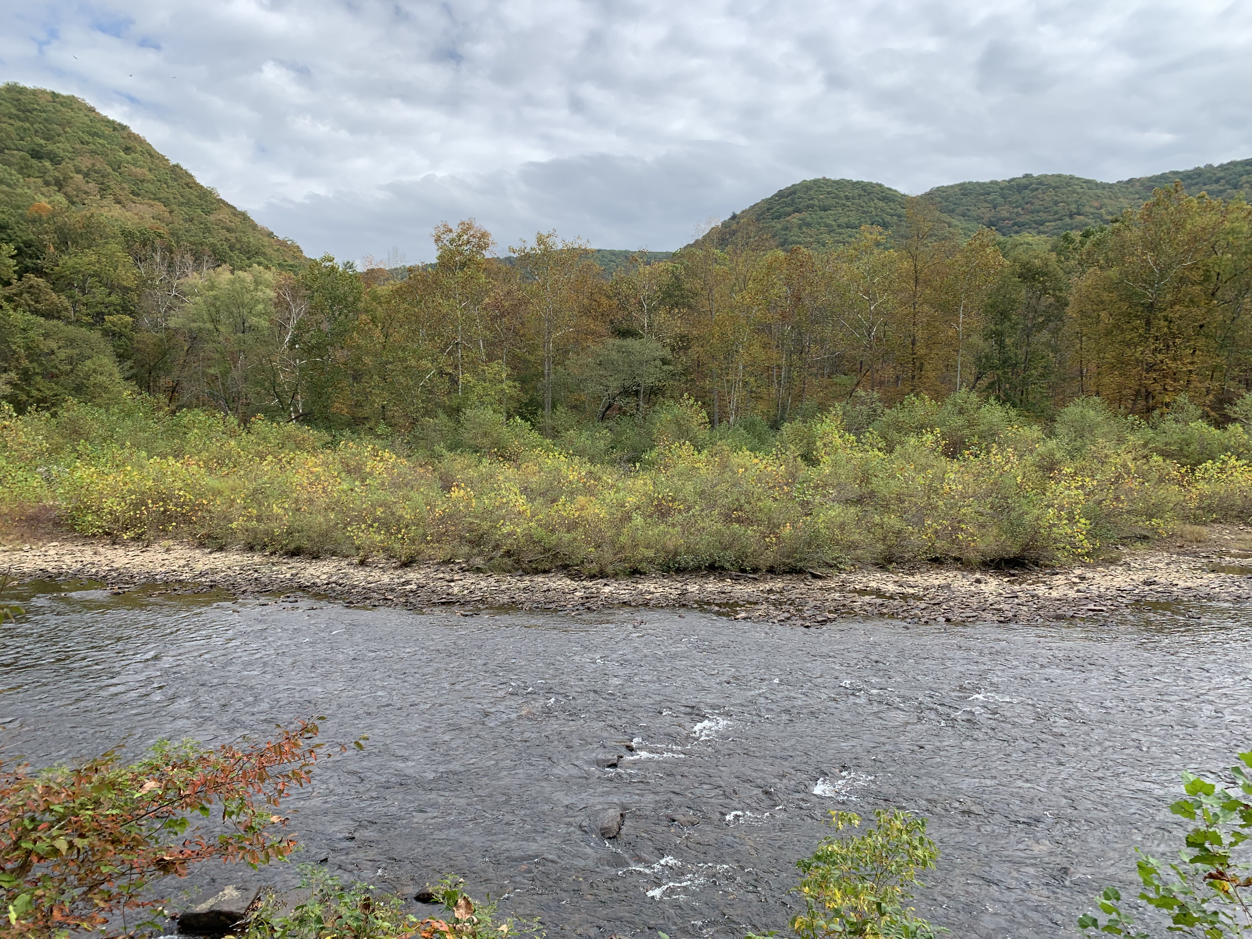
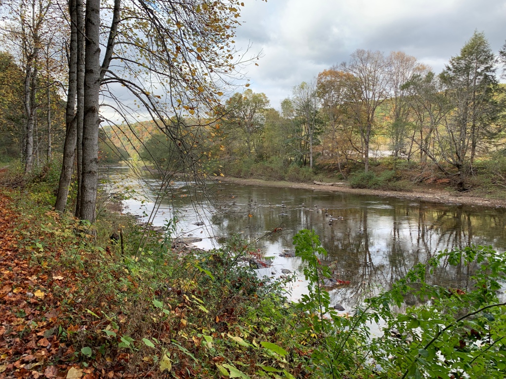
The Greenbrier River is very low. It is currently low enough that you could walk across it just about anywhere you wanted to. We talked to someone along the trail who said that it usually runs low in October. It is still pretty, but I think Joe and I agreed that it probably would be a bit nice with some more water running.
The colors of the leaves were a bit brighter on this section of the trail.
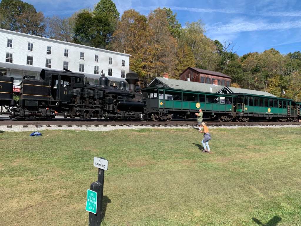
We arrived in Cass just after 11:30. It was good timing as they were beginning to board the 12:00 train to Bald Knob. Joe and I had talked about riding the train, but it is a 4.5 hour round trip and $75. We decided that 4.5 hours would put our return too late to ride back to Marlinton, plus the $75 seemed a bit steep. So instead, we just watched the train until it pulled away.
The Cass train is a chug train that was used to haul lumber out of this area. The train route is steep so the engine is designed to be able to drive a high torque system in the wheels.
After eating lunch in Cass, we turned around and pointed back to Marlinton. I also noticed that my Garmin radar unit was missing from my bike. The aluminum bracket that was attached to my rack must have fatigued enough to break off on the ride this morning. So somewhere between Marlinton and Cass is a Garmin radar unit. Sadly, although we kept our eyes open, we didn’t see it along the trail. That’s an expensive loss.
We’ve only seen a couple of longer bridges on the length of the trail. Here’s one of them.
As we approached Marlinton, the sun was showing on the mountain ahead and made a pretty view. The picture didn’t really do it justice.
After arriving back at the Inn, we got cleaned up and went in search of dinner. Joe still had leftovers from last night to eat tonight. Since I needed something, we walked to a Subway near by. I got 2 sandwiches: one for tonight and one for tomorrow. Joe got one for tomorrow as well. There really isn’t anything between Marlinton and Lewisburg to get food, so we decided to carry food for lunch tomorrow.
After dinner and some conversation, we went in search of a beer next door. We added some chicken wings for good measure. I have a feeling I’ll come back heavier than I left.
We will set off early in the morning to get back to Lewisburg. We’ll have about 55-60 miles tomorrow to get back to our car and then drive 4.5 hours back home. So we’ll get some good rest and be on our way.
Back in 2010 I made my first bike trip, riding with my daughter across New York State on the Erie Canal. On that trip I discovered that I really enjoyed traveling by bike. There’s something really great about seeing the world at the pace of a bicycle, and it feels like most bike routes go through some very beautiful parts of the country.
Since then, I have done a bike trip each year (except 2012, I think?). I also find that having a trip to look forward to keeps me in shape and gives me a goal for the year. This year, I didn’t have a trip planned until recently. Instead I had been dedicating my training towards a challenging ride in the Sequatchie valley of Tennessee: Cycle Sequatchie Century and 3 Mountain Challenge. That ride was a couple of weekend ago and it was beautiful. I enjoyed the training, but I still wanted to try to find a relaxing multi-day trip by bike. The multi-day trips are like a rolling retreat.
A few weeks ago, I asked my trusty riding buddy, Joe, if he wanted to do a short trip. We decided to do a short 3-day bike trip on the Greenbrier River Trail. It isn’t a very long trail, nor is it many days, but we decided it would be a fun trip. The Greenbrier is nestled along the river and stretches from Lewisburg, WV to Cass, WV. Only about 75 miles, so we’re going out and back for a 150 mile round trip over 3 days.
We drove down from Lexington to Lewisburg and stayed last night at the Super 8. Let’s just say it was cost effective and you got what you paid for.
Nestled in for the evening. Bike never out of sight…
The trail starts about 5-6 miles from the hotel. We decided to leave the car and ride to the trailhead. Since Lewisburg is out of the valley, we had a nice ride on a country road that largely descended down. Coming back up might be a bit more challenging at the end of day three. I’m guessing it was about a 5-7% grade with some 10%+ sections. Much easier going down than up.
The weather today was absolutely perfect. We started with temps in the mid 50s and fog, but within a short time, the temperatures were in the mid/upper 60s and overcast. You can’t ask for better riding weather than that.
The beginning of the day
The trail is well marked and we had no trouble finding the south most trailhead. The surface is crushed limestone and is very well maintained. It is similar to the Great Allegheny Passage.
We chose this week partially because it is supposed to be very colorful foliage this week. There are quite a few leaves down along the trail, but not as much vibrant color as I had been hoping for. For nearly the entire ride we had the soft crunching of leaves beneath our wheels.
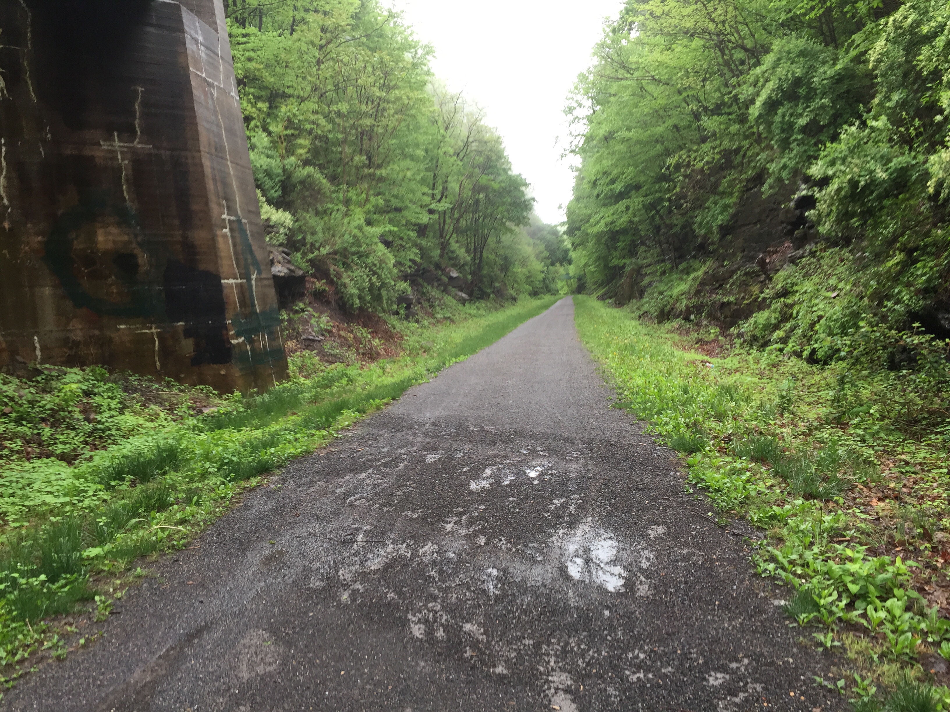
I love tunnels on bike trails
The trail description mentions 2 tunnels and lots of bridges. This was the only tunnel we saw today. It was long enough to need a headlamp, but not very long. This tunnel had a lot of wooden trusses set up near the north end to keep it stable.
One of only a couple large bridges
I only recall seeing 2 or 3 major bridges. The rest are all tiny 10-20’ long bridges over creeks that fed the river.
We took a very leisurely pace today. Our destination today was Marlinton, WV. This is about the only real town we’ve seen since leaving Lewisburg. We decided to book two nights here. We’ll venture north to Cass, about 25 miles, and then return here tomorrow evening.
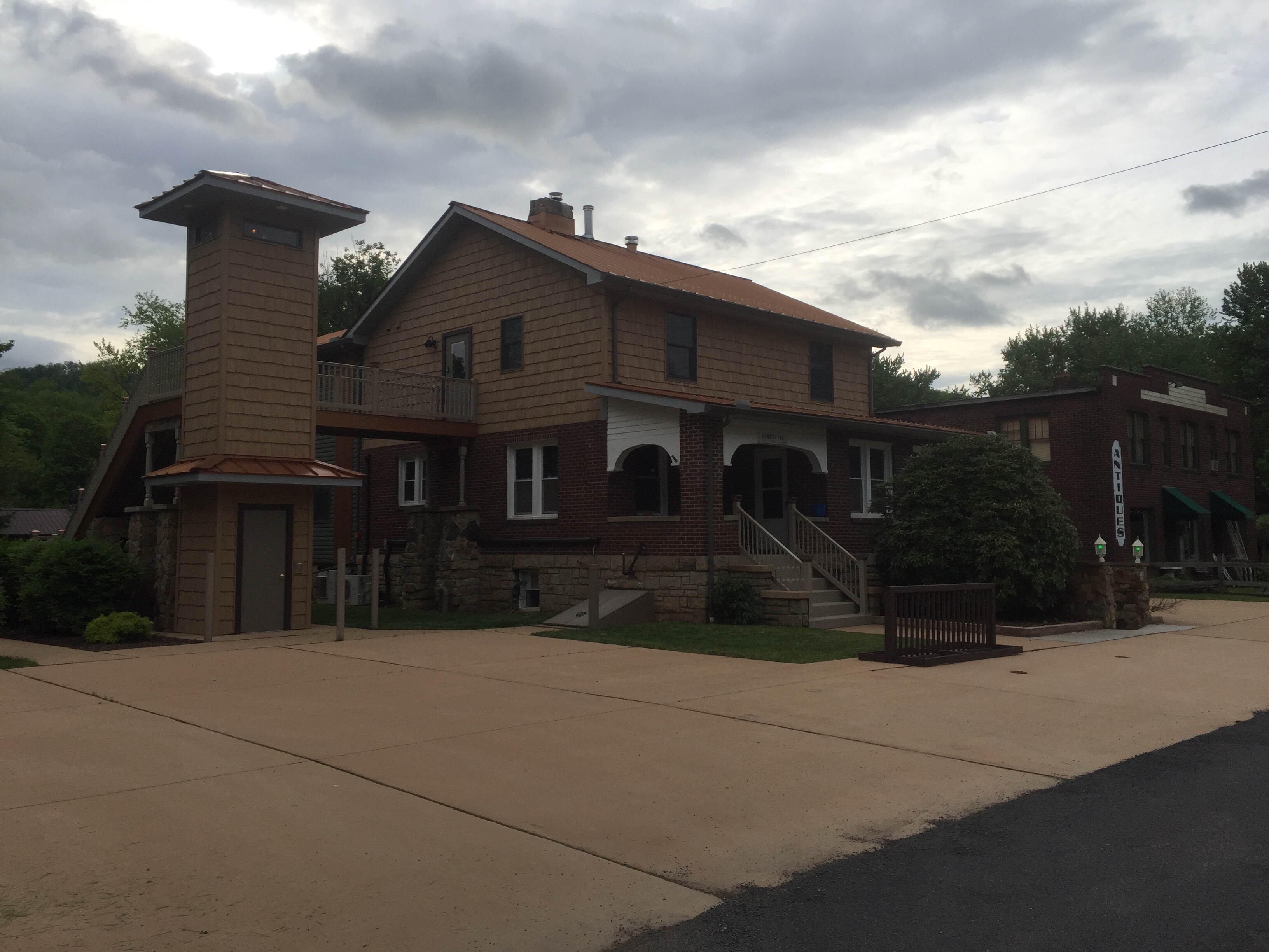
We are staying at the Old Clark Inn. It is a nice older home that has been converted into hotel rooms. It is clean and comfortable.
After getting in and cleaned up, we went in search of dinner. We didn’t have a real lunch on the trail because we didn’t see anywhere to get lunch. We had some energy bars and muffins from the hotel that we carried with us. We also didn’t see anywhere to get water. If you come to ride the Greenbrier, make sure to bring enough water for the day.
We ate at a place called Alfredo’s. The food was good. I forgot to take my usual pictures of dinner. Oh well, just imagine me eating a pizza (without cheese, of course) and some chicken wings. Mmmm…
Joe’s been getting over a cold (no, not covid – he got tested). He not been feeling well this evening, so we may scale back our plans for tomorrow to allow him to get some rest. We’ll see how he feels in the morning.
Our plan for tomorrow is to head north to Cass, about 25 miles, then return. If we’re feeling good when we get to Cass, there is a really neat radio telescope about 9 miles by road north of Cass. I’d love to go check it out!
So until tomorrow, may the Lord bless you and keep you.
Yesterday’s ride was long and tiring. Not in a bad way, but in that way where you feel accomplished and deserve a great night’s sleep. Which I did.
We decided to get up and get moving by 8:15 this morning because we wanted to have time to stop and see the sites around plus we wanted to have a real breakfast in Ohiopyle. We couldn’t find much of anything that we expected to be open in Confluence for breakfast. Ohiopyle is the next real town heading westbound on the GAP.
As we left the BnB, it was very foggy and cool. It made for some interesting backdrop of the ride. Within about 30 minutes, the sun had risen enough to dry everything out and the fog disappeared.
Much of the trail looked like this today. Tall canopies of trees with some rock walls occasionally. When the sun is just past rising, it is bright green and beautiful.
We took many breaks today. Mostly just to absorb the beauty of the day, plus get a snack or water. Mid way towards Ohiopyle, we saw an opportunity to park our bikes and walk safely down to the Youghiogheny river. We sat on the rocks of the river for probably 15-20 minutes and just listened to the water. Very relaxing.
We pulled into Ohiopyle mid morning and set about looking for breakfast. We were all very hungry. Ohiopyle was much quieter today than when we were here on Sunday. We pretty much owned the town. We rode around the main streets and asked some locals where to get breakfast. Every place they suggested was closed. Ugh. We struck out again!
We finally settled for breakfast sandwiches. They were good, but it wasn’t quite the big breakfast we had all been hoping for.
The fact that we’ve struck out so many times on finding food has become a running joke. Every place I’ve recommended is closed. So tomorrow, the other guys get to choose the place.
The Yougiogheny river passes through Ohiopyle in a horseshoe shape, several miles across. One side of the horseshoe is right across from the main part of town. We walked over and sat for a good long time. JB went upstream a bit. I went straight over, and Billy went his own direction. JB and I took our shoes off and soaked our feet in the cool clear water. I did that for about 30-45 minutes. I called my family and did a FaceTime video call so that they could get a small taste of the wonderful views and river sounds.
It was nice not to be rushed today. We spent much more time enjoying the river and views than we did on the previous few days. This has been the most relaxing day of the trip so far.
Eventually I called out to the other guys and we decided we’d better get moving before we decided to sell everything and move to Ohiopyle.
We pressed on at a good clip for most of the rest of the day. As we passed through Connellsville, we stopped to get some water and cool down a bit. The sun started to get a bit toasty. JB has a penchant for laying down on picnic tables and resting. This one wasn’t concrete, but he seemed to like it well enough.
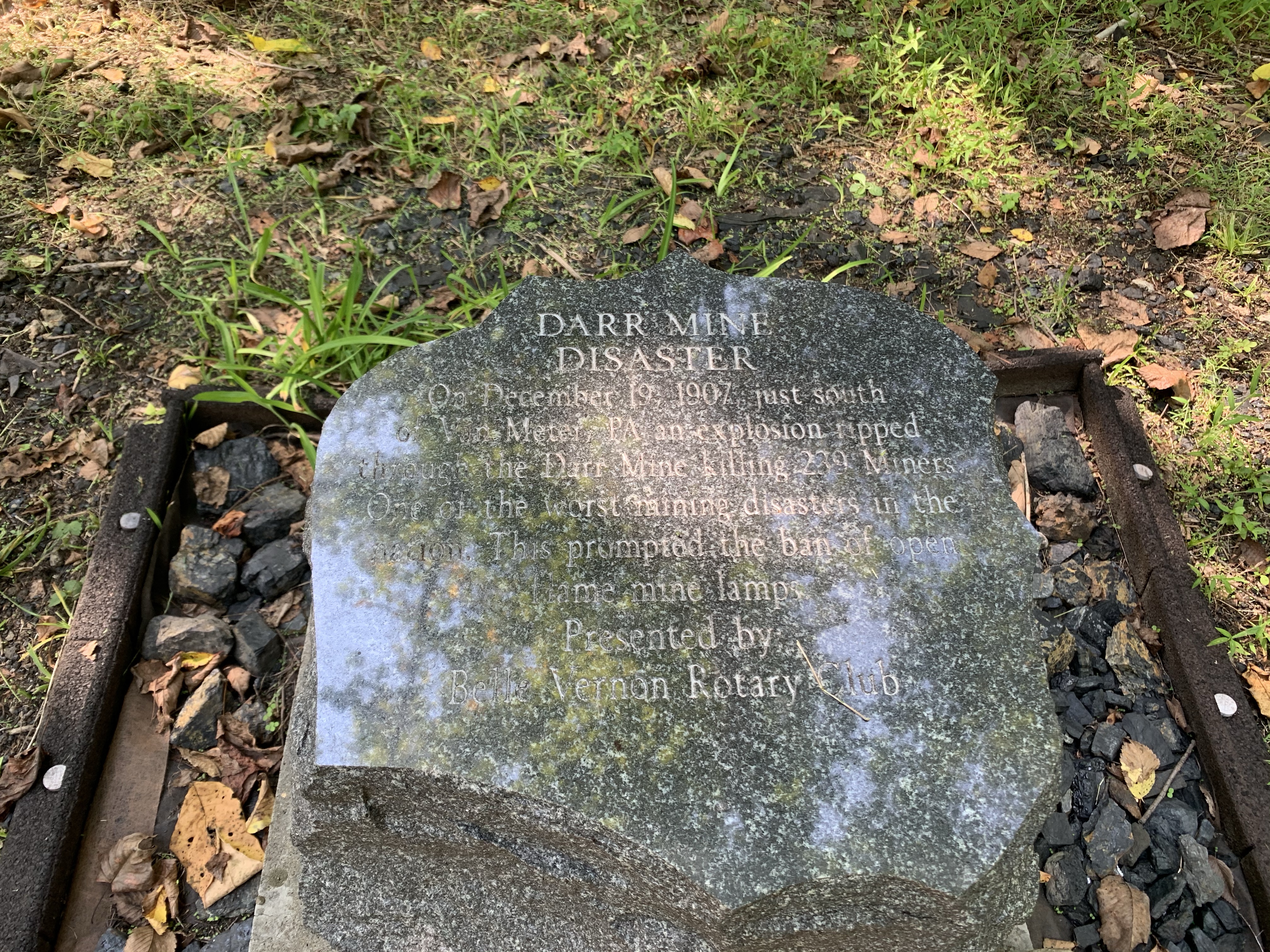
Pressing on, we came to the memorial for the Darr Mine disaster. It is the worst mining accident in Pennsylvania history. In 1907 a massive explosion occurred, likely triggered by hitting a large natural gas pocket along with the miners’ open flame headlamps. The blast killed 229 men – perhaps many more that were never recovered.
A few more miles and we reached our destination for the evening: West Newton, PA. We’re staying at the Bright Morning B&B. This place is right on the trail. It is beautifully restored and spotless. I’m really impressed so far. Let’s see how their breakfast goes in the morning!
After a very soapy shower, we regrouped and went down to The Trailside (again) for dinner. We ate well and then went back to the BnB to sit outside and talk for a while before turning in.
It is only 8PM but I’m really tired. I guess the riding is catching up to me. As soon as I finish my blog and Evening Prayer, I’ll be calling it a night.
Tomorrow we finish up our journey. I planned a very short 34 mile day so that we can be to Pittsburgh before lunch, do a little sightseeing, and then get home before bed tomorrow night. I’m looking forward to seeing my family.
Until tomorrow, may the Lord bless you and keep you.
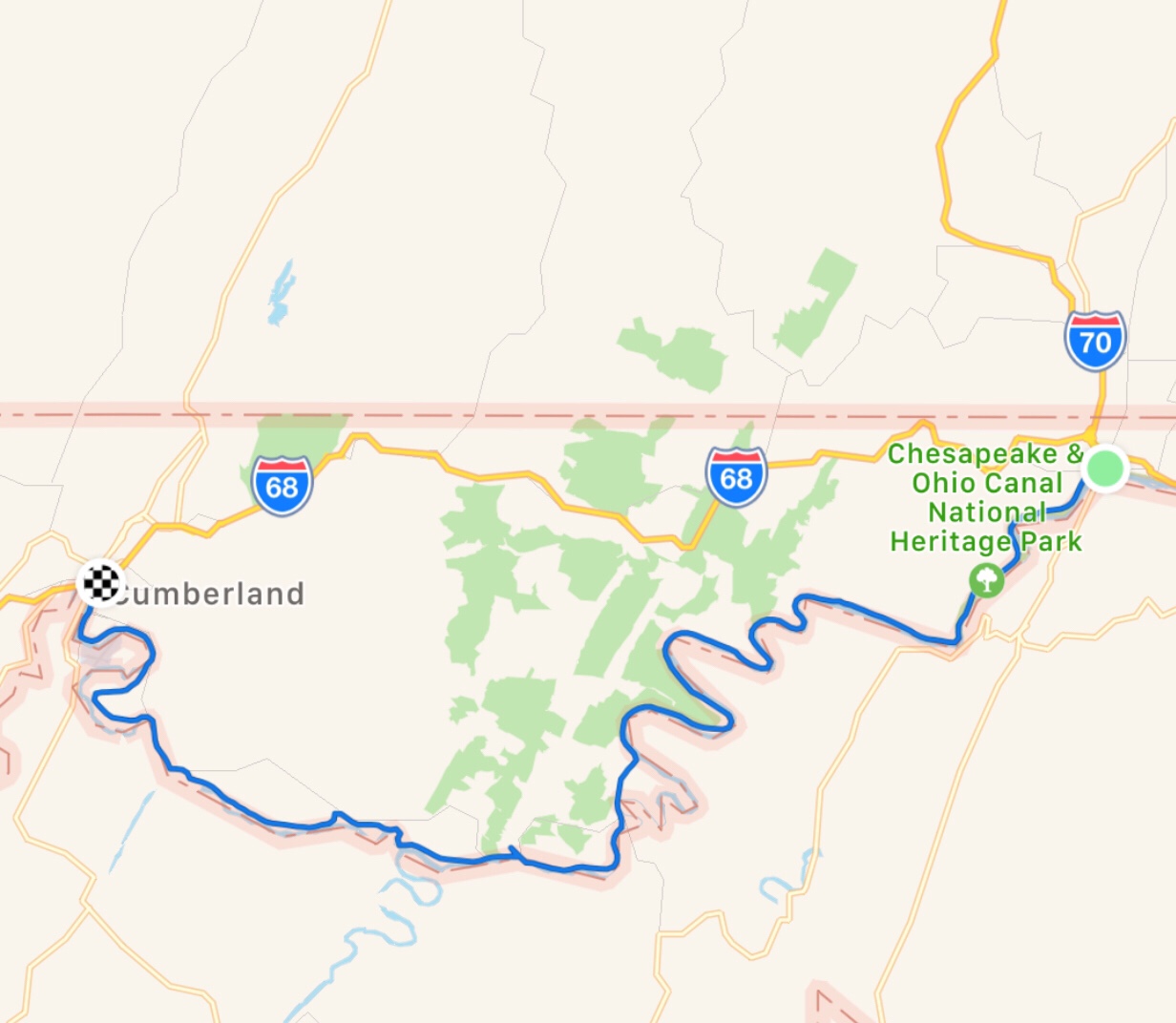
Yesterday completed the first half of our journey. We traveled the entire length of the Great Allegheny Passage from Pittsburgh PA to Cumberland MD over three days. Today began part 2: to go back the way we came and return to Pittsburgh. We will be staying in different towns on the way back so that we see other places and people.
Today’s leg of our return was from Cumberland up to Confluence PA – about 63 miles plus a small detour into Frostburg.
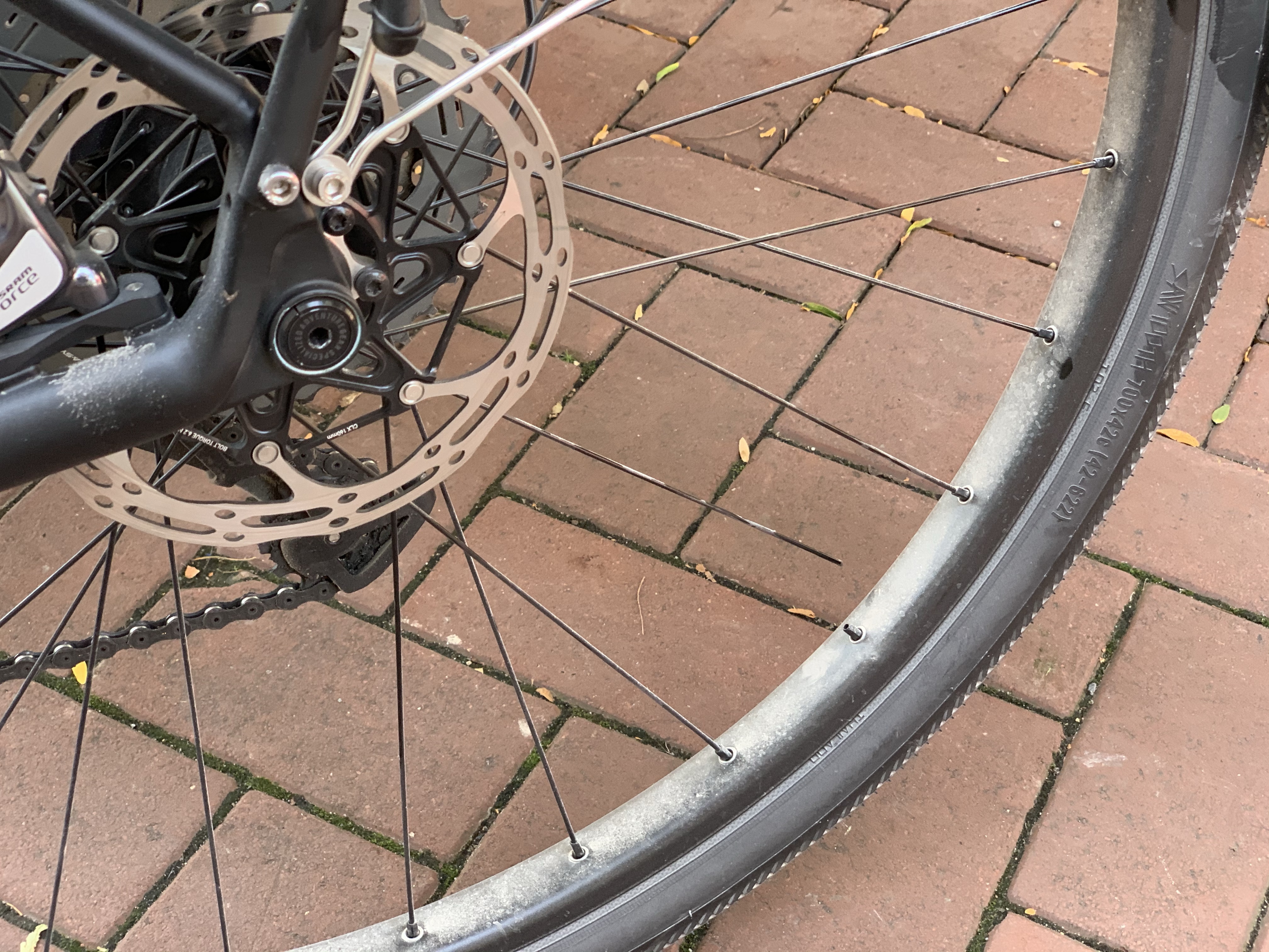
When we last saw our hero’s trusty bike, it was left at the bike shop with a broken rear spoke on the drive side. They estimated that my bike would be ready around 9:30AM. That’s a bit later than we’d hoped, but I was just relieved that my bike could be repaired quickly and get us back underway.
We had a very long day ahead of us – about 65 miles, including a 23+ mile climb from Cumberland up to the Continental Divide. Given the distance and climb, we were going to get started as soon as my bike was ready. I called at 9:30 and they said it would be another hour. Again, I was just thankful it was going to be fixed. So about 10:30 we decided to just go over to the shop and wait there. When I walked in, the bike was ready to go. So I paid my $30 for the repair (a bargain, in my opinion) and got on the road.
The climb up out of Cumberland is really not as bad as it sounds or looks on the map. The first time I did this climb back in 2012 I was very intimidated by the length of the climb and the overall change in elevation. What I learned is that by just going down a gear or two and patiently chugging on, you can do it. Yes, it is ~1800 ft. of constant climb, but if you don’t think too hard, you can just press on. There’s no coincidence that after I reached the top, my average speed jumped dramatically.
Another great part of the climb is that you are treated to some wonderful views. We have been blessed with gorgeous weather all week!
A few miles from the top is Frostburg. There is a nice trailhead here with water. We stopped for a short break to get some calories for the rest of the climb and met some people here. Shortly after, we took the switchbacks up to the train station that serves the tourism train. Unfortunately, the train does not appear to be running. The tracks have a nice haze of rust on them. I’m assuming this is another temporary (?) impact of COVID-19.
A little ways further we crossed back from the South (Maryland) to the North (Pennsylvania). No more sweet tea, I guess.
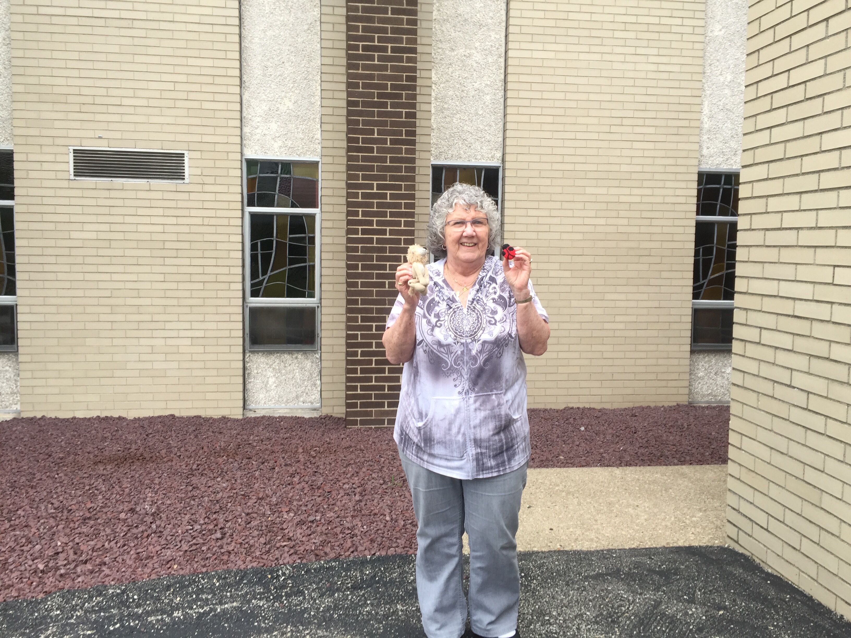
As we stopped for a rest and a few pictures, a couple we met at the Frostburg trailhead came riding along. We talked a bit more and I took her picture with my ride mascot “Ms. Bug”.
Ms. Bug is a neat little crochet lady bug that my daughter made for me a few years ago. I used to travel with a different ride mascot, Mr. Hamster, but he’s away at Rose-Hulman getting his head stuffed with knowledge and keeping my Daughter company.
I decided to stop once again at my favorite lookout. This is the spot just south-east of the entrance to the Big Savage tunnel. I’ve been here several times, but it is still amazing each time. You can see the valley below, roughly the same elevation as Cumberland, I think.
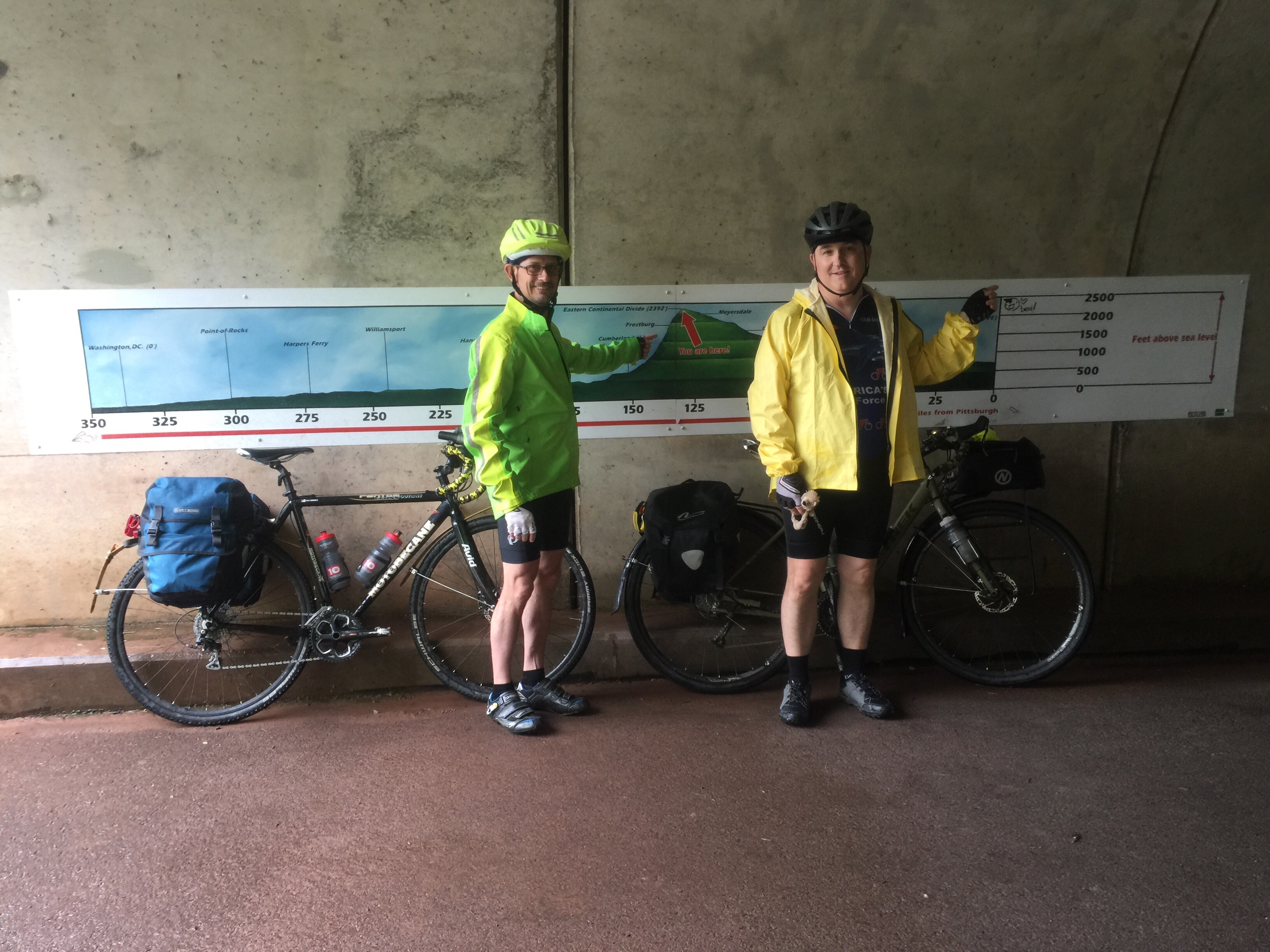
And then we made it! Just a short distance after going through the Big Savage mountain via the long tunnel, we arrived at the first goal for the day: We reached the Eastern Continental Divide again.
Our second goal for the day was Meyersdale and lunch! We made very quick time towards Meyersdale. Without the climbing grade, we were plugging along between 18-20 miles per hour until we got there. We dropped into town at about 2:15PM, only to find out that the GI Dayroom was closing shop for the day. Ugh! It is a great place to eat, but missed it on both directions. I guess that means we just have to come back and ride the GAP again!
We had a quick lunch of chili dogs at ”Take 6” in downtown Meyersdale, and then climbed back up the street to the trail. Not a bad climb, but I felt it a little in the quads today.
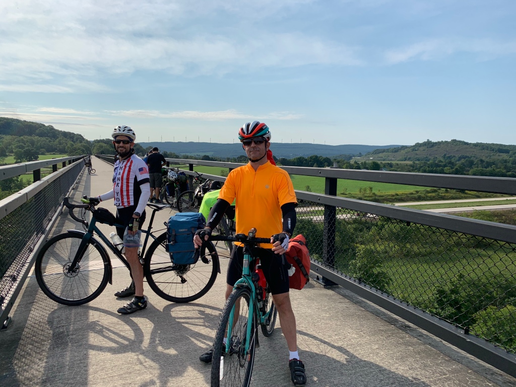
Next up are the great bridges. Just NW of Meyersdale we crossed over the Salisbury Viaduct again. Pictures really don’t do it justice.
We pressed on at a good clip but decided to take a short stop at the trailhead in Rockwood. We sat in the shade and drank some much needed water. Too bad the bike shop wasn’t open.
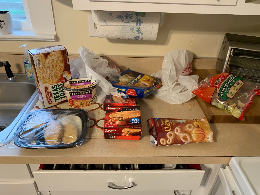
Our last stop for the day is our AirBnB in Confluence. We arrived and got cleaned up. We called a couple of restaurants within walking distance, but nothing was open. The good news is that we’re all three pretty easy to feed. We walked over to the local supermarket and purchased some food we could easily heat up at the rental house. I would not say it was gourmet, but it did the trick. I had a beef pot-pie and some simulated fried rice. I’ve certainly had worse meals.
Tomorrow we head about 55-ish miles to West Newton. We’re going to do a simple breakfast here and then go in search of a really GOOD breakfast in Ohiopyle, about 15 miles down the road. Hopefully we’ll have more success this time.
Overall a great day of riding! Doesn’t get much better than good company, good riding, great weather, and making memories.
Until tomorrow, may the Lord bless you and keep you.
The hostel we stayed in is about 30 feet from a major train line and about 25 feet from a railroad crossing. So every time a train would come through, the noise of the trains and the horn would be loud. However I was tired enough, plus earplugs, and I didn’t hear a single one of the trains last night. I usually sleep until 5-6AM. Today I woke up at 6:45. Needless to say, I felt great.
We had a simple breakfast of energy bars and some canned peaches. We decided that we would make our way to Meyersdale – about 14 miles away. Once again, the weather was picture perfect. Cool, crisp, dry, and blue skies.
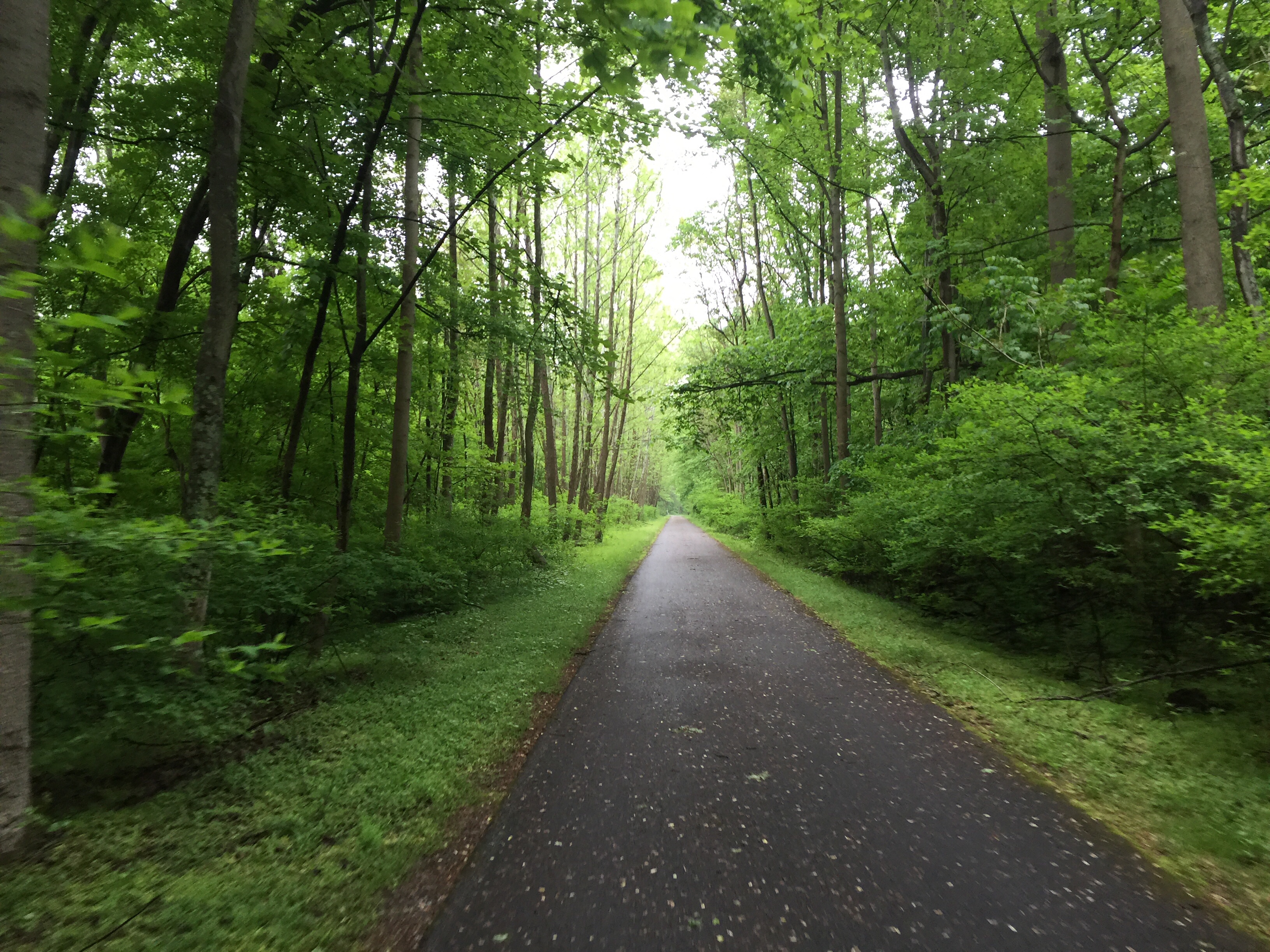
This section of the GAP between Rockwood and Cumberland is probably my favorite part. There are patches of woods, interspersed with railroad bridges, tunnels, and tremendous views of the mountains.
My favorite bridge on any rail-trail I’ve done is the Salisbury Viaduct. This bridge is a converted train viaduct, stretching about 1800 feet long over the valley below. It crosses a major highway, the Casselman river, and some farm country. The views are great. You also get your first glimpses of the windmills that are high in the mountain ahead.
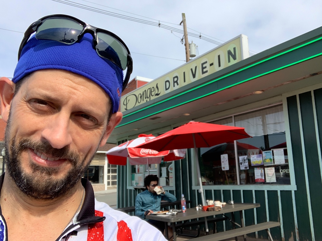
Once we arrived in Meyersdale, we rode down the hill into town and found a place to eat. We really wanted to eat at the GI Dayroom, but it was closed due to Labor Day. We wandered around and found a neat little place called Donges. The food was good and we enjoyed our time before climbing our way back up from downtown Meyersdale to the trail.
As we were sitting down during breakfast, we ran into Russ. There is something that happens so often during bike touring, I feel compelled to describe it. Some people call it “trail magic”. I see it more as “Godincidences”. These are the opportunities to run into people that you know, day after day. Yes, you’re riding the same direction, but each at your own pace, each choosing different places to eat, sleep and so on. Yet with all of these combinations and permutations, somehow you keep crossing paths. I have had this happen on every bike tour I’ve done in the past ten years.
With Russ, we “met” on facebook. He posted in a group of trail enthusiasts that he’d be riding the GAP. Without any planning whatsoever, I bumped into him outside of Pittsburgh and we introduced ourselves. Then we’ve crossed paths several times over the past 3 days. Pretty neat.
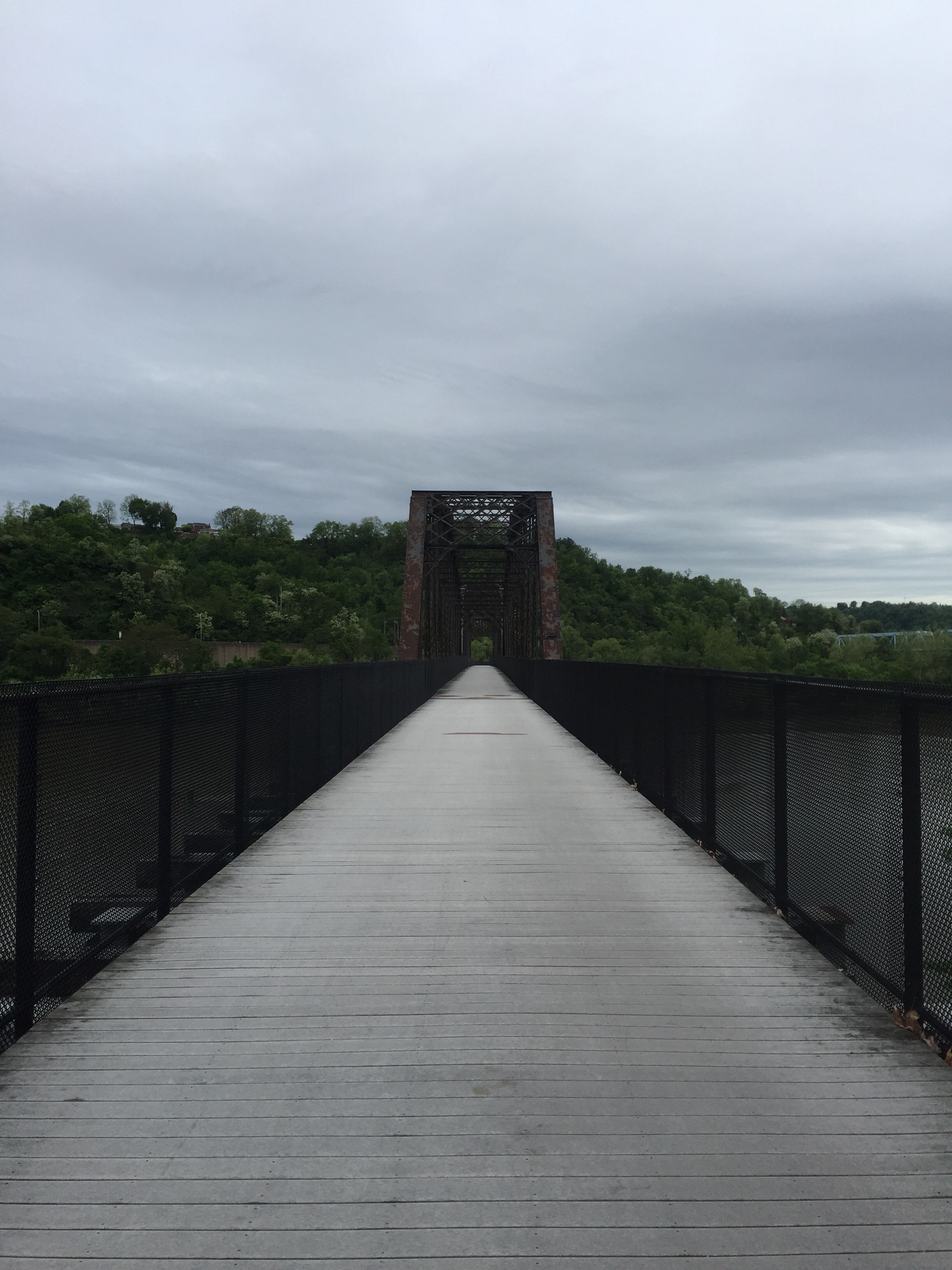
Back underway we made our trek towards the Eastern Continental Divide. A few more really neat bridges and tunnels. This bridge is a Bollman truss bridge. It was not originally part of the railroad here, but was moved here to span the road below for the bike trail. I think the cast iron ornamentals are interesting. You don’t see these kinds of details on modern bridges.
This is another of my favorite bridges. It was originally designed for two train widths. Only one side is used and was converted for the trail. This bridge is several hundred feet long and provides spectacular views of the valley to its left and right.
A few miles later, we finally made it to the Continental Divide. This is the high point that divides the eastern watershed from the central watershed. On the east side, water flows into the Atlantic Ocean. On the west side, water flows into the Gulf of Mexico.
On this map, we rode from Pittsburgh on the right side to the “you are here” marker. We continued today down the mountain into Cumberland later today. Tomorrow, we turn around and make the climb back up to the top!
The way down from the divide is always a fun ride. It is a gentle grade, but enough that it makes for a very easy ride. There are a couple of tunnels along the way, including the Big Savage tunnel. This tunnel is over 3200’ feet long. You take off the sunglasses, turn on the headlight, and enjoy the pleasant cool temperatures in the tunnel. Just wonderful!
After emerging from the tunnel you are immediately treated to one of the best views I’ve ever seen from my bike. From up here, you can see several layers of mountains in the distance.
Just before we went into the tunnel, JB noticed that my rear wheel had a slight wobble. I looked down, and sure enough, it had a wobble! That is not good. When we stopped, I checked and I had a broken spoke. It is not a common occurrence, but it needs to be taken seriously. I called ahead to the bike shop in Cumberland and made arrangements to have someone work on my bike.
Moving along, the next stop was the Mason & Dixon line separating Maryland from Pennsylvania. We took the requisite picture of us being in two states at the same time.
We decided not to stop anywhere else on the way down so that I could get to the bike shop and hopefully catch the mechanic today. We made really good time and found our way to the bike shop.
On the plus side, they did happen to have the right spoke size. That’s a blessing – there are many sizes and they happened to have the right one. On the down side, the mechanic was already gone so it won’t get fixed until tomorrow morning. That will delay our start tomorrow morning until I get my bike back. In the grand scheme of things, that’s not a problem. I’m thankful for the help!
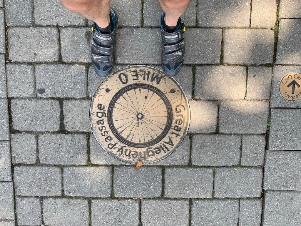
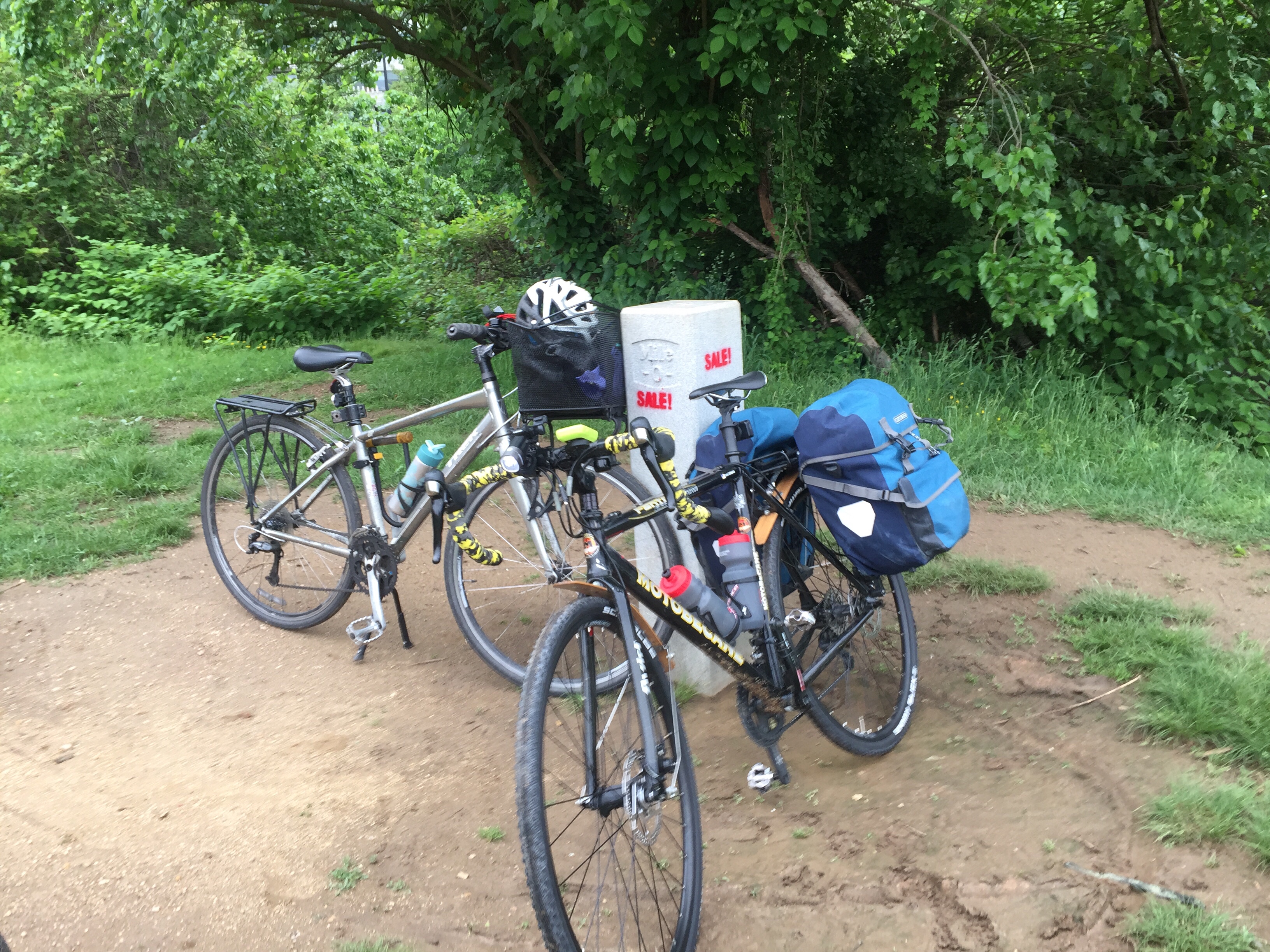
We took our picture at the “Mile 0” marker for the Great Allegheny Passage and then went to the Fairfield Inn to get checked in and cleaned up.
We had some trouble finding a place open for dinner, but we eventually got pizza here. The food was decent but the service was … well … anyway the food was good.
So now I’m sitting at the Fairfield, finishing up our laundry and writing my blog. It has been a very good day.
Tomorrow we begin our return trip back to Pittsburgh. I designed our itinerary to stop in different towns on the way back. Tomorrow will be a long day. We have 63 miles from here to Confluence. That includes a 23 mile climb from Cumberland back up to the Continental Divide. Hopefully my bike is ready early so we can get underway.
Until tomorrow, may the Lord bless you and keep you.
Our stay last night at the Comfort Inn was uneventful and pleasant. We found a way to fit three bikes and an air mattress in. It was a little like Tetris, but really not too bad.
Our breakfast was again a bit underwhelming due to COVID. The hotel provided a bag breakfast of a microwave sausage and egg sandwich, a granola bar, and and apple. It was enough to get us on the road. We decided we would eat a real breakfast in the next major town, Ohiopyle.
Leaving Connellsville you pass these neat grain (?) silos. The first time I saw them back in 2012, the paint was very vibrant. The art is still fun, but the murals are looking a bit worn down.
As we pedaled along, we were continuously treated to some fantastic scenery and views of the river. Here’s one example. As we stopped to get a snack, we met up with a couple of young ladies who were cycling their way to DC. We talked here for a few minutes and wished them well on their journey.
This part of the trail has several places where you can see the shale and coal in layers. I really enjoy the beautiful views as well as just being out in the middle of nowhere. The trail conditions have been fabulous.
As you get closer to the laurel highlands, the river starts to wind back and forth. So when the railroads went through, they would build bridges across the river instead of having to go far out of their way. These railroad bridges are now converted for cycling and pedestrian traffic. The views are wonderful. Today we were treated to great weather, blue skies, and cool temperatures.
We eventually made it to our first stop: Ohiopyle. This is a great little town. The first time I came through here back in 2012, it was a quaint town. In the mean time, the traffic has really increased. Ohiopyle is in a state park and people come from all over for the recreation. There is great whitewater rafting, biking, hiking, and so on. If you are into outdoorsy stuff, you should make a stop here.
We decided to have an early lunch in Ohiopyle. Not only is the traffic up, but so are the prices! I paid $13 for a grilled chicken salad. It was good … but not $13 good.
From Ohiopyle, we pushed on to our next stop: Confluence. Confluence is so named because it is the confluence of two major rivers and a creek. From the sky the intersection of these make the shape of a “turkey foot”. We will be staying overnight in Confluence on our way back, but we decided to check out the town a little bit today. We went in search of ice cream for JB and Billy.
After making a loop around the town square, the owner of Confluence Cycles told us about a good place called “Outflow”. We went over there and JB and Billy each got a wonderful looking cone. I can’t have dairy (booo!) so I got a cherry slush puppy. It was good, but the ice cream really looked much better.
Leaving Confluence we made our path to Rockwood – our destination for the day. Most of the path between the two looks much like this:
This tunnel is the Pinkerton tunnel. It was in total disrepair for many years after being abandoned by the railroad. You used to have to take a 1.5 mile bypass around the Pinkerton Horn to get around it. The GAP raised enough money to have the tunnel repaired and lined with corrugated steel to shore it up and make it safe.
Right after the tunnel (on the south-east side), you cross the Casselman river. The views are great!
We finally made it to Rockwood. My legs are unusually tired for a 50 mile ride. Hopefully a good evening of rest will help a bit. We have an easier ride tomorrow, too.
We are staying at the Hostel on Main in Rockwood. It’s clean and comfortable. Upon checking in, I saw this guy. I recognized his face – I have a great memory for faces. I asked him his name and sure enough, he is a friend of a friend of mine who lives in Pittsburgh! This is John. I met John last year when my friend Rich and I (and John) rode with a large group from Cincinnati to Xenia Ohio. It is a really small world.
Our timing for staying in Rockwood was a little less than ideal for dinner. Everything except the local gas station/bar/mini-mart was closed because it is Sunday. However, as we wandered around town, we found a small grocery store a block away from the hostel. We picked up some pasta and jarred sauce. When we got back to the hostel, I found a casserole cooking thingy. I filled it with water and boiled the pasta then poured the sauce on it. For a grand total of $5.49, the three of us ate till we were full and had leftovers. The sauce wasn’t the best, but it was a decent dinner!
Tomorrow we finish the eastbound trek. We will go from here up to the continental divide. Then we have a 22-ish mile descent down into Cumberland. Looking forward to some beautiful views along the way.
This next section of the GAP is my favorite. We’ll see several tunnels, bridges, and some fabulous vistas. Stay tuned!
Until tomorrow, may the Lord bless you and keep you!
Last night we stayed at the Hampton Inn in downtown Pittsburgh, right near the convention center. The room was really nice. As an added bonus, it was a large enough room to comfortably have 3 guys on separate beds and 3 bikes in the room. Breakfast was meager: due to COVID, there wasn’t any breakfast – just some instant oatmeal. I guess that’s good because I really wanted oatmeal anyway!
Time to go!
As we started, the weather was crisp and cool. Couldn’t have really wanted better weather. Blue skies, cool temps, and not much wind.
Leaving the hotel, we picked up a trail on the south-east side of the Allegheny and rode straight to The Point state park. The is the confluence of the three rivers in Pittsburgh.
After leaving the point, you have to go a few blocks down the Boulevard of the Allies before getting on the GAP trail. About half way, JB looked left and called over. We went back and found PPG Park. PPG is also known as Pittsburgh Plate Glass. When you see the skyline of Pittsburgh, there is a really neat skyscraper that looks like it has a castle rampart at the top. That’s the PPG building we saw. The complex of buildings surrounds a courtyard with a fountain. Each of the buildings is covered entirely with plate glass. Very appropriate for PPG. I’ve never seen it up close before. It was worth the diversion!
We made our way at a comfortable, yet quick, pace eastbound to the Hot Metal bridge. The Hot Metal bridge is named by its former function. It used to carry molten metal from one side of the river to the other during steel production. Now it carries cars, runners, and bikes. It has a separate bridge deck just for bike and pedestrian traffic. We stopped mid way and took pictures. It has a great view of downtown. You can see the PPG skyscraper off in the distance.
We pressed on and made our next stop in Homestead. This is the site of the violent clash between the Pinkerton strike-breakers and unionized steel workers. Several people were killed in these clashes. Ultimately the workers stayed fast and won the day. I found it to be an appropriate place to ponder as we enter this Labor Day weekend.
As you leave Pittsburgh, there are several really nice bridges that help the GAP go across the various train tracks and switch yards. They are fun to go up and over and back down, plus they give some neat views.
The last two bridges for a while took us into, and then out of, McKeesport. We stopped for a snack and pressed on.
Working our way westward, we passed through several small towns before stopping for lunch in West Newton. We stopped at “The Trailside”. I’ve been here before and it did not disappoint. I also put away about a quart of beverage. I had been drinking all along, but didn’t realize how thirsty I was!
After lunch we pressed on to our stop for the evening: Connellsville. We pulled into the Comfort Inn and got washed up. I was able to get quickly cleaned up and made it to mass at St. Rita’s.
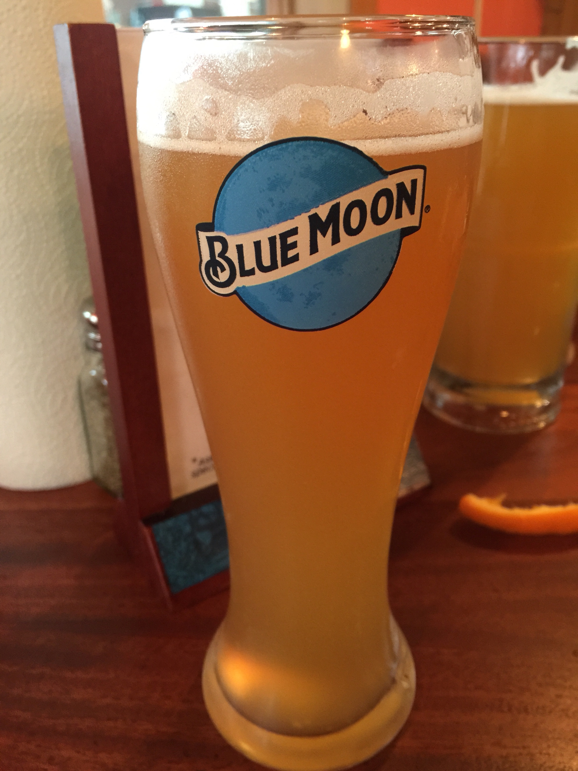
After mass, I met JB and Billy at a local pub for a dozen wings and a Blue Moon. Mmmmmm…. a bit of a guilty pleasure. I don’t often have a beer or chicken wings – but today was a good day to have both.
Tomorrow we head to Rockwood. We’ve got some good sightseeing to do along the way.
Overall, today was a fabulous day of riding. Good weather, good trails, good friends, and not a single zoom or MS Teams call!
Today’s Stats: 62.35 miles, about a gallon of water, one hamburger, 12 tasty chicken wings, one beer, and a great time.
Until tomorrow, may the Lord bless you and keep you.
A little over a week ago, we finished up our tour from DC to Washington on the C&O Canal and Great Allegheny Passage. I’m just adding a few parting thoughts about our adventure.
Some stats:
372.61 Miles, mostly off-road
Total Time on the bike (moving time): 32 hours, 15 Minutes, 44 Seconds
155,083 complete pedal rotations, give or take a few. (310,166 left/right pedal steps)
Meals with french fries: 2. Meals with bacon: 3.
This is the fifth trip that Joe and I have made together. Usually we’ve found a new route to try, but this time we decided to go back and do the C&O/GAP again. We rode it together 3 years ago going from west to east (Pittsburgh to DC). That time, we did it in 6 days, which didn’t leave much time for sight seeing or side trips. It also made for three very long days on the C&O.
When we picked our trip for this year, we considered a few different bike routes. There are some on our bucket list that would take longer to ride, or are farther from home. We narrowed the list down to trips we could get to/from in a day and complete in a week or less. Looking back, we both really enjoyed the 2015 trip, but we wanted to see a little more of the history along the C&O. Given that we were very familiar with the course, it also made the planning easy. So… we chose to do this course again, but start from the DC end.
Every time we do one of these trips, people ask me some common questions. Here are some answers:
How much did you train? I recommend at least 500+ miles of training, with at least 2 or 3 back-to-back 50 mile rides. Build up slowly if you’re not already a cyclist. I had about 700 miles under me this season, and I stayed in shape over the winter using a spin bike. Last year, I had about 1,000 miles before our trip and it really helped.
What do you do if it rains? We put on raincoats and keep going. We’ve never been caught in a torrential storm. I suppose it could happen, and we carry enough clothing to keep us safe in the event that we need to seek temporary shelter.
Why do you like this? It doesn’t sound fun to me! Some people like to run, camp, hike, lay on a beach, or take a cruise. I really enjoy seeing the outdoors and I enjoy cycling. When we are riding, there is a lot of time just to let the mind and spirit unwind. It is like a rolling retreat for me.
What kind of bike is that you’re riding? I use a converted cyclocross bike because it is a bit more heavy duty than a road bike. I strongly suggest 34mm or wider tires and fenders. When dealing with mud, you’ll want them. The GAP is more forgiving, but the C&O definitely requires at least some decent tread on the tires. This is certainly not a trail for a road bike. You might get away with it on the GAP, but definitely not on the C&O.
My thoughts on the overall trip: I enjoyed this trip very much. We had a great time together, and we saw some neat places. I enjoy the people we meet the most. We had a few people we crossed paths with several times throughout the trip. It was fun to compare notes.
The C&O is not high on my list of good trails. The surface is very muddy and bumpy. There are some neat places along the trail: Harpers Ferry, Shepherdstown, and so on. But it is pretty sparse. The Potomac is a beautiful complement to the trip since you’re next to it for almost the entire ride. This year the conditions were very muddy, especially the area between Hancock MD and Cumberland MD. That 60 miles was really rough. That made for a very long day with not much to break up the hours in the saddle.
We also saw that the National Parks District had several shutdowns on the C&O just one day after we went through. The rains caused a lot of damage on the path and washouts. Back when the C&O was in operation, some flooding is what ultimately brought it to a halt by breaching the canal. I can see how that would happen.
The GAP was in great shape, though. We had more rain on that section, but the trail surface drains well. We didn’t see much of any mud and our equipment stayed relatively clean. The GAP trail town alliance does a very good job of building up the micro economies in the towns, providing food and shelter along the GAP.
I don’t know if I’ll ride the C&O again any time soon. If you like trail riding, it should be on your bucket list. After riding it 3 times now, I can say it doesn’t rate in my top 5 trails I’ve been on by itself. Combined with the GAP, it does make for a very nice week-long bike trip.
If you’re interested in learning more about either the C&O or GAP, feel free to drop me a note and I’d be happy to talk you about it. You can also find more information here:
Great Allegheny Passage trail: Web Site
C&O Canal from the National Parks: Web Site
We’re not sure where we’ll go in 2019. If you have any good suggestions, let me know!
Today was a much shorter day. We planned it this way so we could drive home to Lexington after we finished up today.
We left the rectory at Holy Family and started our trip out of town from West Newton. It was a little sad to say goodbye because we felt so at home there.
This last part of the trail is one of my favorites. There are lots of neat things to see and there is enough change going on to hold your interest. In 30 miles you go from small towns, past lots of little water falls, some old coal mining history, industrial areas, the outskirts of of the city, a bunch of nice bridges over the rivers and train tracks, and finally down into the heart of Pittsburgh. That’s a lot to see in such a short distance.
Here’s a neat example of one of the water falls. This particular one is full of iron so it runs red.
This one, a little farther down runs white due to some sort of aluminum runoff. I made a very short video so you can see it. In a picture, it looks like a regular waterfall. But in the video you can see that it looks more like a milky color.
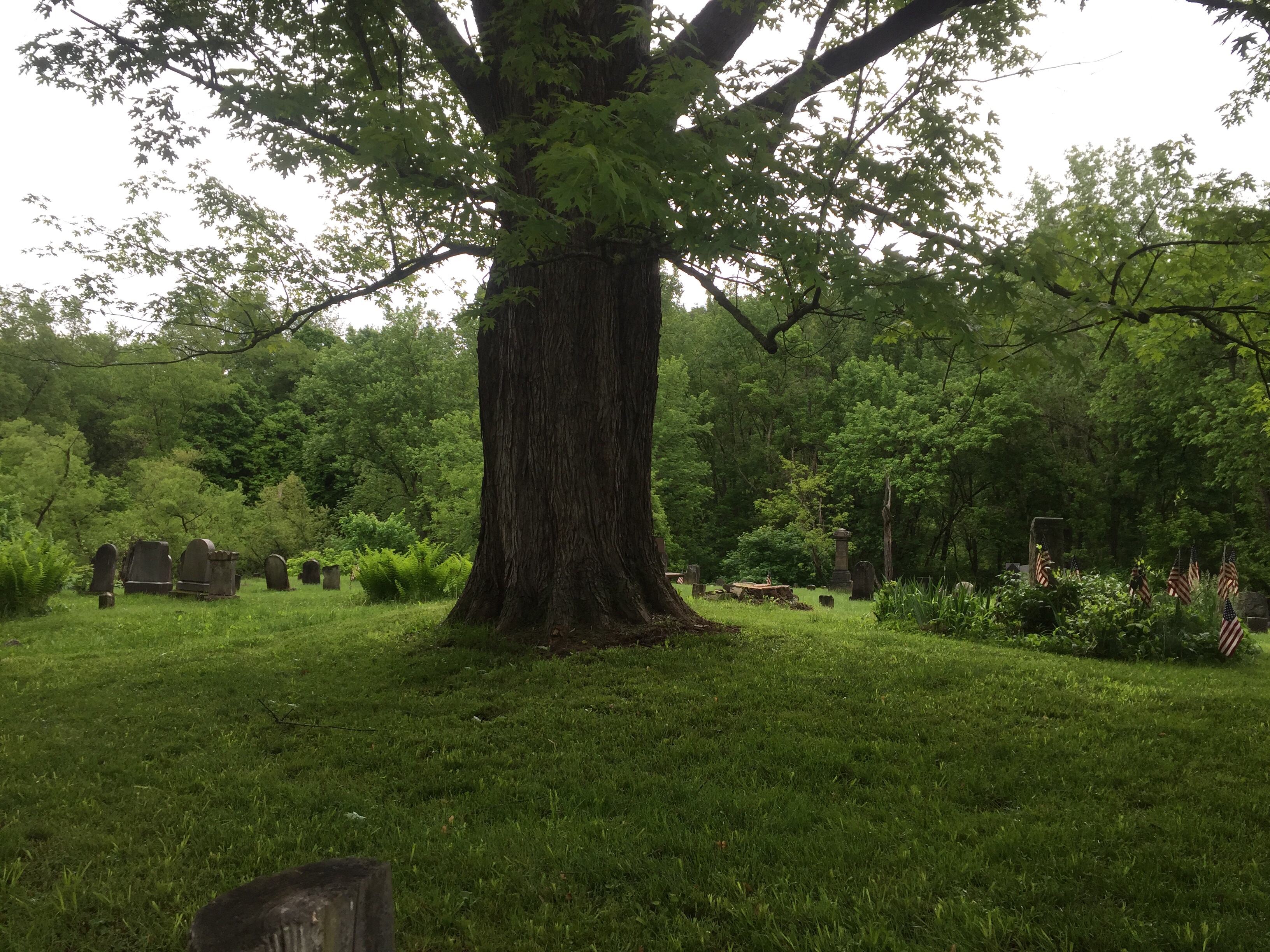
We also passed this really neat little cemetery that is where two small railroad towns used to be.
As we pedaled along, we came through McKeesport. About this point, you start to see more of the industrial beginnings of Pittsburgh. Lots of old steel bridges and structures.
The Great Allegheny Passage has some really nice bridges across the river. I’d love to know the history of some of them – I’m sure some were former railroad bridges, and some of them appear to be new structures built specifically for the GAP.
We stopped mid-bridge to take in the view of the Monongahela River with some barges being pushed along.
You can see how overcast it was early this morning. We had chilly temperatures and some light rain for about the first half of the ride.
We reached Homestead, the sight of the famous strike clashes between the union and the steel mill owners.
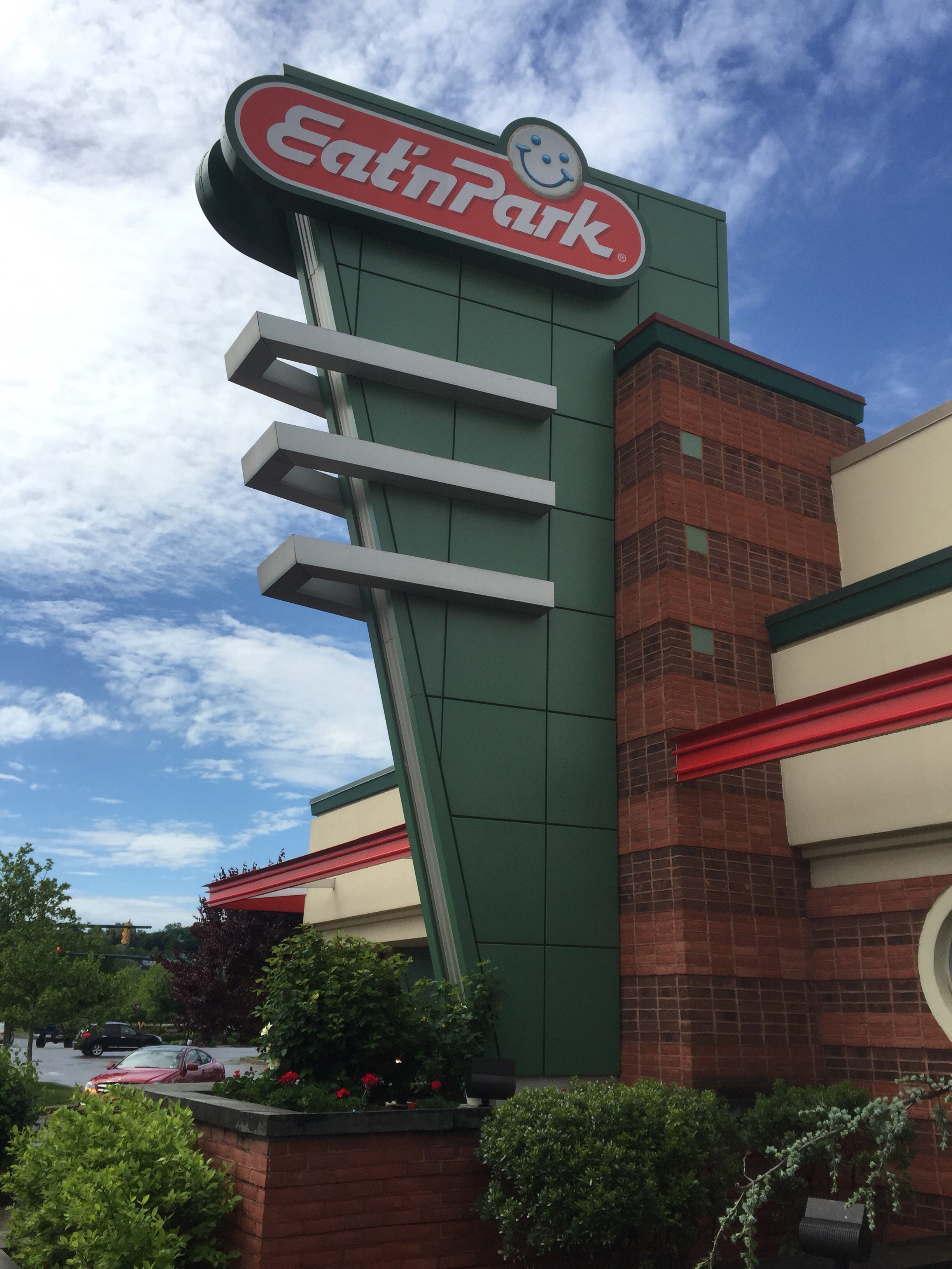
We were getting hungry – we had just a very light breakfast of pocket food before leaving. We cycled past the Eat ‘n Park. Joe had never seen one before, so we went in and had a good breakfast. When we went in, it was raining. When we came out, the skies were blue and the sun was shining. It was an amazing change in such a short time. The nice weather stuck with us for the rest of our trip today.
The Hot Metal bridge is just on the south-east side of the city. It gets is name from its original purpose: it used to carry molten metal across the Mon river to be processed. Now it is a bridge for cars and a separate deck for bikes & pedestrians. The bridge also gives some great views of downtown.
Here’s the first real view of downtown we were treated to. It was a beautiful day once the rain stopped!
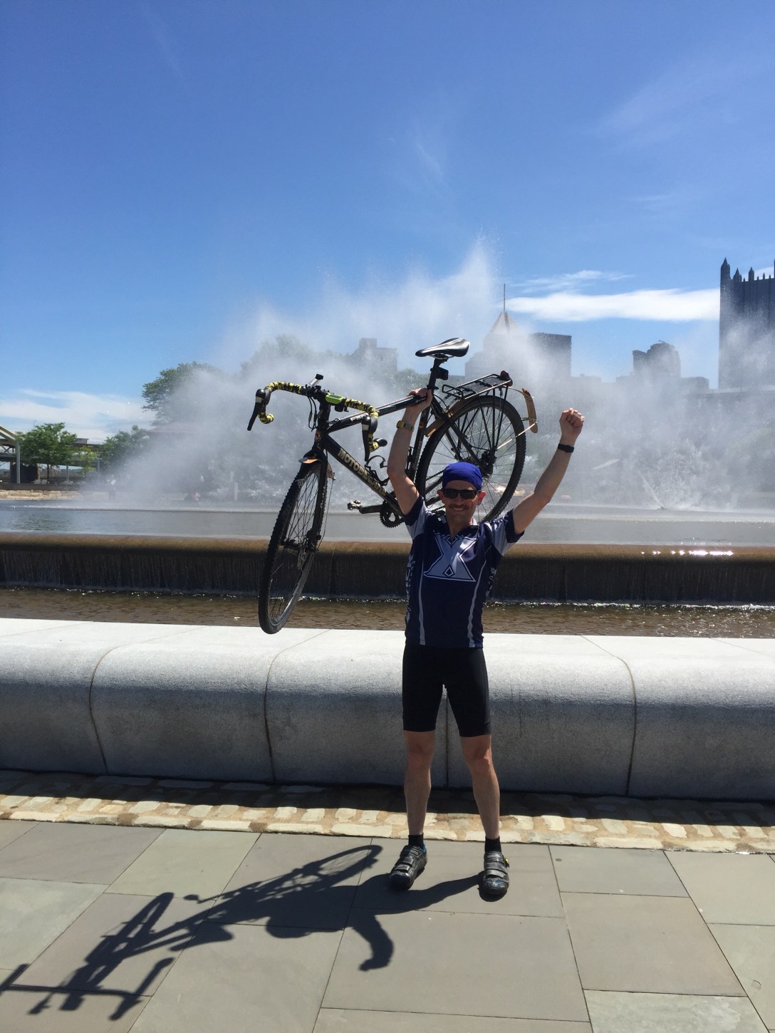
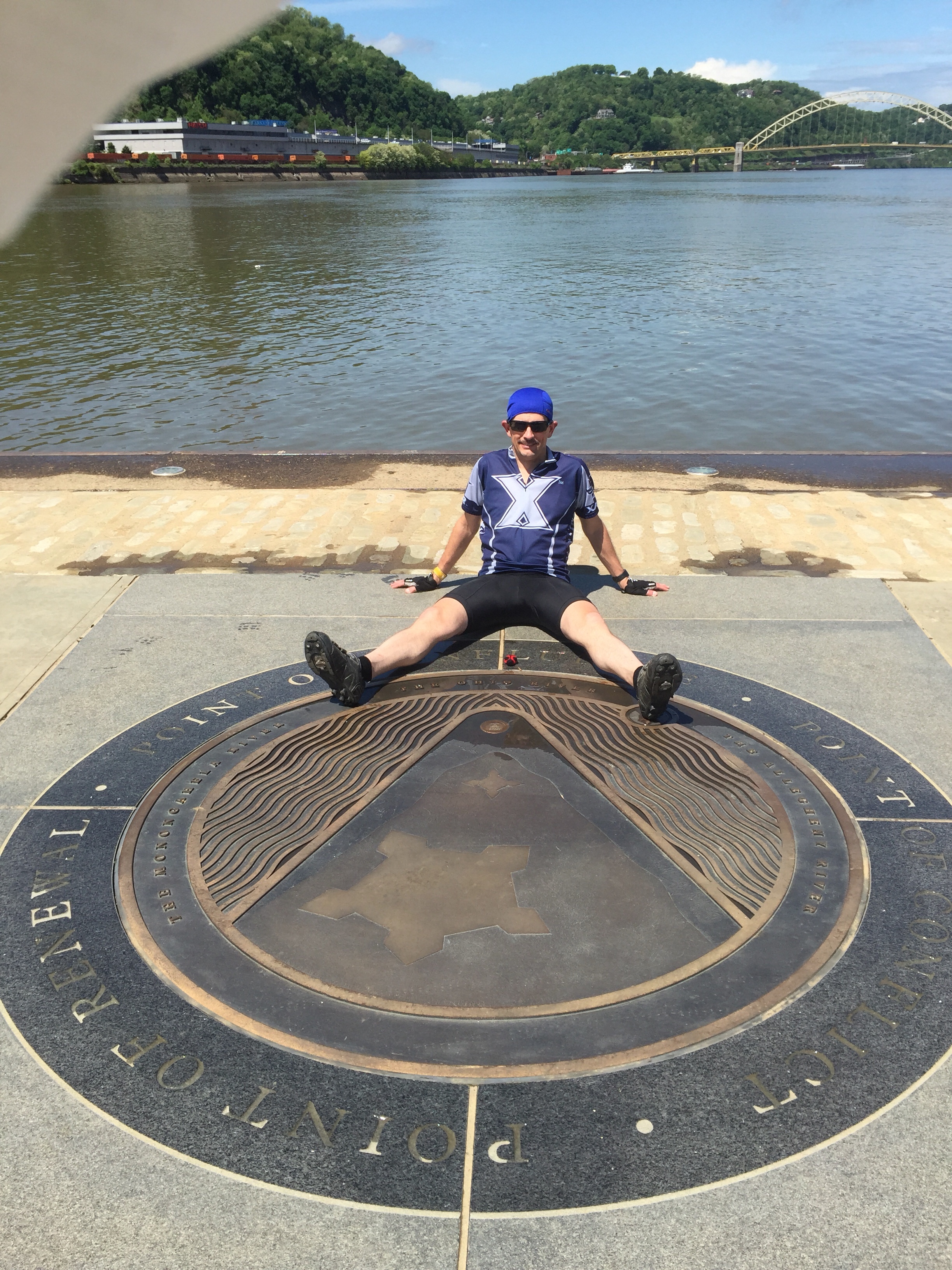
A few more miles took us down on a few city streets and to The Point State Park. This is at the confluence of the Monongahela, Allegheny, and Ohio rivers. It also is the historical location of Fort Pitt.
Inside the park is an iconic fountain that you will often see in pictures of Pittsburgh. There is a large marker in the concrete to show the confluence, as well as the official end of the Great Allegheny Passage.
Although it had been pretty chilly earlier in the day, it was getting a bit warm, especially in the direct sun. The water of the fountain looked very tempting. I’m quite sure the parks people would frown on our behavior, but we decided to take off our shoes and soak our feet in the fountain for a few minutes. It was delightfully cold and felt great. It was nice just to soak up the end of our trip. We talked for a few minutes and just enjoyed the accomplishment.
We did it! 373 miles in 7 days. 4 states + Washington DC.
We still had to get back to our car and drive home. We took a bike path up the eastern side of the Allegheny that took us very close to St. Stanislaus parish and our car. We quickly changed our clothes and did a quick bird bath with some wet wipes before driving home.
It has been a great trip, but I was awfully glad to get home and be greeted by my wife and our two schnauzers. If you ever really want a great greeting committee, it is hard to beat a happy dog – or two.
I’ll follow up with a couple more notes for the trip in my next posting. I’m really looking forward to my own bed tonight!
Our day started with a quick breakfast of “pocket food” (energy bars and a pop-tart) before leaving the hostel. It wasn’t enough for our day, but we just needed enough to get us to Ohiopyle – about 12 miles away. The Yough river was running pretty high as we crossed the bridges back to the GAP.
The weather today was cool and overcast, with a few gentle sprinkles throughout the day.
We arrived in Ohiopyle about an hour ahead of schedule, which allowed us to get a decent breakfast.
Today we were able to do something that has been on my bucket list since I was 16 years old: I visited Fallingwater, the Frank Lloyd Wright house here in Ohiopyle.
Originally we thought we would cycle the 4 miles from the trail out to Fallingwater. But when I called for tickets, the person at the desk said that it was a dangerous ride. Then Joe called a place in Ohiopyle that could give us a ride. They said the same thing. So … we paid for a shuttle out. After seeing it for ourselves during the shuttle, I am very glad we took their advice. The grade was very steep, very long, and had a narrow shoulder.
We arrived a few minutes before our scheduled tour.
Fallingwater was designed by Wright for the Kaufman family – the family who owned the Kaufman department stores in Pittsburgh. Eventually their son donated the property to a conservancy which now cares for the property and maintains it as a museum.
Fallingwater was designed to be Organic Architecture, meaning that it takes its form from its surroundings. This area is full of rocks and water falls. These were the inspirations used for the home. The rocks used for the structure were all quarried from just a few feet away from the structure.
The Kaufmans liked to vacation in the Laurel Highlands. They had Fallingwater designed to be their vacation home. There are many interesting features of the home, but perhaps the two most distinctive features are that it is built over a waterfall, and that it is cantilevered so that it is suspended over the surroundings. Even the furniture inside has been designed to be cantilevered to carry the motif throughout the structure.
I had studied this house for a project in high school and although I had forgotten many of the details, the tour was really fun for me. I’m not sure Joe had quite the same level of enthusiasm as I did, but he seemed to enjoy it as well.
We were not allowed to take pictures inside the structure.
This picture from the outside is where the stairway from their great-room descends down to the water. Just beyond the stairs (left side of the picture) the water turns into a waterfall to the forest below.
After our tour, we made quick progress back on the trail. We had some good distance to cover to arrive at West Newton.
Along the way, our next stop was Connellsville. On the East edge of town, we are greeted by these interesting silos. I’ve seen them before. The murals seem to be fading a bit with time.
We needed a good lunch before leaving town. We took a random chance at a pizza & pasta place. We both got some pasta and it was definitely a good choice. Yum.
As we left town, we passed through a park. I’ve been through here before and this sign always motivates me… we’re most of the way to the ‘burg!
We had about 26 more miles to go. Lots of miles passed uneventfully. Both of us are starting to have some tired legs, so I’m glad tomorrow is a shorter ride.
We finally made it to our home for the evening: Holy Family Parish in West Newton. We were greeted by Paula – she has been a phenomenal host.
Tomorrow we will finish out with about 35 miles to get to The Point state park – the end of the Great Allegheny Passage, at the 3-rivers confluence in Pittsburgh.
It has been a good trip, but I’m looking forward to being done and getting home.
We started the Great Allegheny Passage today, leaving the mud of the C&O canal behind.
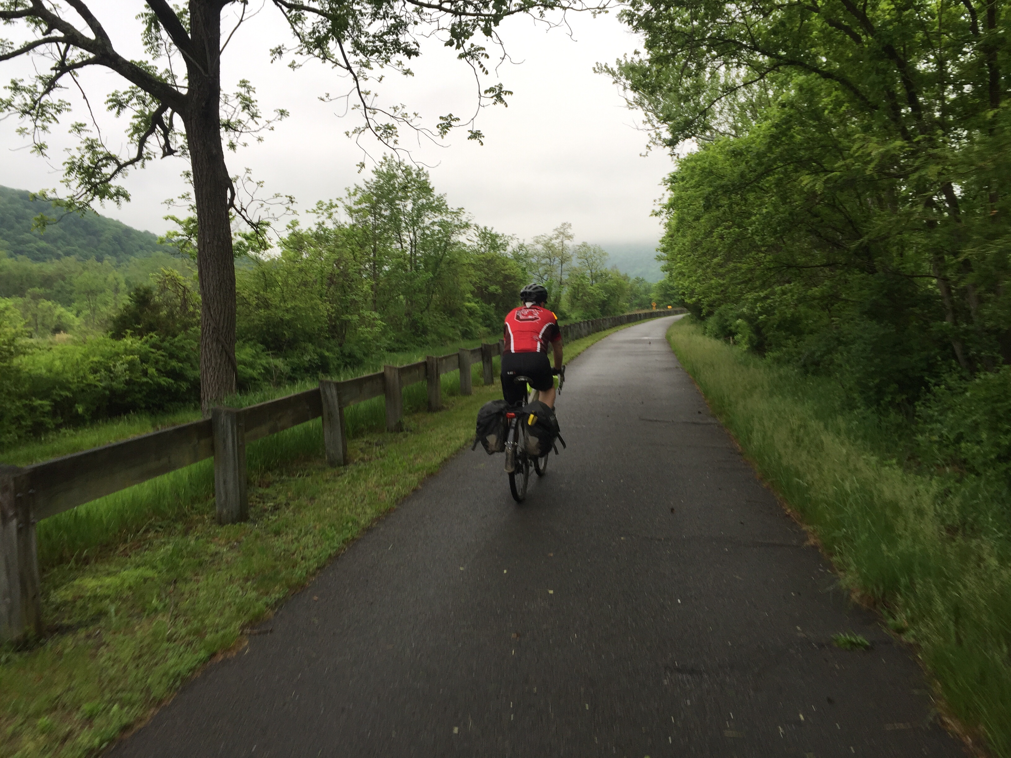
It was a very rainy day, but the GAP drains very well. Not very many puddles and very little mud. Glad to have the worst of the mud behind us.
As we left the Fairfield inn, the rain started and just kept with us for about the first three hours of our ride today. It was a chilly rain, but with a nice raincoat and the ride going on, we stayed plenty warm.
The first 22 miles of the GAP are a constant climb. It is not a terribly steep grade, but you climb and climb and climb. We paced around 10 MPH so it took a little over 2 hours to reach the top. The ride up is beautiful and you pass a lot of great views. Today had its own beauty because of the very low clouds in the trees and valleys. But because of the weather, we couldn’t see some of the long distance views.
Along the way up we passed Frostburg. It is a neat little town to see, but with the rain pelting down on us and a few more miles to go, we decided to keep going up to the top.
The next stop along the way is the Mason & Dixon line separating Maryland from Pennsylvania.
We met this nice couple at the Mason & Dixon line. They’re on their way to Cumberland.
This is usually one of my favorite views anywhere I’ve been on bike. On a clear day, you can see 4 states from here. Today, you could see a few trees. It was actually more beautiful than it looks in the picture, but you don’t get any feel for how high you are above the valleys below.
The next few miles of the GAP are loaded with great bridges and tunnels. This is the Big Savage Tunnel – about 3,200 feet long. It is really neat.
Eventually we reached the top: The Eastern Continental Divide.
Inside this overpass is an elevation map – you get an idea of the elevation change. We came from Cumberland, just below my hand, and went up to the top, where my finger points. In 22 miles.
Some cyclists really enjoy climbs. Joe isn’t known to be one of those kind of cyclists… but he did well today.
We were getting pretty hungry so after crossing the divide, we went into Meyersdale to the G.I. Dayroom. Yum. We stopped here once before and it was worth coming back.
A BLT with some macaroni salad, home made french fries, and pie for dessert. Got some calories, for sure.
This is John. We met John in the Pittsburgh Amtrak station. He’s riding the same general direction as we are. We’ve crossed paths with him about 10 times since we left him in DC. He’s been camping on his way across. We invited him to join us for lunch.
John’s from Cincinnati, so I gave him my contact info and perhaps we’ll meet for some riding later in the season.
Leaving Meyersdale, we made our way west. The next highlight is one of my favorite rail-trail things anywhere: the Keystone Viaduct. A former railroad bridge that has been converted for bike traffic. It is really high and really long. The views from up here are awesome.
We stopped in Rockwood to get something to drink. I love this mural they have celebrating their town’s history as a railroad town.
A couple more bridges and tunnels, including the newly opened Pinkerton Tunnel.
Eventually we arrived in Confluence PA and we’re staying at a hostel. It is very clean and pretty comfortable, but meager. Fortunately, Joe and I are the only two staying here tonight so we spread out and took over. Hoping most of our clothes dry out overnight.
Here’s the route for today. It’s all downhill from here into Pittsburgh.
Tomorrow we’ll begin by heading to Ohiopyle and then onto West Newton for the evening.
It is supposed to be very rainy and cool tomorrow again. It would be nice if the rain could hold off until evening… but we’ll take whatever we can get. It sure beats 94° from last year on the KATY!
Our day started with a modest breakfast at the B&B before heading out. We finished out a few more miles on the Western Maryland Rail Trail. I didn’t realize this, but the WMRT is being extended many more miles. It’s too bad that the C&O can’t be paved like the WMRT.
Between Hancock and Cumberland is pretty sparse. It is about 60 miles with no food choices and only water from the C&O campsite pumps. The only real place to stop is a place called “Bill’s Place” in Little Orleans. Little Orleans is a very tiny little town and Bill’s is the only place there. One fun tradition is to go to Bill’s place and sign a dollar bill. They then put them up on the ceiling and you can try to find your dollar bill next time you come through.
Last time Joe and I did the C&O we gave them dollars. Unfortunately, Bill’s was closed until 11AM and we didn’t have the time to wait. So we couldn’t take the time to find them today.
One of the neatest things on the entire C&O canal is the Paw Paw tunnel. It is a mile-long tunnel that was carved through the mountain over 14 years. The National Parks had closed the access to the tunnel last year to clear the rock walls of falling rock and repair some of the decking on the approach. The alternate route involves hiking your bike about 2 miles I’ve an old logging route with 11-14% grade (yikes!).
I had called the project office and they said that it would not be open for a while longer. I talked to some riders who have come through in the last few days and they indicated that you could squeeze past the fences and go through. I like to follow the rules, so I was pretty excited to hear that they opened the tunnel TODAY! As we approached the tunnel, I thought the news was too good to be true, so we were going to check things out. For sure, we were allowed to ride up to the tunnel and walk through, saving us about 2 hours of hiking with our bikes. Yay!
The approach to the tunnel was really beautiful this time. I’ve never seen water falls here in my previous two trips here. There has been enough rainfall to feed some amazing water falls around the entrance to the tunnel.
Approaching the tunnel there was a nice lady taking pictures. She was a photographer and offered to take our picture. You can see the waterfalls on the right and left (next to the steps).
You have to walk your bike through and you really need to have a good headlight because it is pitch dark in there. (Please do not try to ride it, the surface inside is very very rough and choppy!). This is what it looks like about 100 feet from the exit.
The next 20 miles from Paw Paw to Cumberland were just a plain ‘ol slog. Lots of mud and puddles. It was very slow going and made for very tired legs. Joe explained it best: it was like when you are driving your car in a snowstorm or rain storm. You have to be always be alert and your muscles are tense waiting for any unexpected movement of the bike. The mud makes the rear tire lose traction very easily and the bike gets out of control easily.
A few miles away from Cumberland there was a large tree down across the path. It was far too big to move and we couldn’t get around.
There were several cyclists gathered around and there was a team of people helping to lift bikes through the large branches and across to the other side. Many hands made for light work.
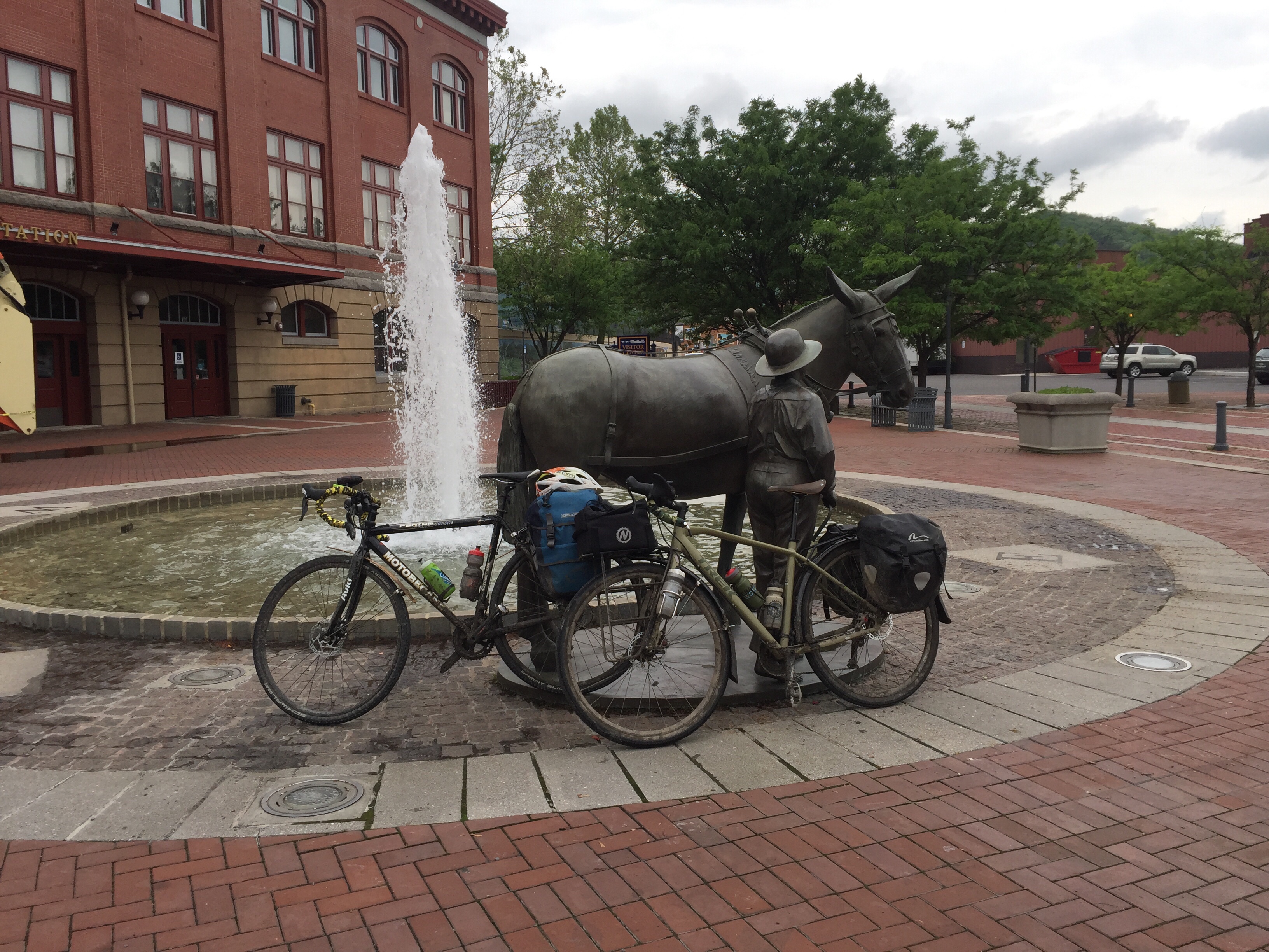
A few more miles of slugging through brought us into Cumberland. Tradition is that you kiss the mule’s behind when you arrive. So we did.
Cumberland is the end of the C&O canal path. This is also the start of the Great Allegheny Passage, which we will start riding tomorrow. Over the next 3 days we will climb over the continental divide and then cycle our way to Pittsburgh.
It is good to leave the C&O behind. The Potomac is a beautiful backdrop for the trail, but the surface is bumpy and muddy. After 4 days, I’m ready to move on. The GAP is a much better trail surface.
The C&O is a national park, which means it takes an act of congress (literally) to make any changes or improvements. It is too bad, because if they would resurface with crushed limestone like the GAP or even, gasp, pave it like other high-use trails, it would be a fantastic path. But as it stands, the surface makes an otherwise great trail, less than ideal.
When we arrived at the Fairfield, first business was to rinse the C&O off of our bikes and gear. My bike was so caked with mud and muck that my lowest gear didn’t work anymore and shifting wasn’t reliable. I rinsed down my legs, shoes, socks, and panniers, too. Here is the before and after:
After washing up and showering, it was time for dinner. Some steamed clams and a rack of ribs, plus the obligatory blue moon rounded out the dinner. Yum.
Time for sleep soon. I’m exhausted.
We start tomorrow morning by climbing for about 2 hours up to the continental divide. We have about 60-65 miles ahead of us tomorrow on the GAP.
Weather forecast is looking like rain all day from sunrise to sunset. I’d appreciate some prayers for weather again – they’ve been working so far!
We started our day early. We went to bed expecting the worst: lots of rain making the trail into mud, with rain chances towards the end of our ride. We had a very pleasant ride today with only a little mud and muck. Our bikes were still pretty messy, but not nearly as bad as we had expected. The temperatures were pretty warm. It was about 91° when we finished today.
We didn’t have much sight seeing today because there really isn’t much between Shepherdstown and Hancock. We did make a side trip to see Fort Frederick, but that was about it.
The C&O parallels the Potomac and is usually only a few yards from the river. If you can afford the moments to look up, you are treated to some beautiful views.
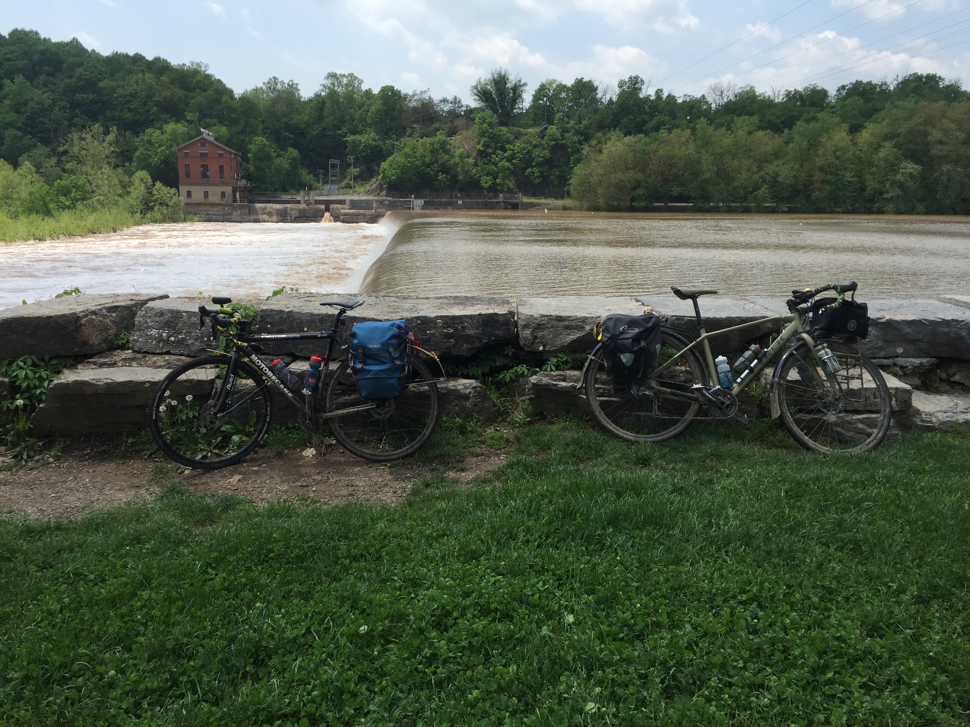
There are two major dams that are on the Potomac in this area – Dam 4 and 5. Huge slackwater areas are behind them and the roar of water over the dams is very impressive. The dams used to support water-wheel power generation for mills, but have been converted to hydro-electric power with small generating plants. You can see the regenerating station in the top-left of the picture:
There is a really neat part of the trail that is on a concrete platform along the edge of the river. The rock walls to the right are beautiful and the water on the left is peaceful.
When we were leaving Pittsburgh, there was a young guy who was heading to DC that had just completed his trek. He warned us about a section just west of this where there was a washout with about 10″ of water to wade through. When we arrived at one of the trailheads, the parks district had put up a barricade and “trail closed” sign. No detour posted.
I have made very good use of my Garmin’s built in GPS routing. This time I told it to take me to Williamsport. We took a ~5 mile detour on surface streets to get us into downtown Williamsport. It was a good detour and actually felt pretty good to get out on the roads and away from the mud.
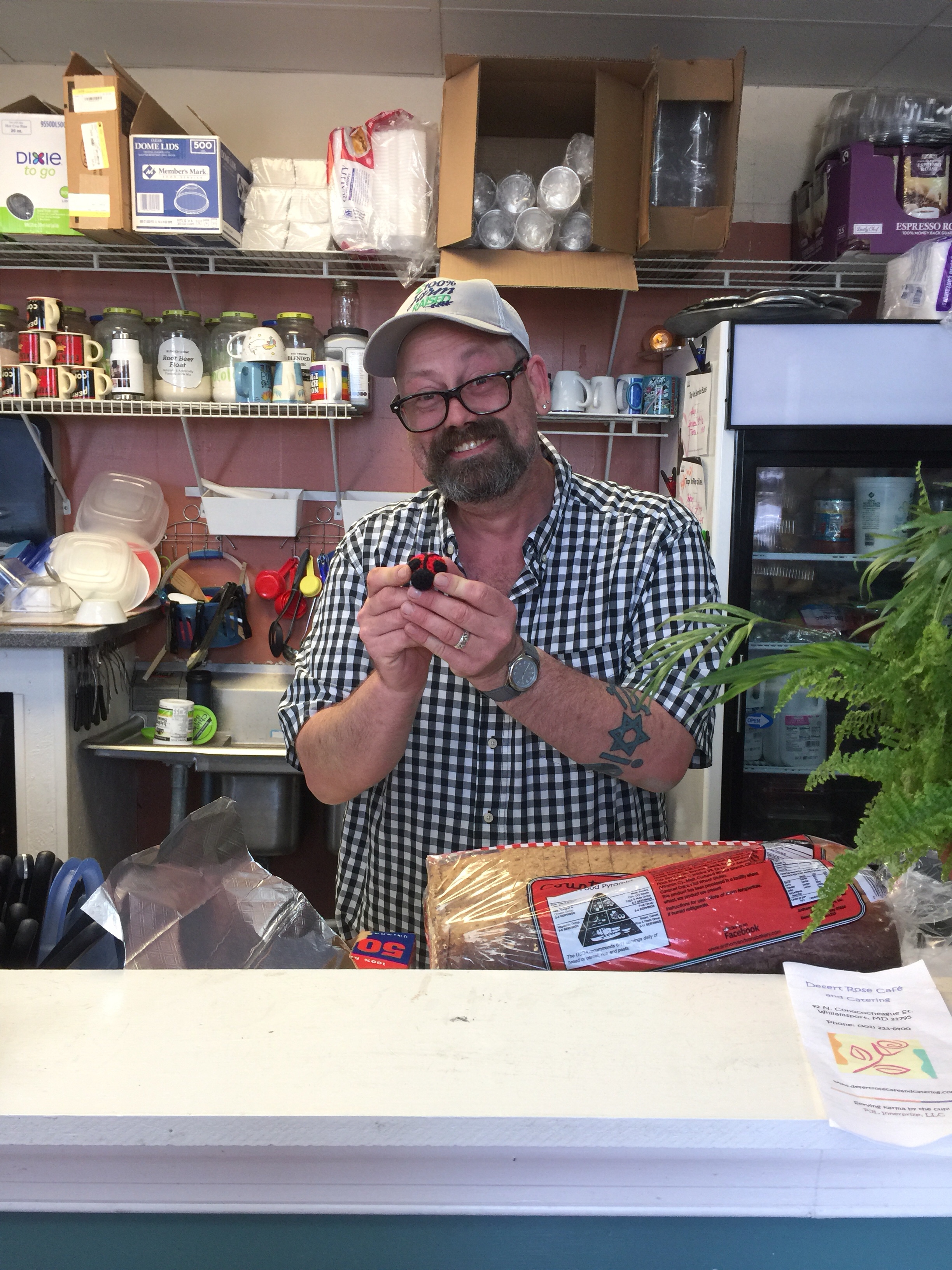
We stopped at the Desert Rose Cafe for a quick lunch. We’ve stopped here once before and decided to do it again because the food was good. I picked up a PB&J, chips, and a coke.
The staff here is really fun. We remembered one guy, Alex, from the last trip. We made a comment that we had been there before. Alex said “yeah, you are the guys who were here on bikes, who were not from around here and were wearing spandex, right?”… He didn’t remember us. Joe made some small retort and Alex came back with “I’m sure your wife is glad you’re on vacation this week”. Game, set, match. We laughed and laughed.
But then, he saw Joe’s ring and asked if we were clergy and the light began to flicker on. After a brief discussion about our ride mascots, he did remember us. It was a fun conversation.
After our detour around Williamsport, we were back on the canal and making our way to Fort Frederick. We saw several black snakes like this one. He watched me very intently as I cycled around him. Sit, stay… good boy.
Dam #5:
Eventually we arrived at Fort Frederick. I’ve never found it open before. No tour guides inside the park, but we did watch a 10 minute video at the visitors’ center. I hadn’t realized that the fort had fallen into complete disuse and disrepair. It was restored, or should I say reconstructed to what you see today.
Leaving the fort, we picked up the Western Maryland Rail Trail. This is a paved path that parallels the C&O for 22 miles. Glorious! This took us all the way into Hancock for the night.
Our bikes were pretty filthy by now and I couldn’t shift my front derailleur. But the B&B had a hose to clean up our gear. Here’s what a day on the C&O canal does to your bike. Just imagine if it had rained, too!
We stayed at the River Run B&B again. It’s very clean and comfortable. Susan didn’t remember us at first. She meets hundreds of new people each year, I’d guess. But after a little conversation and mentioning our ride mascots, she said “I do remember you guys – you guys are fun!”
Dinner was at a local place: Buddy & Lou’s – named after the restaurant owner’s two dogs. I had Ahi Tuna steak … and a beer of course. You have to trust me that it looked nice before I ate it. It was deeeeelicious.
Happiness is clean laundry. Yay!
It’s time for bed. Ms. Bug thinks so, too.
Tomorrow is supposed to be a very rainy day on the mushiest part of the trail. Prayers for the rain to hold off would be greatly appreciated!