Katy Trail Day 2 – Flat and Flats from St. Charles to Rhineland (68 miles)

Today started with a nice breakfast send off from Deacon Larry and his wife Mary.  They were amazingly wonderful hosts.  Dcn. Larry likes to come out to Kentucky to Gethsemane Abbey for retreats – so maybe we can convince him to head our way before/after so that we can return the hospitality.

The weather for today looked to be a great forecast.  Doesn’t get much nicer than a cool start and highs in the upper 70s or lower 80s.  (But note the forecast for later in the week when we are making our way back – 95 degrees.)


At the St. Charles trailhead, they have a couple of cabooses, so it seemed like a good place to get our start-of-day obligatory picture.


Today’s trip was about 68 miles.  We had originally planned a few extra miles of side-trip into Hermann, but decided later to hold off on the extra trip.

Throughout the 68 miles, the entire trail is very flat.  The Katy is a crushed limestone surface and pretty well maintained.  We rode over a few minor washout repairs, but no major trail ruts or problems.  The trail is fairly smooth, but the buzz of the gravel is a constant companion, and the surface doesn’t allow you to coast much.  So although it is very flat, you are constantly working to keep the pedals turning.

We were told to expect nearly all shaded area today.  I would say we were about 70% shaded and 30% very direct sun.  Parts of the trail are canopied with trees, but there are very long stretches where you are adjacent to, or down the middle of farm land with absolutely no cover at all.

On the east end of the Katy, most of the trail is close to the Missouri River.  Sometimes, it is only a few feet, and other times you are a few hundred yards.

We saw several places where these murals up to draw attention to the construction of the Katy through the land trust.

Throughout nearly our entire ride today we kept crossing paths with a guy named Doug.  He is in the green shirt blow.  He is from Juno Alaska and flew in with his bike to ride the Katy.  We talked a bit and he seemed pretty nice.  We didn’t get a chance to exchange contact info.

Today did bring a few challenges, too.  Yesterday, Joe had a flat on his rear tire.  Today he had a flat on the rear tire, and another on the front.  The second flat happened less than a mile from our destination.  It looks like the tires he chose just aren’t up to the challenge of the tiny and jagged rocks of the Katy.  His first flat today took a little time to repair, and by the second one, we decided that we need to find him some new tires.  So when we get to Jefferson City tomorrow, we will be heading to the bike shop to find something that is a little more suited to the trail.


After the second flat repair today, we finally arrived at our home for tonight: Church of the Risen Savior in Rhineland.  It is right across the street from a huge corn field.

We were greeted by the parish secretary who showed us around and got us situated.  One neat thing that I’ve not seen at a parish before: a quilting ministry.  As we arrived, the quilters were just wrapping up.  They meet and work on hand-crafted and pieced quilts that are then auctioned off as fundraisers for various ministries and needs.

One of the quilters, Maxine, came out and talked to us about the Katy.  She is a trail volunteer who used to like to ride the trail.


After getting cleaned up, we went to 6PM mass.  Right after mass, the assisting deacon and his wife offered to take us over to the (as in the only) restaurant in Rhineland: the Trailside.  Jerry and Elaine grew up in this area and have lived here for many years.   Over dinner, they told us a bit about themselves, their grown kids and their families.

For me, dinner consisted of fried chicken.  Yum.        It was pretty tasty!


After dinner, they offered to drive us around a bit, including taking us to Hermann – the town we elected not to ride into.  It was a wonderful tour and great dinner.

While in Hermann, they took us by St. George’s.  It is a really beautiful church with great stained glass depicting the corporal and spiritual works of mercy.


So now our laundry is washed and we’re about ready to call it a night.  Tomorrow will be shorter day – probably around 40-45 miles into Jefferson City.  We are hoping for a respite from the flat tires, too.

Until tomorrow, good night!

Peace.

Katy Trail Day 1 – An easy start (25 miles)

Today was an early day.  We began by leaving Lexington very early and driving out to St. Charles, Missouri to begin our week-long adventure on the Katy trail.  After a mostly non-eventful ride, we finally saw the iconic St. Louis arch off in there distance, which meant that our first destination was pretty close.  A little while later, we arrived in the town of St. Charles.

I had read a little about St. Charles, but I still don’t really know much about this neat town.  The old main street is brick-paved and really fascinating.  Lots of old buildings that now house small shops and restaurants.  I wish we had another day just to wander the streets here.

The Katy starts a few miles east of St. Charles, but there isn’t much at all to see or places to stop between here and the eastern end.  So we began our trip by leaving our car at one of the parishes in St. Charles and riding our bikes out to the east end in Machens, MO – about 25 miles round trip.

The ride eastward was fairly uneventful.  The trail is a nice crushed limestone surface.  Not as smooth as pavement, and a bit harder to pedal, but all-in-all, a good riding surface.

Missouri has had a lot of rain this season, and the river had reached flood stage not too long ago.  I had read on the state web site that there was a closure a few miles east of St. Charles.  We found the closure, but chose to continue on because we wanted to see the entire Katy trail.  The wash-out area was pretty rough with mud and ruts.  It took some careful riding to navigate, but we managed to do it OK both directions.

Eventually we reached the eastern end of the Katy in Machens.  The trail abruptly ends here.  Aside from a latrine and the trailhead map, there is nothing here.  No water or parking lot.  We stopped for a photo opportunity, and then turned our way back to St. Charles for the evening.

On our way out to Machens, the winds were fairly strong and in our face.  We could see the occasional flag that was blowing straight out, and the prairie grasses were all bending towards us.  The nice thing was that the headwinds became tailwinds as we turned back to St. Charles.

Shortly after turning back, Joe had a flat tire.  It wasn’t obvious where it was leaking and it was a slow leak.  So we stopped about every 2-3 miles to pump his tire back up and nurse it along the 12 miles to St. Charles.  When we returned, we were able to find a bike shop to change out his tube at the Bike Stop Cafe.

After the delay, we quickly packed up our things and made our way to our hosts for the night.  Deacon Larry and his wife Mary prepared a nice dinner of pasta and we spent the entire evening talking, sharing ministry stories, and laughing a lot.  A really nice glass of red wine completed the evening.  Once again, as I often point out, the fellowship we have on these biking adventures is great.  I had never met Deacon Larry before, but over some pasta and wine, we become family.


It is time for bed.  We have a long day tomorrow in the saddle – probably about 75 miles.  We’re hoping for no more flat tires and definitely more tail winds to help speed us along.

Next stop: Rhineland, MO.

Peace!

– Dcn. Matt

7 Days to go, then off to bike the KATY!

This year, Joe and I have decided to ride the KATY Trail.  The Katy (short for “Missouri-Kansas-Texas Railroad”, MKT, or now just KT/Katy) is a 240 mile long off-road trail that runs from Machens, MO (near St. Louis) to Clinton, MO (about 45 miles SE of Kansas City).  240 miles is not a real long distance for bike touring, so we’ve decided to leave our car at the east end of the trail, ride all the way to Clinton, and then all the way back.  We will be making a side trip or two, including into Jefferson City and into Columbia.  We figure we will end up around 500+ miles for the trip.

The Katy has been on our bucket-list of rides for a while.  I’ve talked to several others who have biked the Katy, and it sounds really nice.  It hugs the Missouri River and passes through many small towns that grew up along the railroad.  It is also a large part of the Lewis and Clark National Historic Trail, so we hope to get a little education along the way.

We drive out next Tuesday and begin our journey with a short day of riding on our arrival.

As usual, I will be blogging about our adventures, people we meet, the towns, and of course whatever we find to eat.  I found a really neat full-sized, very lightweight, keyboard that folds up into a tiny package, and then unfolds so you can type on it.  It is Bluetooth and can connect to my iPhone.   I am going to carry it with me and use it for blogging this time.  Typing a long blog using my thumbs on my phone takes a lot of patience, so I think the extra few ounces of weight will be worth it.

We hope you’ll follow our journey and perhaps find a laugh or two with us!

A couple of good resources for the KATY:

Missouri State Parks: Katy Trail State Park  and  www.bikekatytrail.com

Peace!

– Deacon Matt

Wrap up: 2016 Ohio to Erie / Ohio Bike Route 1

It’s been a few days since I returned home from our tour across Ohio.  It’s a bit hard to believe it’s over already.  The five days in the saddle went by very quickly, and now it’s in the memory books.

One nice part about this trip was that neither Joe or I had any familiarity with most of the route, it gave us some new things to see.

The past few bike tours I’ve done have been on dedicated bike trails.  I like bike trails because they tend to be safer since they’re away from traffic.  They also offer shade from the sun, and often meander through neat little towns.  The Ohio to Erie route does have lots of miles on dedicated trail, but it has a variety of riding conditions.  If you’re looking for a typical rail-trail ride, the Ohio to Erie won’t exactly fit that model.

Many people I talked to wondered why we chose Ohio.  The prevailing opinion was “it doesn’t have much to see.”  I have to disagree.  We found it to be a very pretty state for a long ride.  Sure, there was a lot of farm land.  But seeing the Amish farming their land, the various crops, and the blue skies was very peaceful.  We went through downtown Cleveland, Akron, Columbus, and Cincinnati.  We got a taste of a little of everything you could want.  We didn’t linger long in any one place because we were bound to a schedule, but if you could afford the time to meander a bit, there were lots of options on spending your time.

The Ohio to Erie route is also marked as Ohio Bike Route 1.  It isn’t a single trail or road, it is a collection of trails, city streets, and country roads that can carry you across the state.  You have to be pretty careful about following maps and watching for turns.  Most were pretty easy to spot, but we did miss a couple of them along the way.  In most places, they’re pretty far apart, so if you miss a turn, it could be a while before you notice.  Fortunately, we didn’t get too far off track.

IMG_8292

From a difficulty perspective, I would rate this route as intermediate for both navigating, and for the physical challenge.  The route requires city smarts for navigating on city roads in Cleveland, Columbus, Akron, and Cincinnati.  None of the city riding was super challenging, but if you’re not comfortable riding amongst pedestrians and cars, I would recommend trying to time your city routes during less busy traffic times.

There was about 50 miles of country road riding on the route.  Most of it was very tame and beautiful.  Some rolling hills and the traffic seemed very light.  However, the 14 miles between Killbuck and Gann were a little more than “rolling” hills.  After looking at the data on maps when I got home, the grade didn’t quite look as bad as I had expected.  The average grade of the worst part was about 8.5% for .5 miles.  On a bike loaded with an extra 20-25 lbs. of gear, plus a gallon of water, on a hot and sunny day, those miles provided some challenge.  Perhaps on a cooler day with fewer miles on my legs, it wouldn’t have seemed so bad.

The road conditions varied from city streets with potholes and grates, to crushed limestone of the Ohio & Erie canal, paved bike trails, and quiet country roads.  I would recommend a bike with 36mm or larger tires, mostly because of the crushed stone sections, especially if you have any rain.  Unlike most other rail-trails, there are really long sections of paved path.  For example, our last two days of riding were entirely on paved path or road.  That makes it easier to cover longer distances.

We were pleasantly surprised at how many of the small towns we went through had sufficient services for food and water.  When we laid out our travel plan, we didn’t know enough about these little towns.  On one hand, that made for some fun discovery periods.  On the other hand, it would have been nice to plan a little more time to spend in a few places.

We chose to do this tour in 5 riding days.  In part because of the time we had to spend, and partially because we didn’t see too many ways to split into 6 days with lodging.  The result was that we had 4 days over 70 miles, and one day around 60 miles.  Our legs seemed to survive the miles pretty well due to the good weather and good riding surfaces.  But we only had a little time for smelling the roses along the way, too.  It’s a tough tradeoff to make.  What I can say is that the 5 day plan worked pretty well for lodging.

Overall, this was a very fun tour.  If you’re up for a little more challenge than the average rail-trail, this might be a good route to try.  Great scenery, nice towns, wonderful people, and enough stops along the way to be self-supported.

You can find more information about the Ohio to Erie route at: http://www.ohiotoerietrail.org/

#OH2Erie

I’m not sure what the next bike tour might be for me.  I might look at some familiar territory, or look for another new route to try.  We’ll have to see.  If anyone has any suggestions for a 350-450 mile self-supported bike route, let me know!  I’m hopeful that a great adventure will arise for some time in 2017.

Until then…

Peace.


Day 5 – Ohio to Erie ride: Journey Complete! Xenia to Cincinnati OH / Newport KY, and the Covington Cathedral (71 miles)

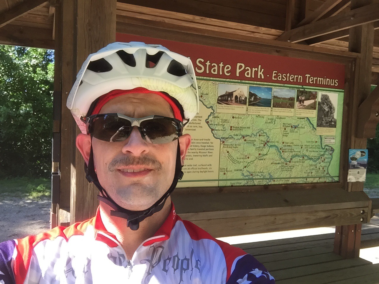
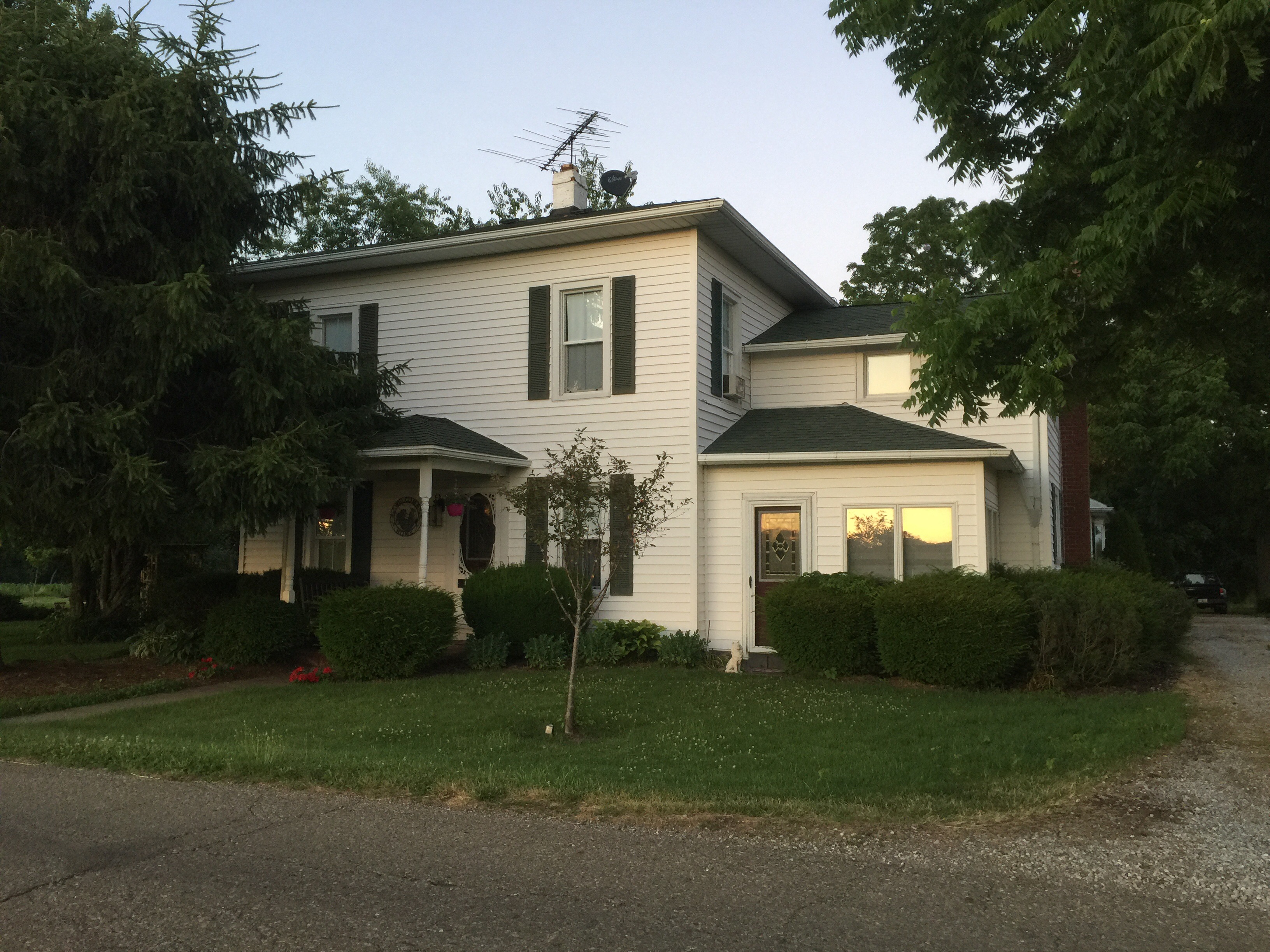
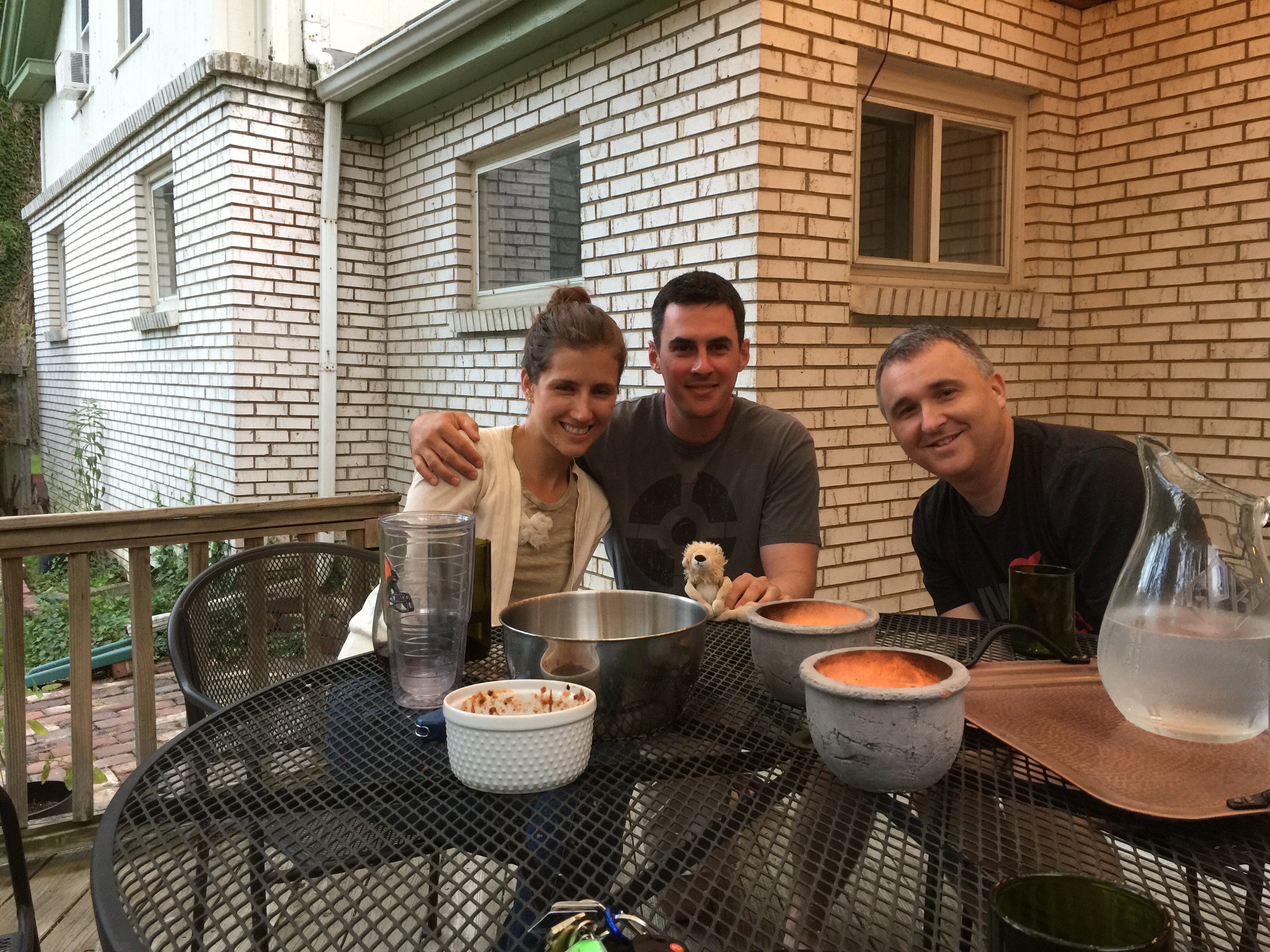
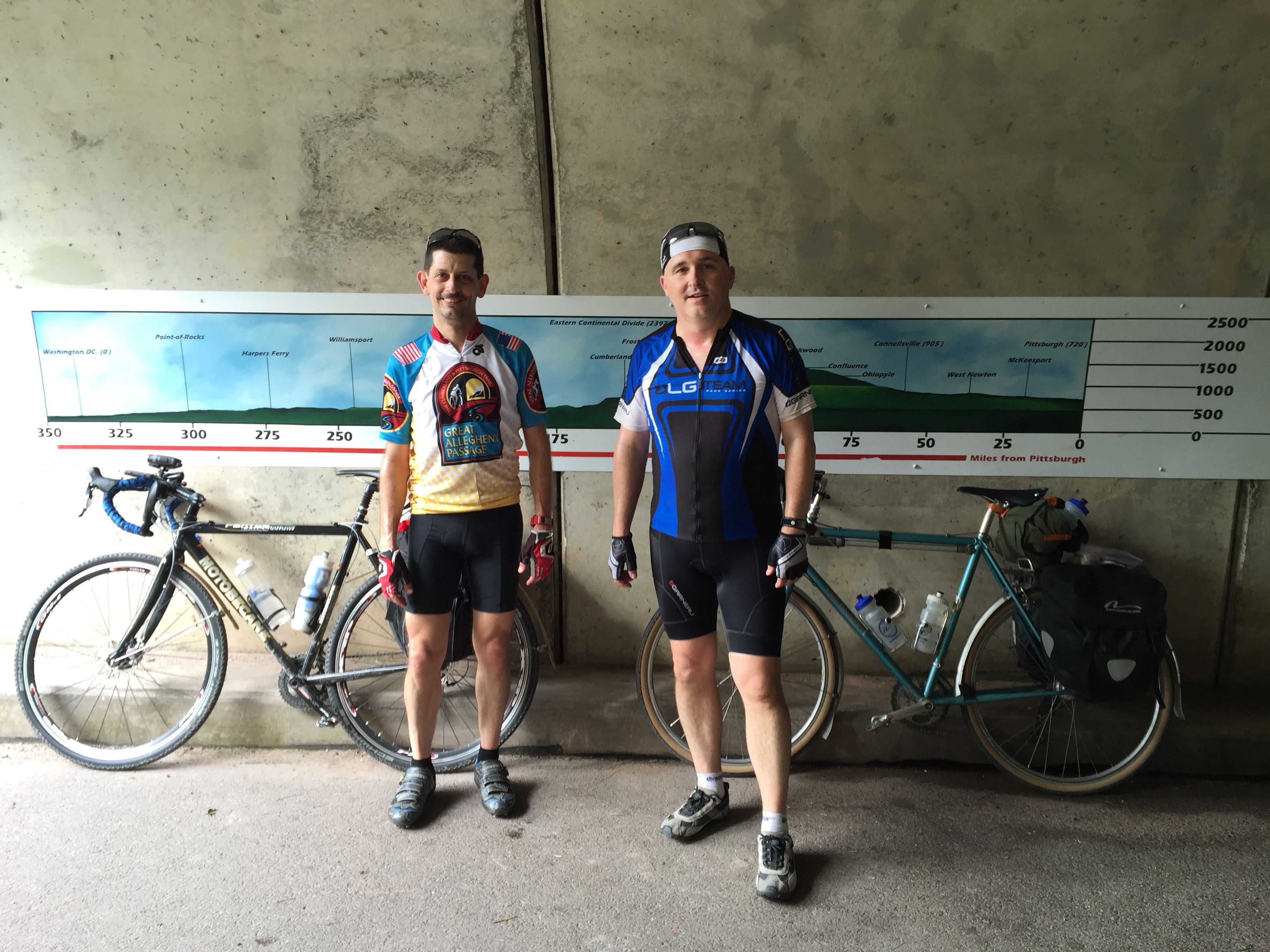
Last night was a very enjoyable evening.  Our AirBnB hosts, Barak and Victoria were wonderful hosts.  We shared pizza, delicious ice cream with peaches, and best of all, good conversation.  I love how we gathered around their family table and became family for an evening.  Before this trip, I sort of wondered what would inspire someone to become an AirBnB host, but after doing two of them, I now know why: to get to know other people.  Wouldn’t the world be such a much better place if we were able to invite strangers to dinner more often!

After finishing up our laundry and some great conversation, I finally turned into bed around 9 or 9:30PM.  At that time, the various weather forecasts for the morning ranged from storms to no-rain.  We decided that if it was raining, we’d try to leave later, but if it was not, we wanted to get going early.


I haven’t had a really good, deep night’s sleep the entire trip.  But last night, I fell asleep almost instantly and enjoyed a great rest.  I woke up a few minutes before my alarm and felt great.  After my morning prayer hours, I pulled up the forecast.  The question was: “Am I going to get a little more sleep, or were we going to get going on our way?”

The Weather Channel, Weather Underground, and My-Cast finally got their act together and gave a similar forecast.  No rain forecasted.  Moderately high temperatures for later in the day.  It was time to get going so we could avoid most of the hottest part of the day.

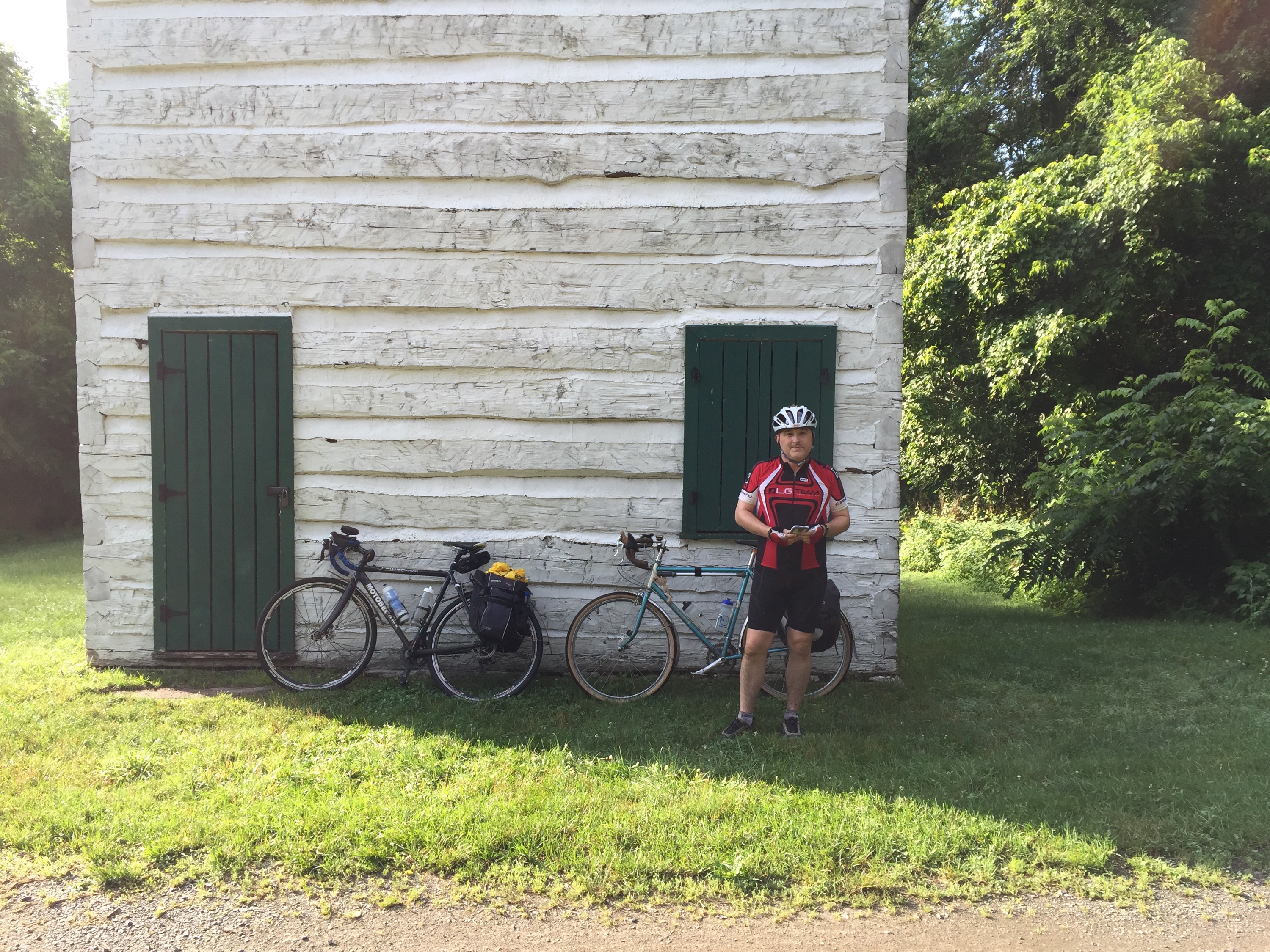
Victoria had prepared a nice breakfast, and I cooked up a double-batch of oatmeal to add some calories to get the day going.  Breakfast conversation was as delightful as the discussions we’d had the previous evening.  Once again, fellowship comes up as one of the best parts of bike touring.  But with a very long day ahead, we had to get going.  We bid Barak and Victoria good bye and were on the road by 7:00AM.

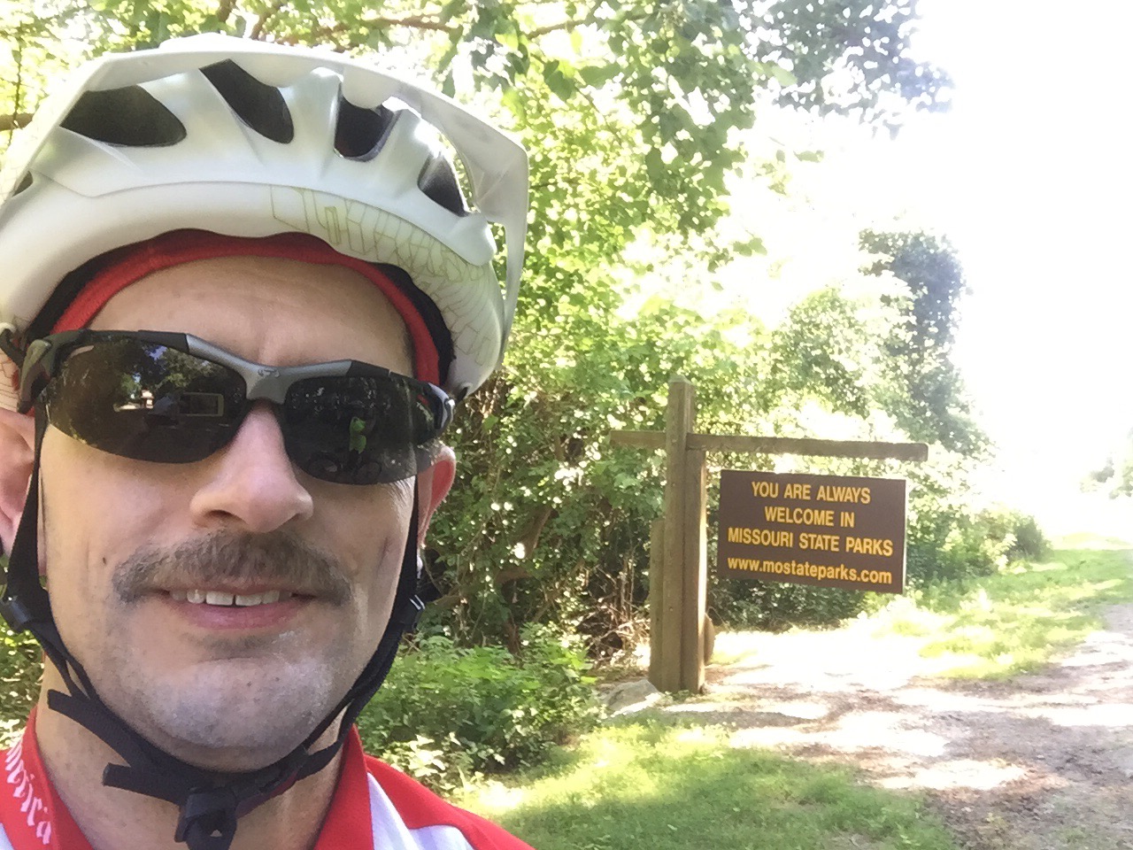
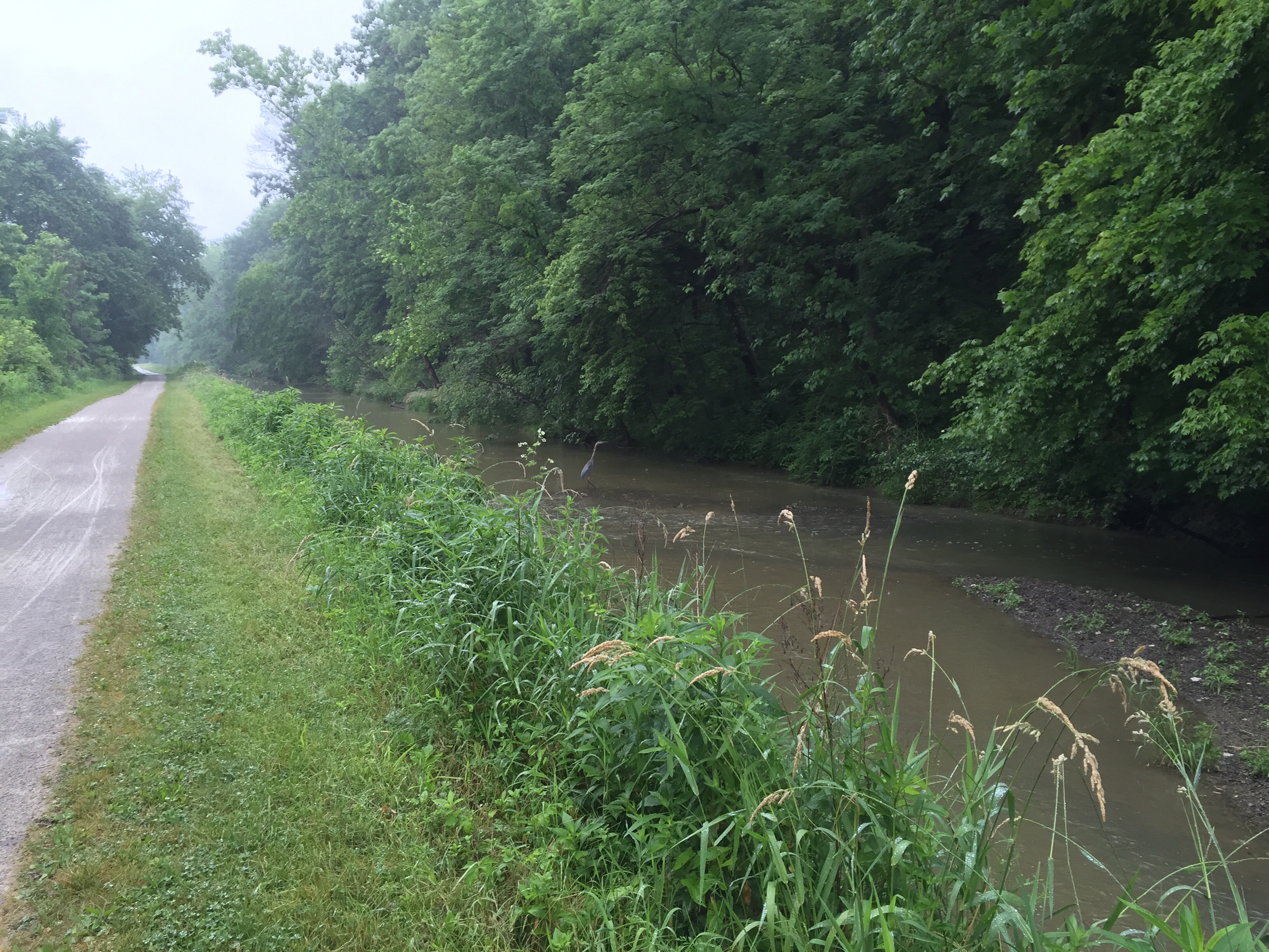
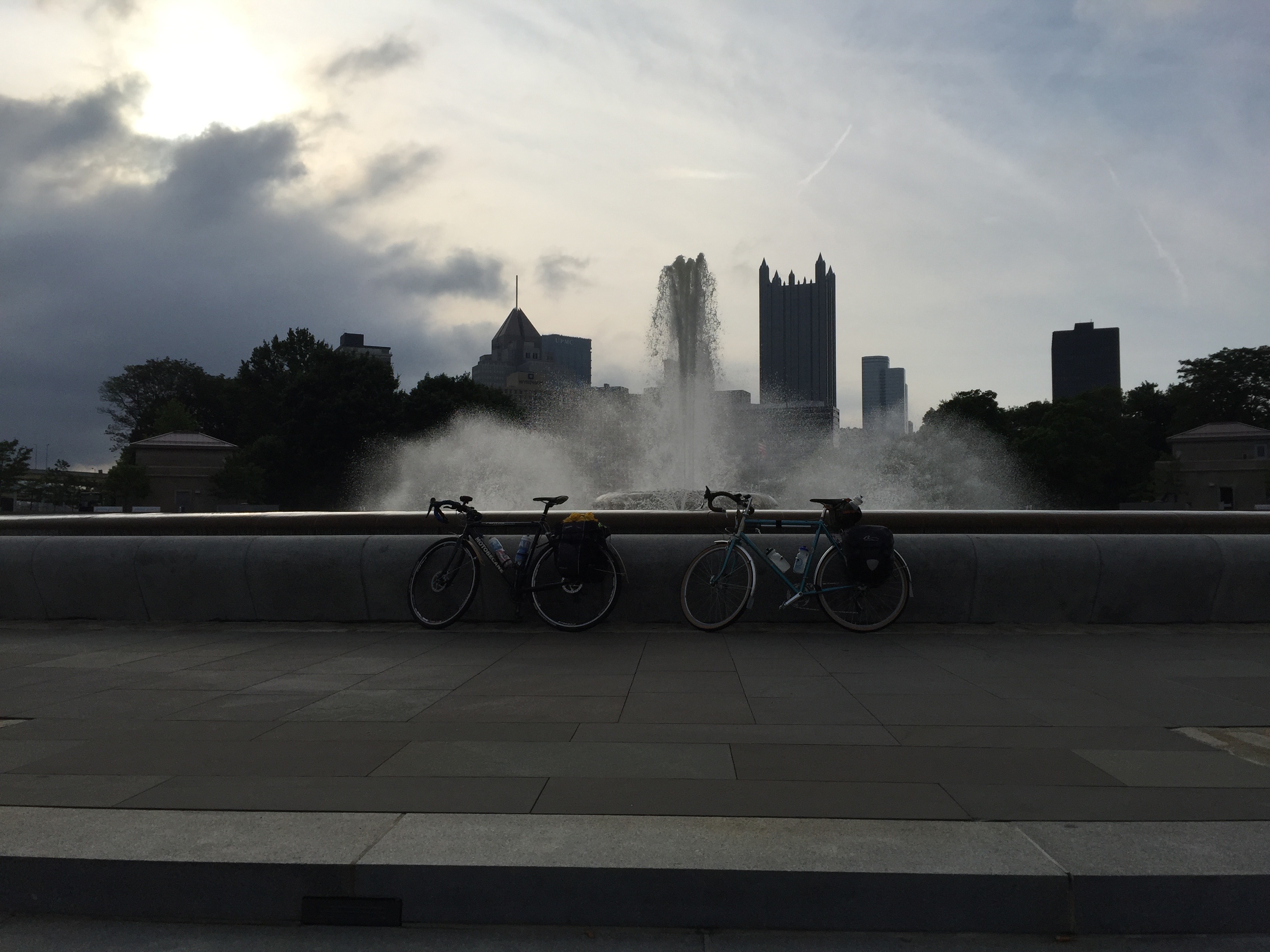
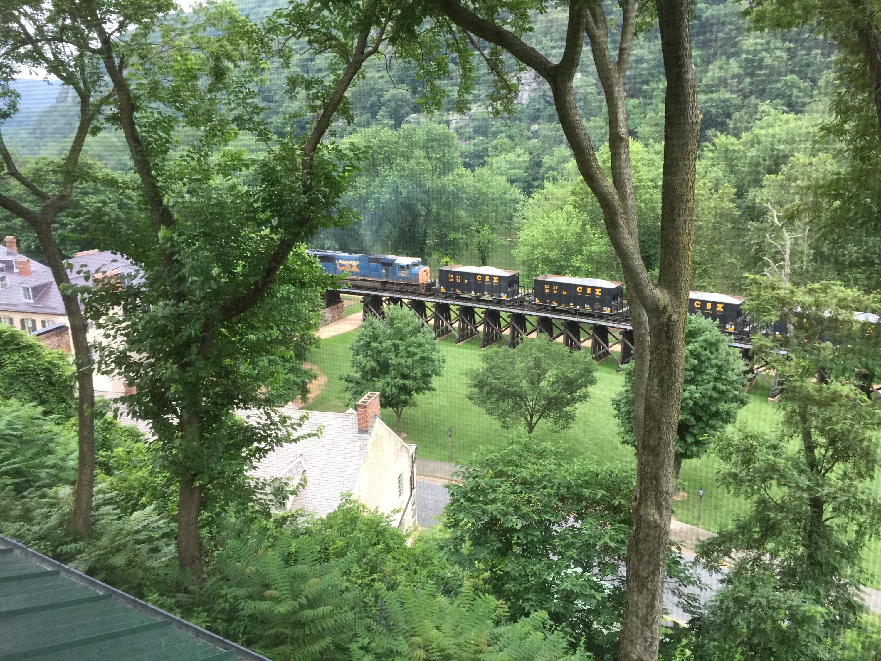
Today’s trip took us across a lot of familiar territory along the Little Miami Scenic Trail.  I have ridden the entire length of the Little Miami many times, in fact, Joe and I rode a 100+ mile century ride here just a couple of weeks ago.  It is one of my favorite places in all of the country to ride.  The trail is nicely canopied by trees for most of the length, providing a respite from the sun.  There are enough small towns and trail heads to get water and food.  The path is completely off road, safe from traffic.  And the surface is paved and well maintained.  If you like rail-trail riding, this is one of the best.

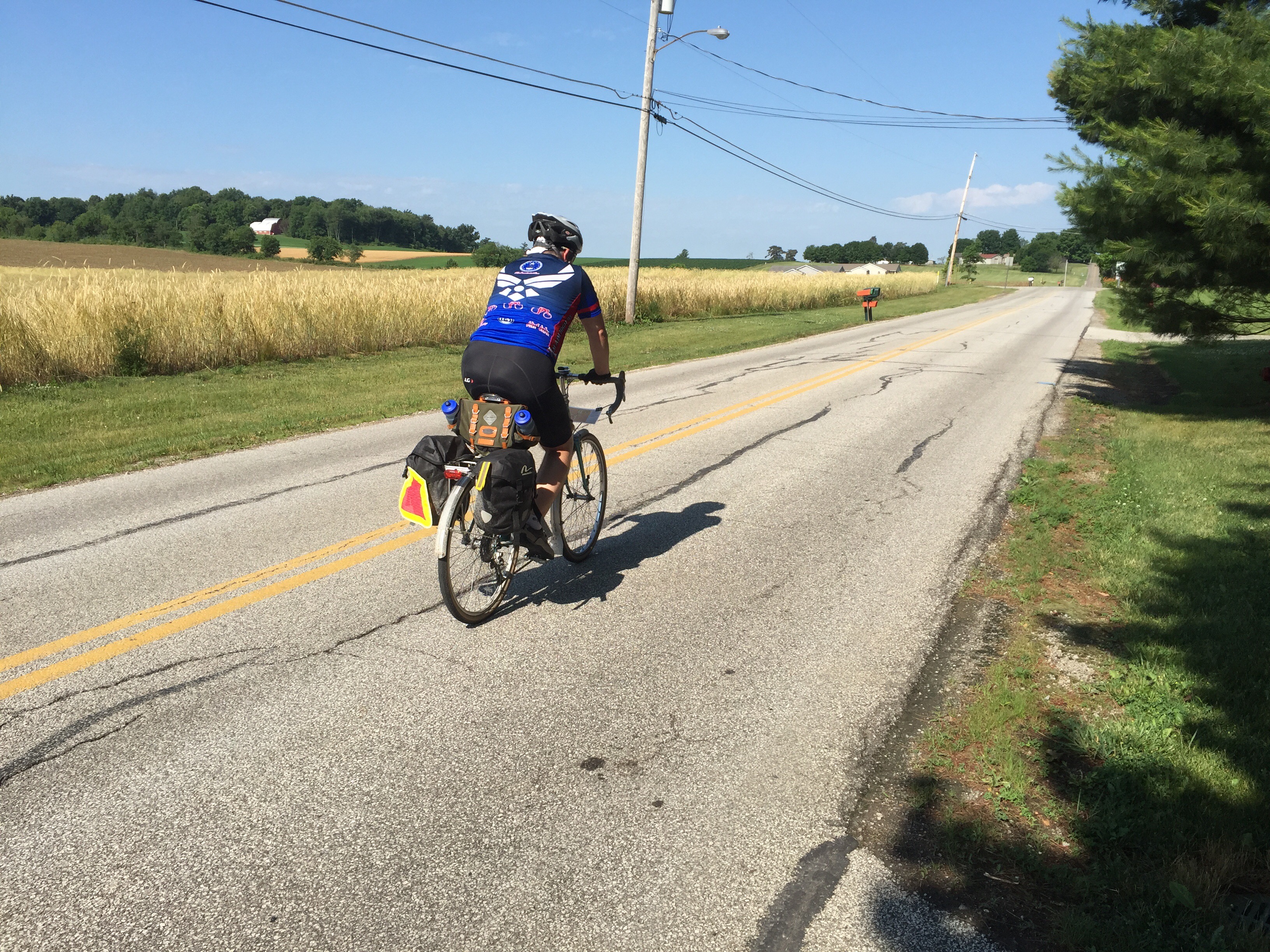
As we started today, we didn’t need any jackets or arm warmers.  It was already warm and very humid at 7AM.  Within a mile or two, we were both feeling pretty sticky.  Whenever we would stop to take a picture, our glasses would instantly fog up.  On the huge plus side, the clouds formed a nice cover for us all day long.

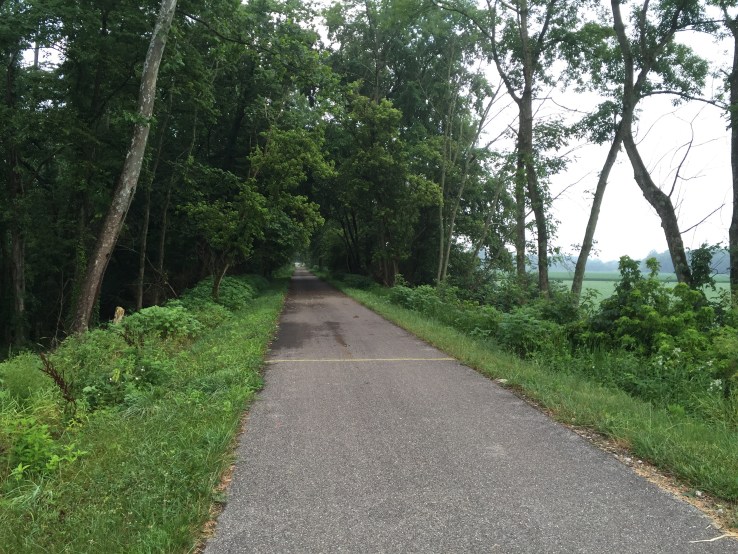
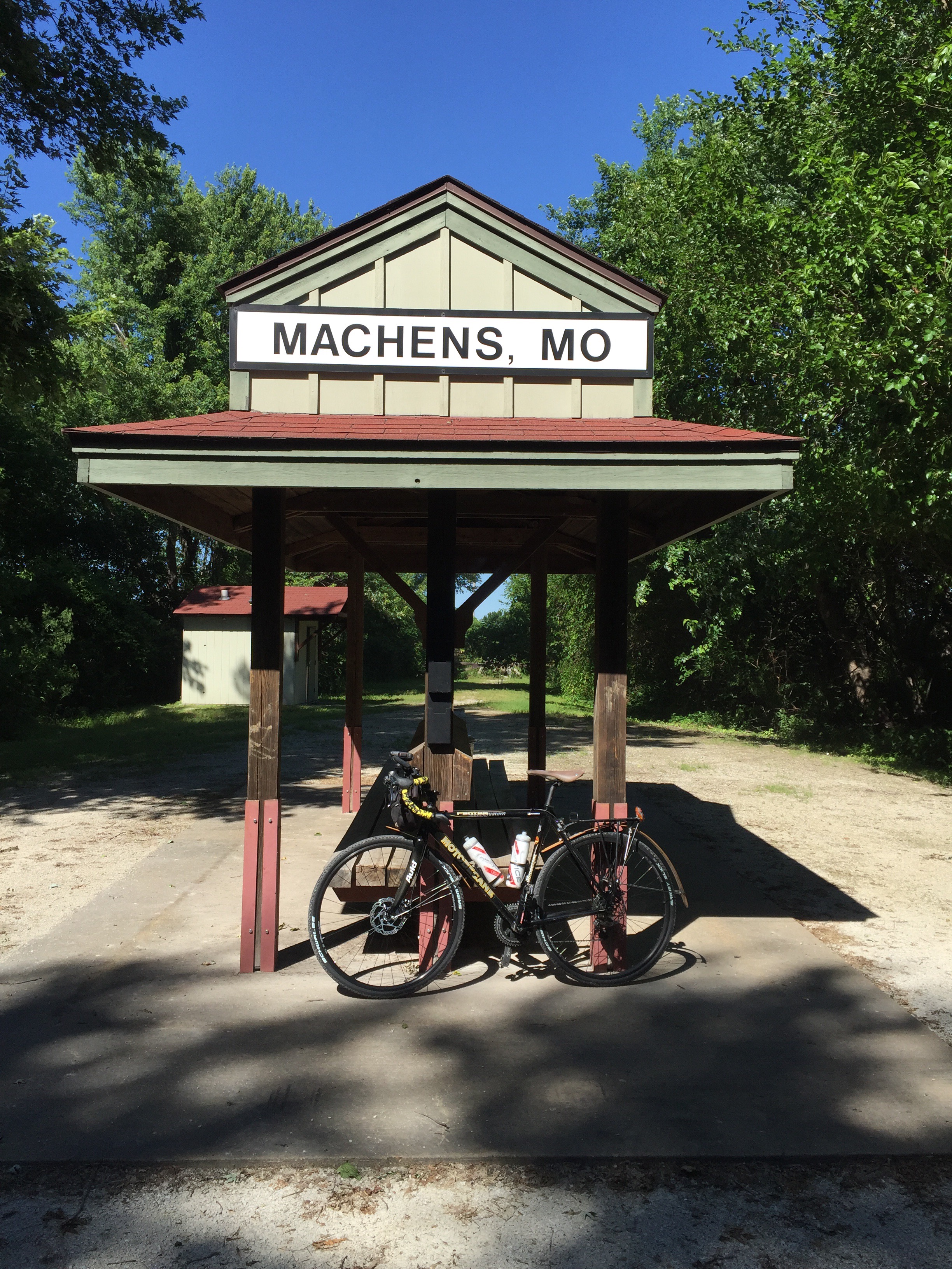
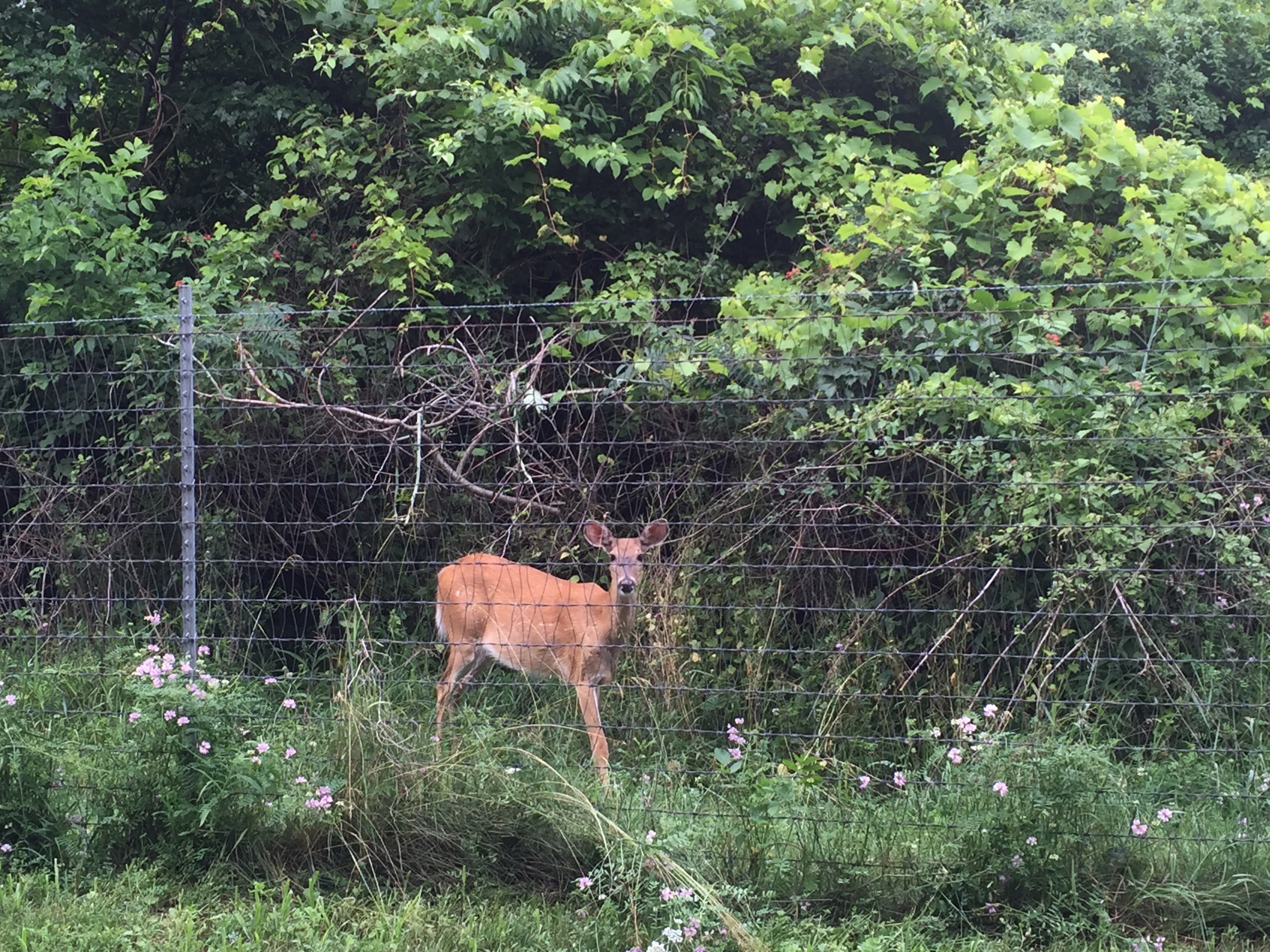
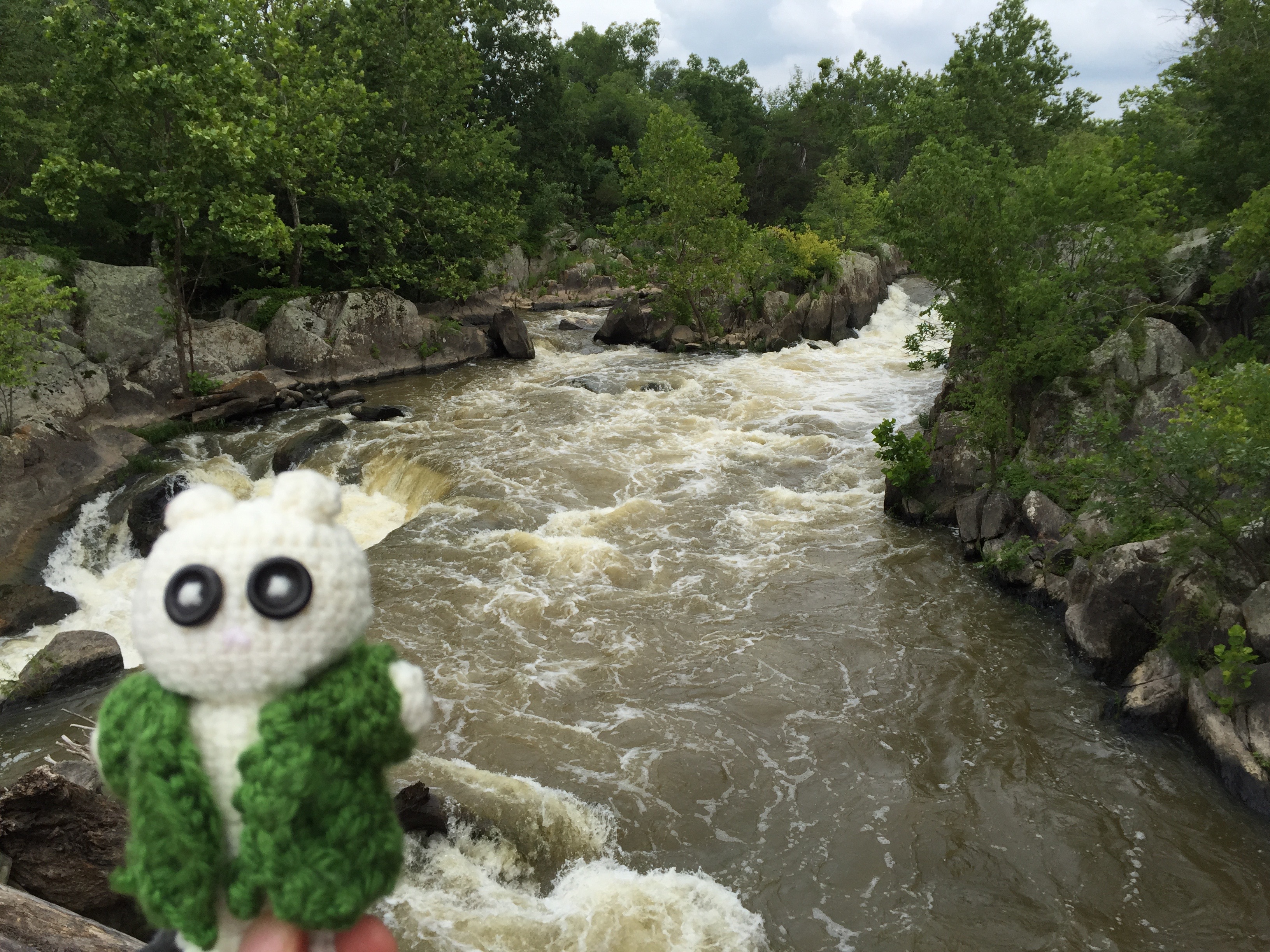
Sunrise was pretty early, but we didn’t really see much of the sun for a while.  The trail goes through a lot of rural farm land, and provides some great views.  A few times, we pulled over just to take in the views.  Sure it is just farm land, but when mixed with sunshine, fog, and the quietness of a morning, it is a beautiful combination.

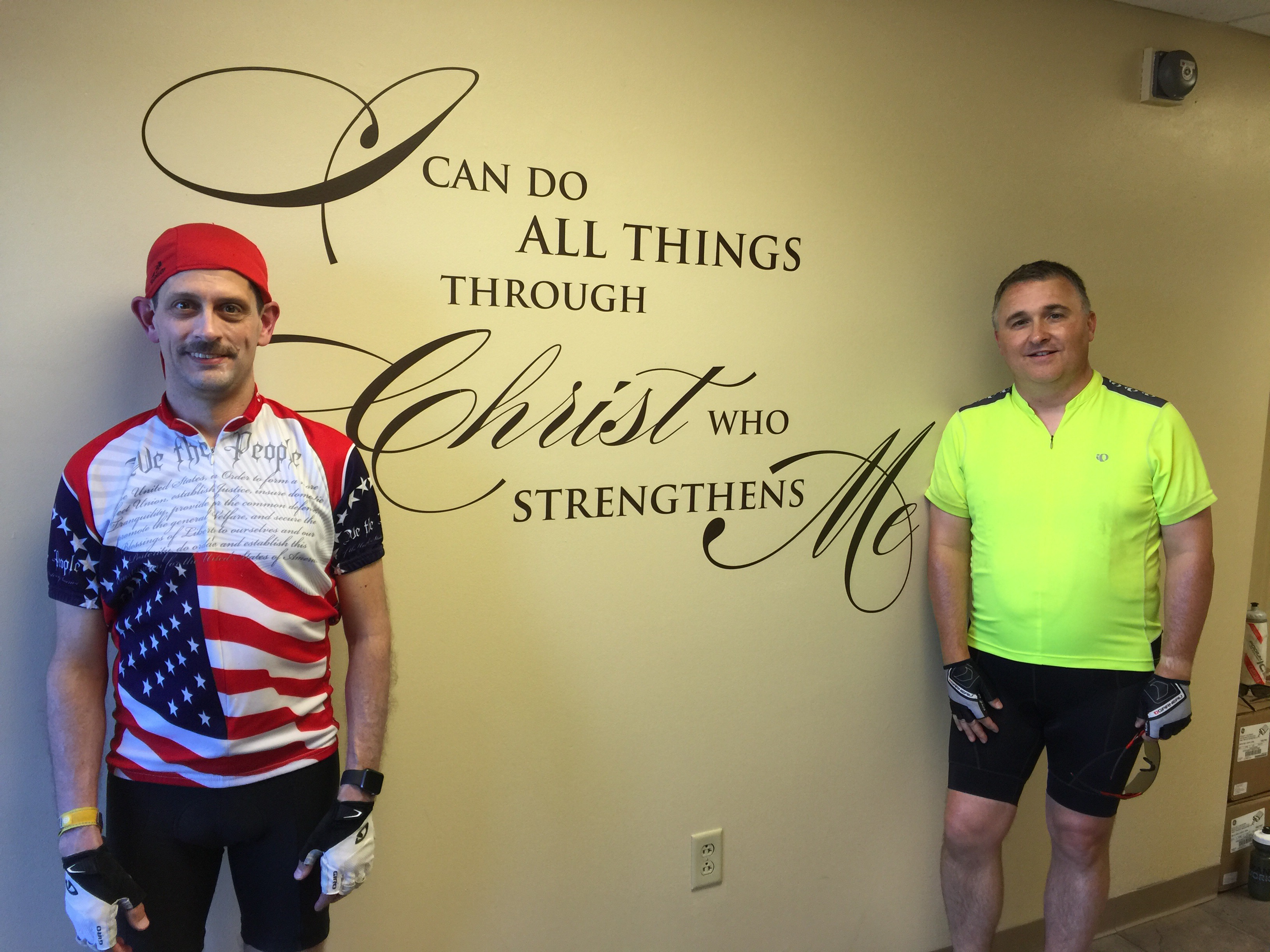
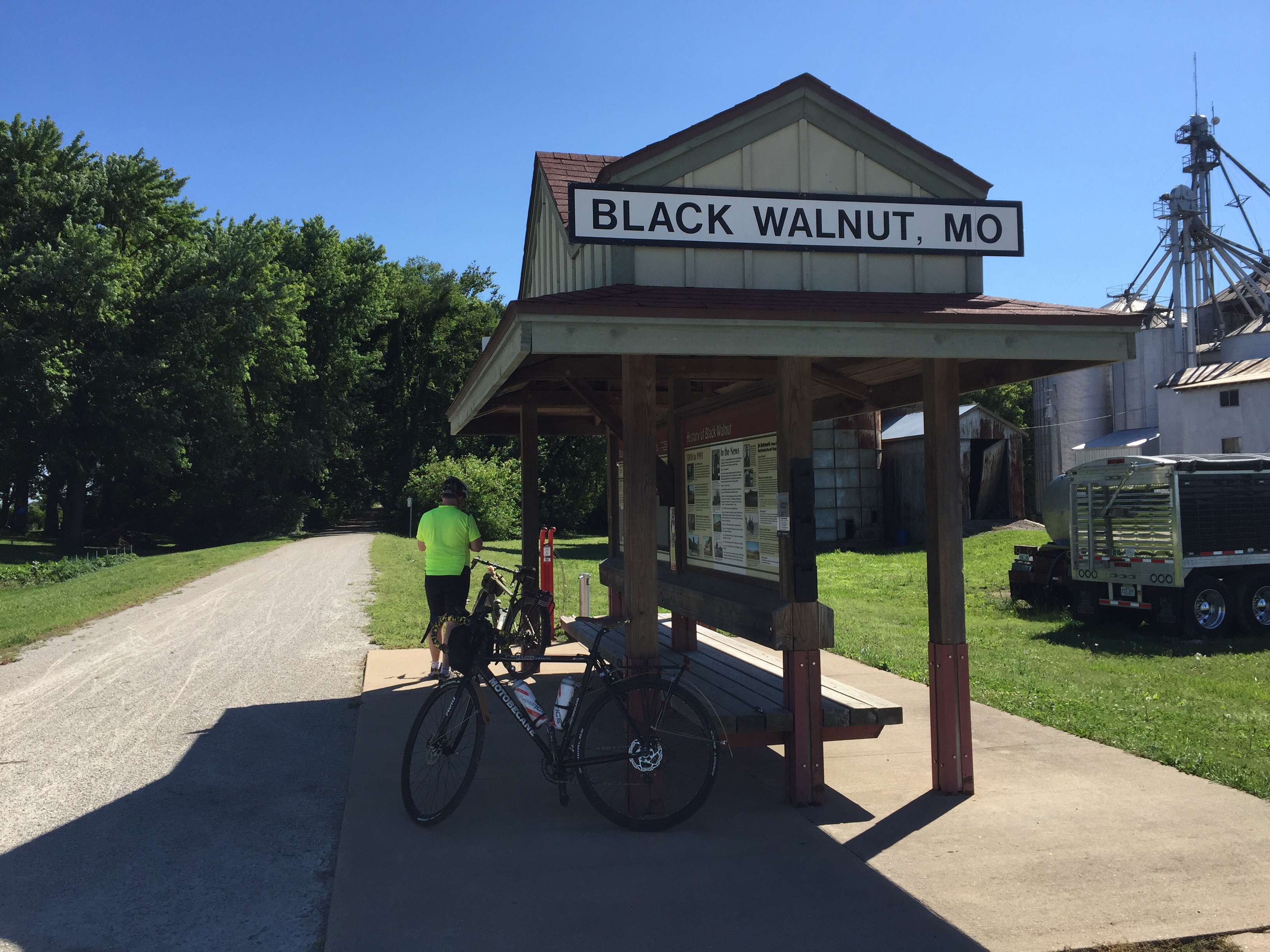
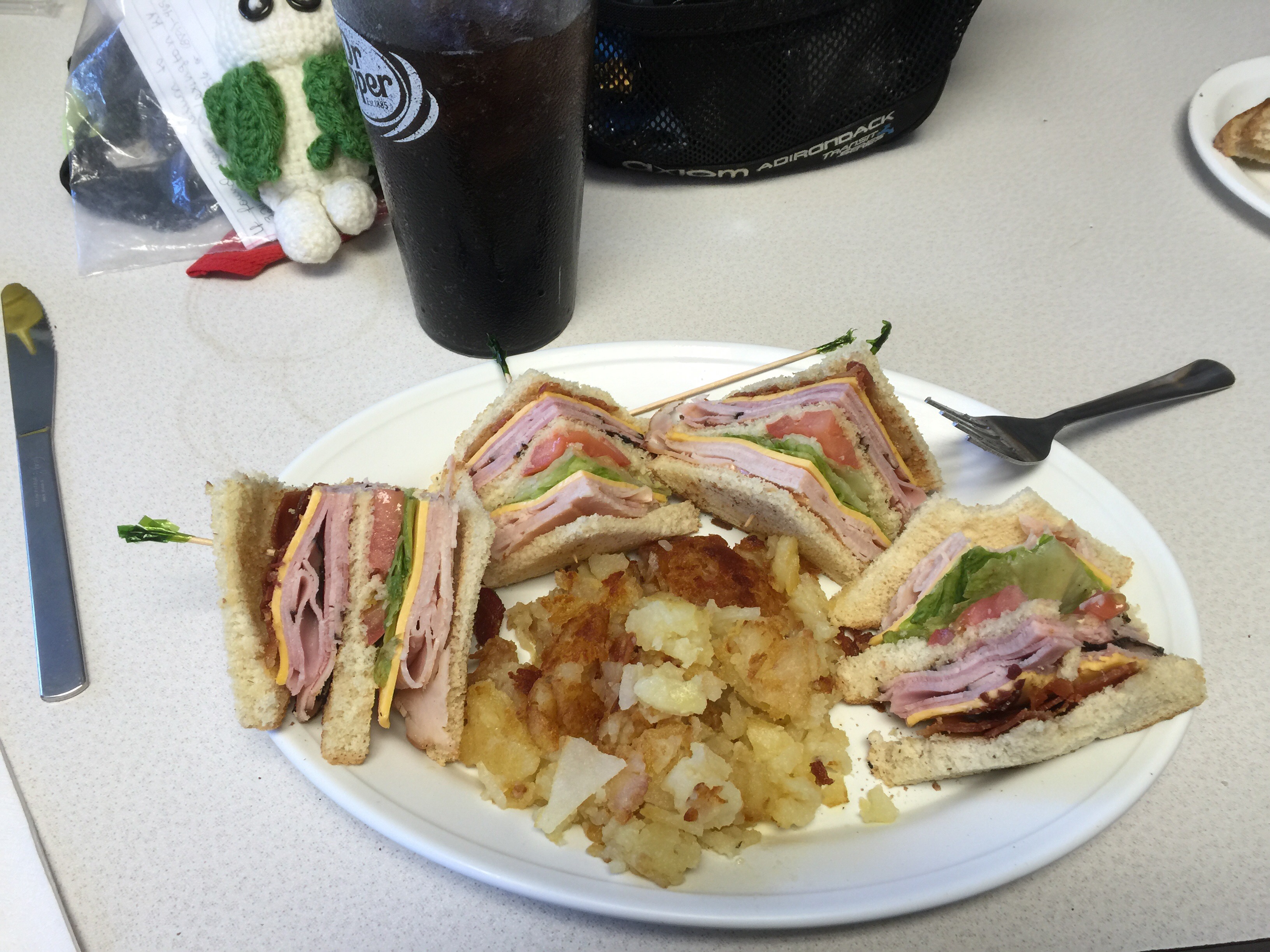
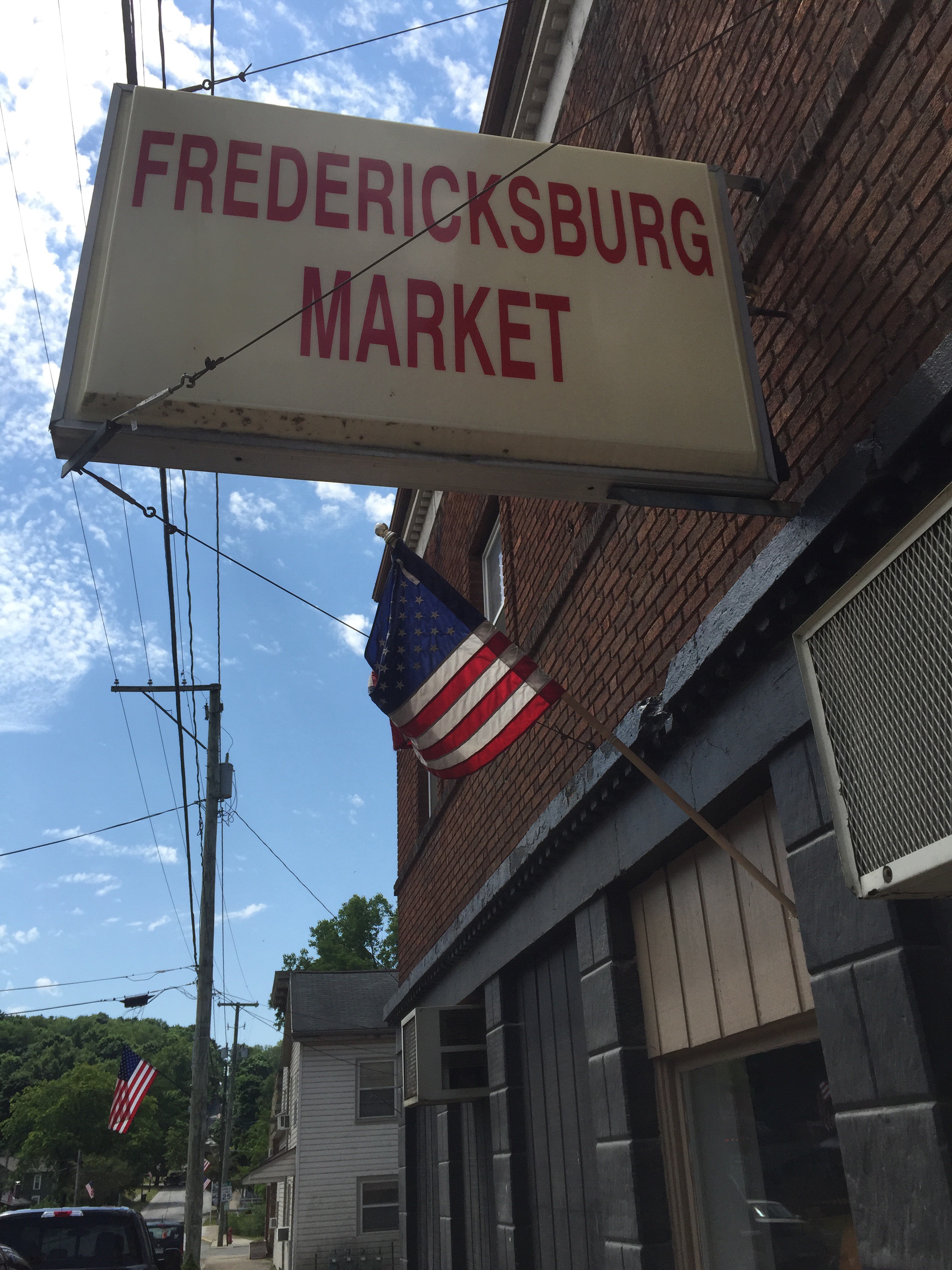
The first 60 miles went by incredibly quickly.  Our legs felt pretty good, we had several fun discussions, and the familiarity of the trail made time pass fast.  Before we knew it, we had passed Spring Valley, Morrow, South Lebanon, and decided to stop in Loveland for a quick bite to eat.  We arrived far ahead of schedule – most of the restaurants weren’t open for lunch yet.  We stopped at the deli and looked for something quick to take and eat.  Joe settled in on some pasta salad, and I had a good sized scoop of tuna salad.  We just needed a few more calories to power our way home.

We had originally figured it would take us until 2-3PM to complete our ride, but knew that we were running far ahead of schedule.  So I called Stephanie to give her a heads’ up to meet us earlier than we had originally planned.  In some ways, you don’t want to rush, but on the last day of the tour, we were both really looking forward to getting to the end.

Our next stop was to get near the south end of the Little Miami trail.  Unfortunately, the Little Miami doesn’t get into downtown quite yet.  They added a few more miles this year, but there isn’t a good way to get from the south end trail-head over to downtown.  So instead, we had to exit near Newtown and begin surface streets to get to the river front.

Both Joe and I really prefer to stay away from busy streets, so we were pretty tuned-in to watching for cars in every direction.  We exited the trail at Wooster Pike, following the road into Mariemont, through Fairfax, and other roads down towards Lunken Airport.  Some of the roads were a little narrow for my taste, so we used sidewalks for some parts.  (Note, that’s probably illegal, but I prefer my safety)

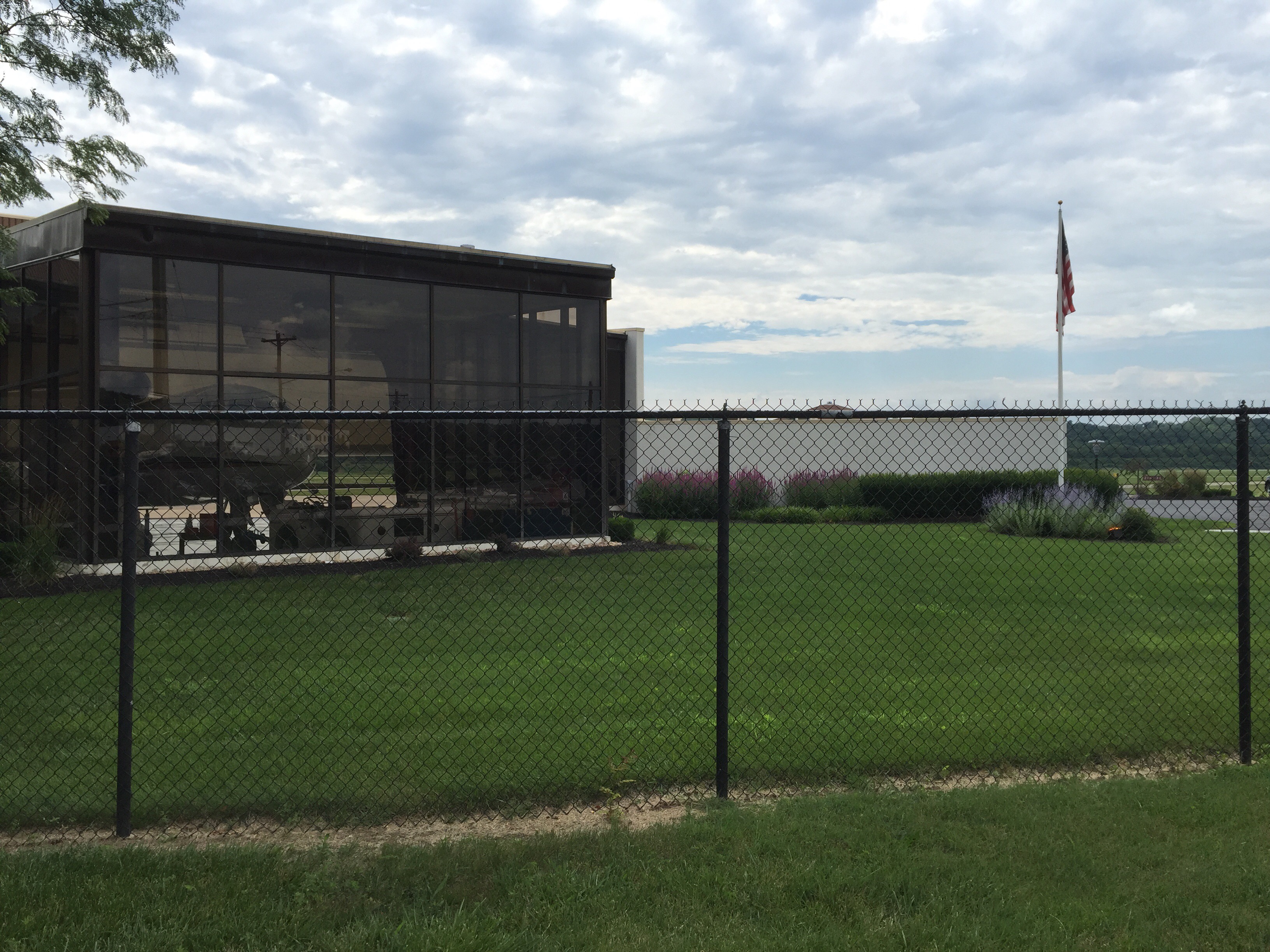
Next stop was Lunken Airport – the old airport for the Cincinnati area before the Northern Kentucky airport was built.  Lunken was opened in 1925 and was the largest airport in the world at the time.  Today, it is primarily used for private aircraft.  The airport grounds now includes some bike trails on the east and west edges.  We jumped on one of the Lunken trails for a short stint before picking up the Ohio River Trail near the river front.

The Ohio River Trail runs for about 2 miles from Lunken Airport towards downtown.  It winds through some parks and gave us our first views of Downtown.

At the end of the Ohio River Trail, we moved to the bike lane on Riverside Drive for the next 3 miles.  It has a nice bike lane and felt pretty comfortable, except for when large dump trucks whizzed by.  We made quick time heading towards the city.

Along the way, we both noticed how nicely Cincinnati has been redeveloping the east riverfront.  Lots of nicer row-style homes were being built, and it had a bit of a “hip” feeling to the area.

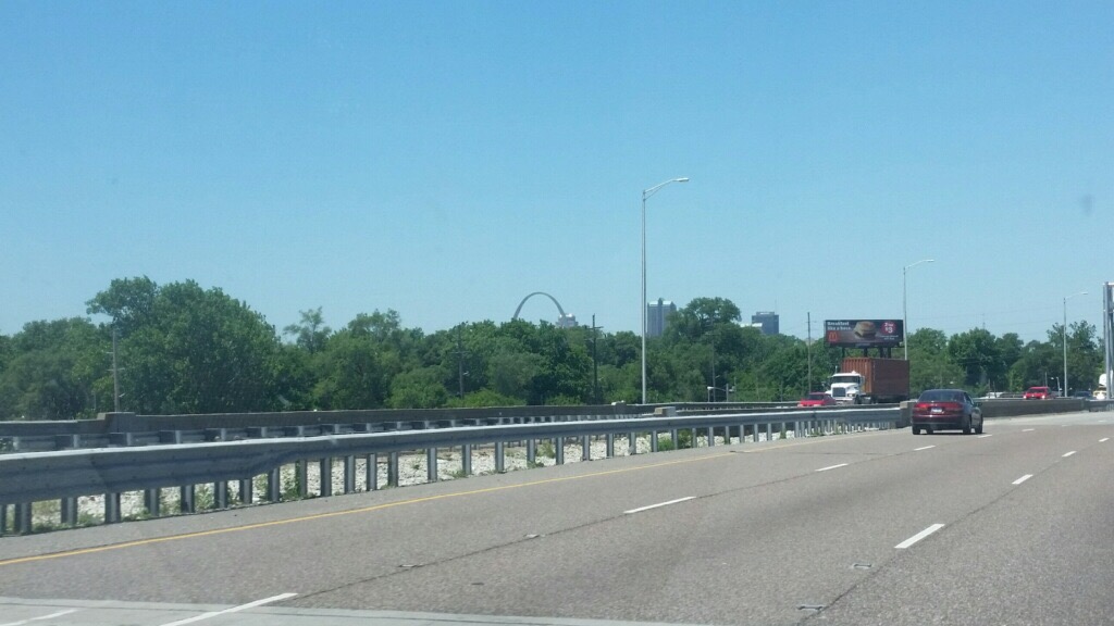
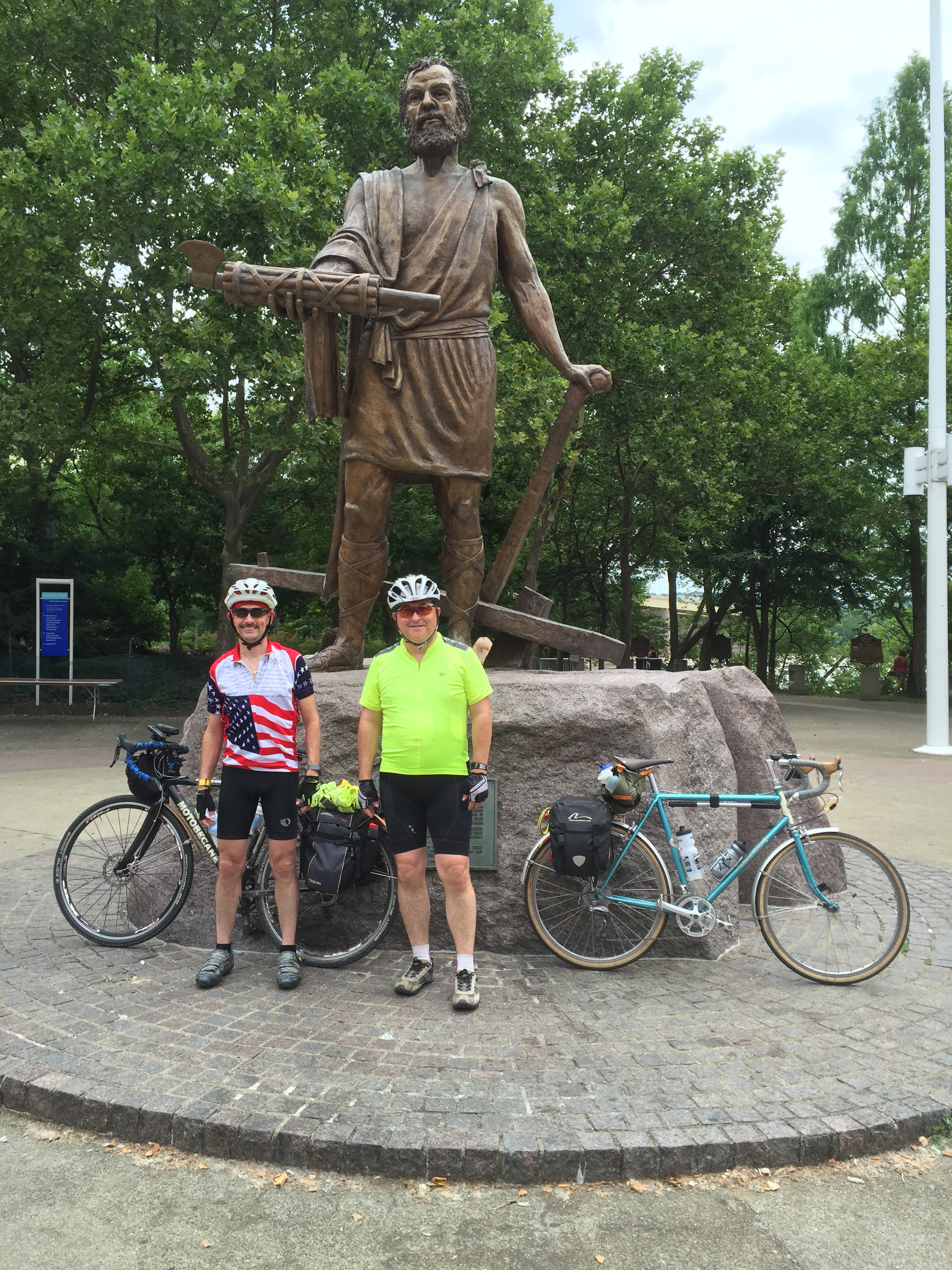
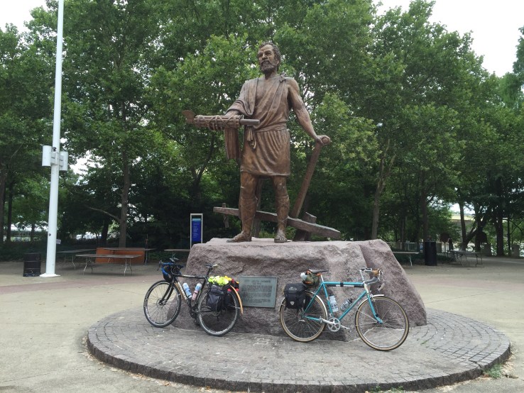
Once we reached the Berry International Friendship Park, we moved back to trails along the river front.  These trails delivered us nicely to the Yeatman’s Cove park.  We stumbled across this statue of Lucius Quinctius Cincinnatus.  Hey, it’s a giant guy with an axe!  We didn’t take the time to read the plaque, but hey, when there’s a statue that looks like something out of the original “Clash of the Titans” or “Jason and the Argonauts”, you should definitely get your picture taken.

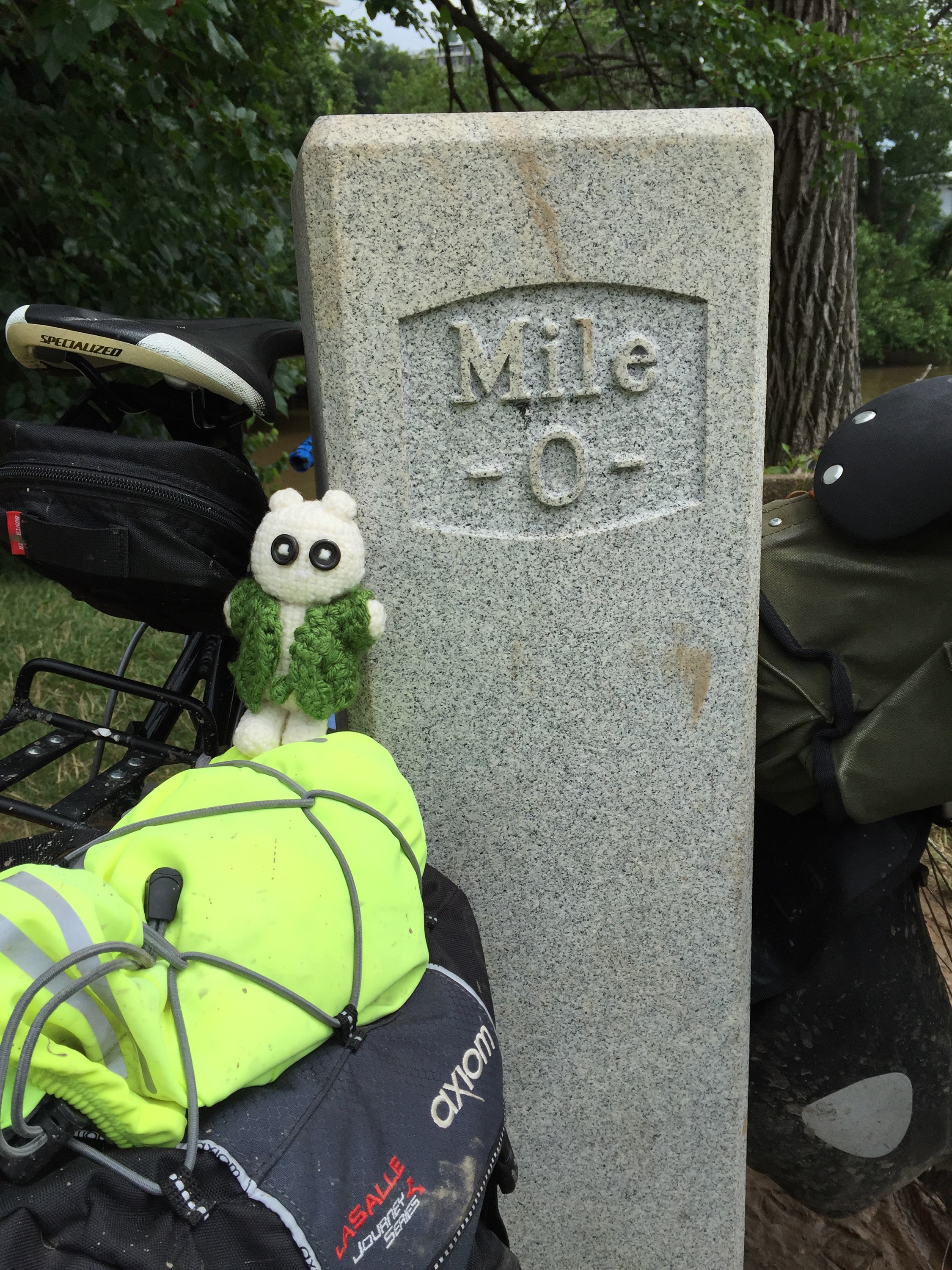
A short trip up around the corner took us across the pedestrian bridge and out of Ohio.  We had officially ridden across the entire state now!  Yeah!

We found the sign on the bridge somewhat humorous – it challenges people to take the “Get Moving Challenge”.  Yeah, that’s what we need – to get moving.

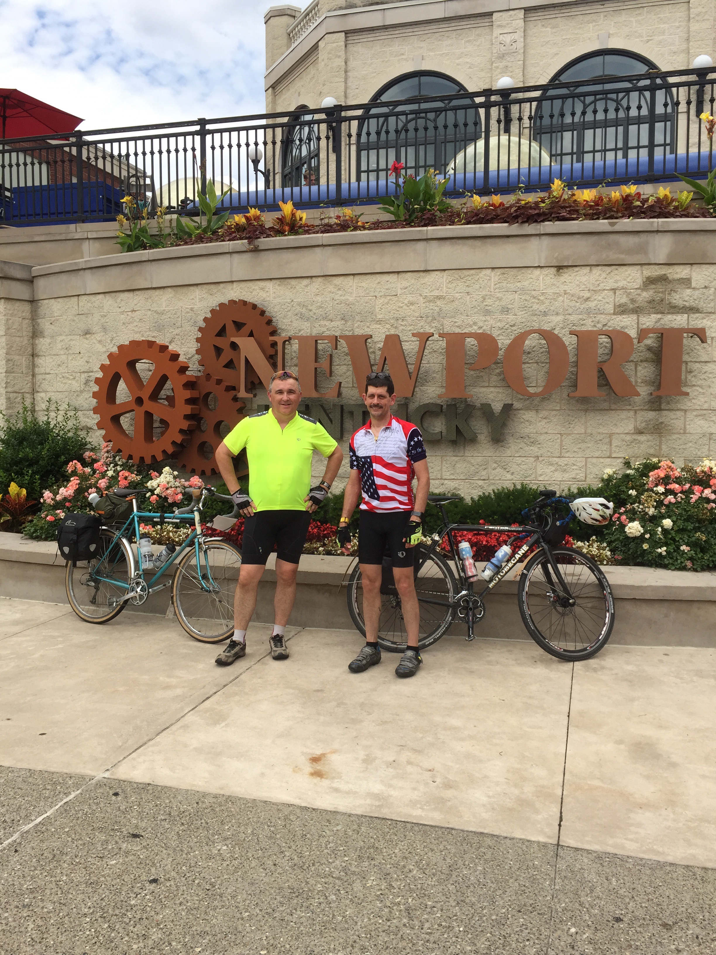
We had decided that the Newport Aquarium would be a great place to meet Stephanie.  So we wound our way across and to the front entrance of Newport on the Levee.  I called Stephanie who was still a few minutes away.  Joe and I took advantage of the water feature-fountain in front to put some cool water on our faces.  It felt pretty good.

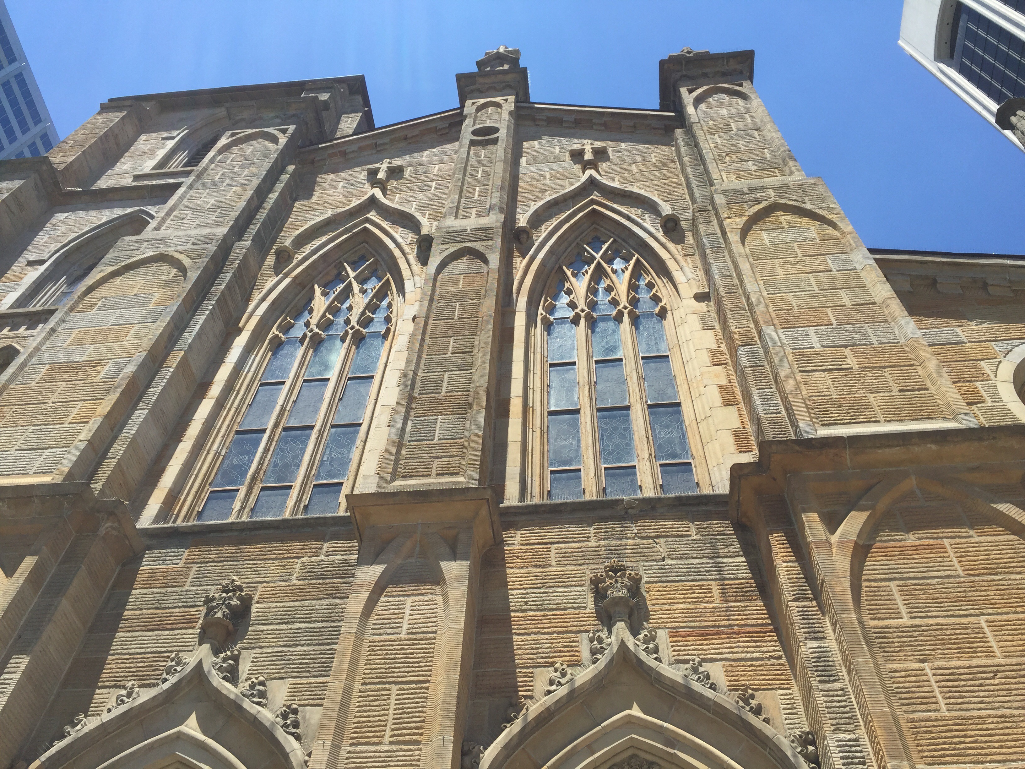
We had decided ahead of time that if we weren’t completely exhausted, we would ride our bikes to the Cathedral of the Covington Diocese, about 2 miles away, and finish by entering the Holy Door there.  So since Stephanie was a little behind, we called and had her re-route and meet us there.

Getting there sounded pretty easy, but turned out to be a bit of a challenge to get to the right roads.  We had to seek out a path to cross back over the levee and get to the Riverboat Row road behind the Aquarium.  It took a while, but we finally got to the Cathedral and met Stephanie.

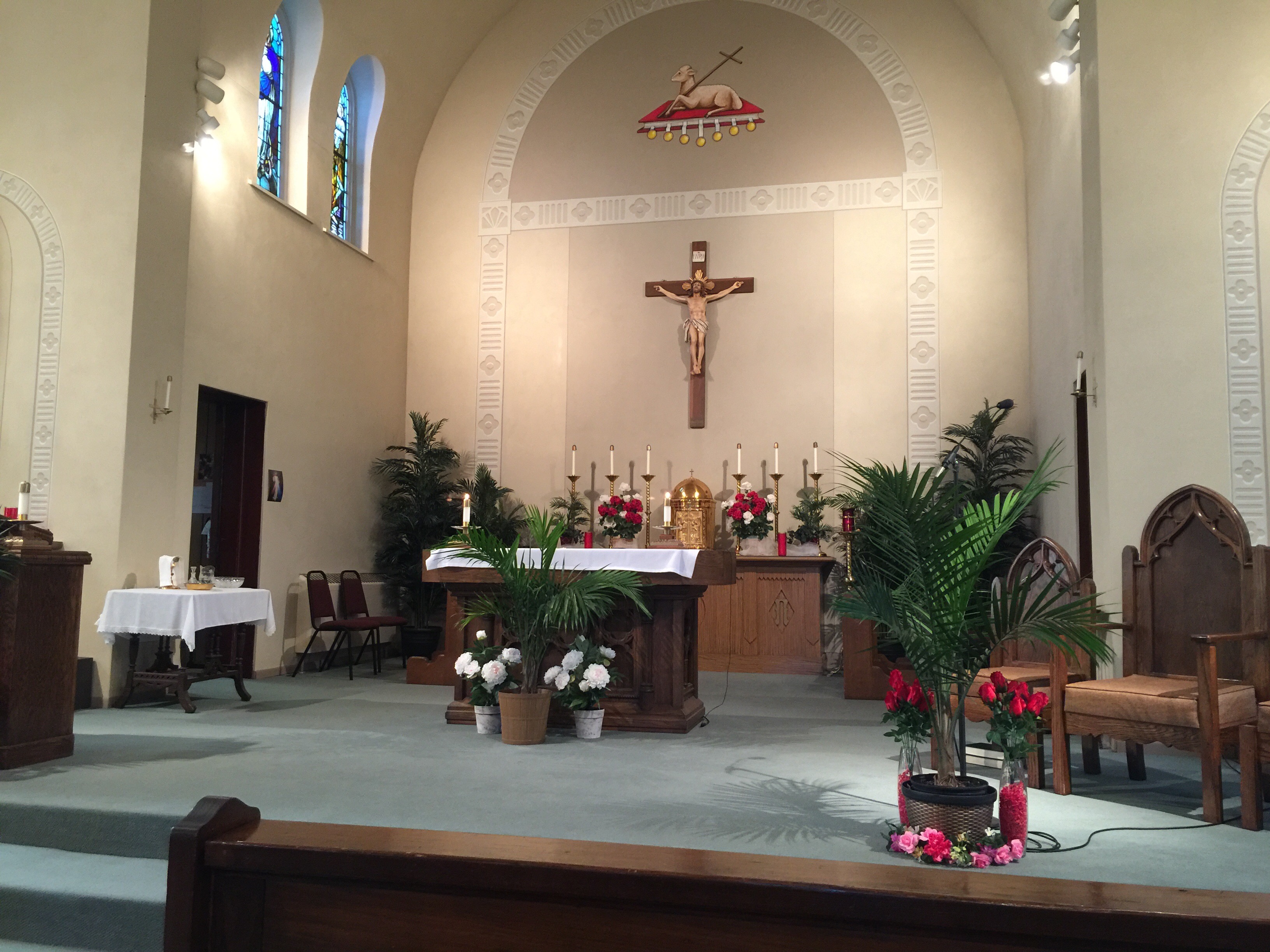
The Cathedral is magnificent.  I don’t have any pictures that do it justice.  What I can tell you is that if you are traveling anywhere nearby, you owe it to yourself to stop by and see the beauty of this church.  The tremendous art and scripture stories in the stained glass is stunning.

A few minutes later, we packed up the bikes and headed back to Lexington.  We made a quick dinner stop and then drove home, dropping off Joe along the way.

This trip was really a great adventure.  It was different than other tours I’ve done: we didn’t really know much about the route, and there were many more road-miles than we typically do.  And as always, even though it was a great trip, it is also really great to get home.

Thanks for all of the prayers, emails, text messages, and so on that carried us through the journey.

After I have a chance to stop and think a bit, I will have one more blog entry summarizing some of my overall thoughts about the Ohio to Erie Trail in a day or two.

But for now … a much needed rest in my own bed.  Yay.

Peace!

Day 4 – Ohio to Erie ride: Columbus to Xenia OH (58 miles)

Today was our shortest ride for the tour.  The weather forecast indicated that it would be a hot day without any clouds, and it definitely was both.

Father Ron made us a yummy breakfast, essentially an omelette-in-a-mug, to get us started.  He took very good care of us during our brief stay.

We said goodbye to Father Ron at St. Agnes around 7:00AM and carefully tracked our way to the Camp Chase trail head.  However, just as we were getting close, a smell hit both Joe and I.  It wasn’t just any smell… It was the kind of smell that draws you in, leading you by some subconscious impulsive desire that must be satisfied.  Yes, it was freshly made donuts.

Again, I am supposed to be avoiding wheat, and I haven’t had a donut in about a year.  But… There must be some sort of pheromone thing in the donuts at this place.  Joe and each had a donut and split a third.  Awesomeness.


It was comical trying to order these three donuts.  The nice young lady behind the counter wanted to put them into a styrofoam box.  I explained that I didn’t need the box.  She got out smaller styrofoam containers.  I told her they were going to be eaten very quickly.  She seemed perplexed as to what to do with this strange request.  So I grabbed some napkins and said “just put them here”.  She begrudgingly handed over the chocolate-cake glazed wonders.  And within two minutes, they were gone.

My wife says we talk too much about food on our bike trips… So I guess I’ll just move along here.

We jumped onto the Camp Chase trail.  This is a very smoothly paved trail that runs next to some rail lines.  It was already warm enough that we didn’t need any arm warmers or jackets, and you could feel the humidity in the air.  Several miles later, we arrived at the Batelle Darby Creek Metro Park.

Once inside the park, there are a couple of ways you can go.  One path takes you through the woods, while the other is nearly all on a paved surface.  There is a short section that goes off-road into the woods next to the Big Darby Creek.  We stopped to grab a couple of pictures and continued on.


After leaving the park, we followed the Roberts Pass trail for about 7 miles into the town of London.  This was another case where the maps didn’t indicate how large the town was.  We were pleasantly surprised to find a very nice little town.  Knowing that we had many miles to go in very hot weather, we went in search of water to refill our bottles, and stopped at a convenience store.  A large bottle of Gatorade, and three refills of icy cold water later, we were back on our way.

Just outside of town, we found the northern trailhead for the Prarie Grass Trail.  I stopped to adjust my rear brake mount, and as I was working on my bike, two young ladies zipped by and said hello as they passed.  More about them in a moment…

The Prarie Grass Trail is a well maintained and paved trail that is ~25 miles long and runs all the way into Xenia Station.  It is not very shady – it doesn’t have the canopied tree lining that some of the older trails do.  The sun was pretty hot and the headwinds picked up.  Watching the grasses and trees alongside the trail, we could see that the wind was pretty directly in our face, and pretty strong.

We reached South Charleston and needed to refill water again.  This is a really wonderful little town.  We took a leisurely tour of their downtown and made our way toward the trailhead.  As we were turning onto the street near the trailhead, we saw a group of cyclists who were wearing the same jersies as the two young women we’d seen earlier.  They all convened in the park next to the trail, eating lunch.

It turns out that this is a group of 29 young college students and recent grads who are cycling across the US to raise funds and awareness for affordable housing.  One of the kids lives in Lexington KY as well, and had just graduated from the University of Kentucky.  They started in Providence RI and were heading to the Northwest coast.  We chatted for a few minutes and wished them well.


With the sun high over head, we pressed on to Xenia.  The winds kept pushing against us, but we were anxious to arrive.  We passed through Cedarville, topping off water and getting a quick snack, then continued to Xenia Station.  From this point on, most of the rest of the trip is in very familiar territory along the Little Miami Scenic Trail.


We arrived too early to check into our AirBnB, so we rode north of town a short way to find our lunch / early dinner.  We decided on Frisch’s, and had a nice meal.  The best part was that the air conditioning was cranked up high.  It felt good to get chilled down.  We took our time eating and relaxing a bit in the cool comfort of the restaurant.  By the time we left, we both were a bit uncomfortably cold.  That was great.

Our final stop for the day was the AirBnB.  We took a relaxed pace for about another 3 miles to get there.  A very thorough showering was in order to get off the mix of dirt, tiny bugs, and sunscreen.  It always feels soooo good to scrub down after a long day on the bike.

It is only 4:30 now, and I am already feeling like it must be close to bed time. Yawn. It will be work to stay awake.  Must…do…laundry.

Tomorrow is the last day of our tour.  We ride into Cincinnati, and cross over the Ohio River into Kentucky.  We will meet my wife there and head home.  It looks like about another 70 mile day.

Weather tomorrow looks to be pretty warm, and potentially a little stormy.  We are hoping to get an early start and beat the heat.

We’d appreciate prayers for good weather and safety.  Thanks in advance.

Peace!

Day 3 – Ohio to Erie ride: Howard to Columbus OH (73 miles)

It has been a pretty good day.  On the up side, the ride was beautiful and we finished ahead of schedule.  On the down side, my previously trusty Garmin Edge 605 stopped being trusty today.  (Insert Kenny Rodgers Randy VanWarmer tune “you left me, just when I needed you most” softly playing in the background, or Bones saying “She’s dead, Jim”)

Editorial update: I have not idea who Randy VanWarmer is, but I had incorrectly attributed this tune to Kenny Rodgers.  Perhaps Queen’s “Another One Bites the Dust” would have been a better choice, anyway.

We got up before dawn and quickly packed up our belongings, hoping to get out around 6:30 today.  We were treated to a super delicious breakfast at Dave’s place.  Dave and his wife raise chickens on their farm, and we had delicious fresh eggs.  They tasted awesome.  But the best part of breakfast wasn’t what filled our stomachs, it was what filled our souls.

As we were saying grace over our breakfast, Dave paused at the doorway.  When we finished, he sat down to join us and said “I had a feeling you were some good Catholic boys.”  We had an awesome conversation over breakfast about his faith journey.  I won’t even attempt to describe it here – partially because it was a personal conversation, and partially because I couldn’t do it justice in a short blog posting.  Our discussion put us about 30 minutes later on our start, and I am so glad we took the time to listen.  It was well worth it!


We stepped outside and Joe played one last game of fetch with Diamond.  What a great dog.

As we packed up our things onto our bikes, Dave came out to see us off and prayed with us before we departed.  He gave us a hug and asked us to come back again for a longer visit.  Once again, we have been blessed by the people we come into contact with on these bike trips.


About 7:10am we finally hit the road.  The temps were nicely chilly and the air felt great as it blew over our faces.  The first few miles were a bit more challenging than they were supposed to be.  Our legs seemed to be saying “not today.”  We had a hard time getting to a steady speed for a while.  I think it was a combination of physical fatigue and that this part of the Kokosing trail apparently has a slight grade up.

About 7 miles later we reached Mount Vernon. My (no longer) trusty Garmin 605 said “low battery”.  What?  I just charged you last night! I bypassed the message and hoped for the best.  It sporadically worked for a while.

In Mount Vernon, we eventually found our way to the Heart of Ohio trail.  This runs for about 13 miles to Centerburg OH.  It was a pretty uneventful section… Until near the end.  We were stopped waiting to cross some traffic and I was using one hand to eat an energy bar and one hand on the bike.  The bike nearly tipped over and the pedal caught the back of my calf.  Nothing serious, just a nuisance scrape, but enough to remind me to be more careful.

After topping off our water, and putting some neosporin on my freshly minted flesh-wound, we set our sites on the town of Sunbury about 15 miles away along country roads.

The road route to Sunbury was beautiful. Gorgeous blue skies, the moon was still up most of the morning, and farm land as far as the eye can see, bedecked with green leaves of corn, golden yellows of wheat (I think), and many other colors. The roads were gently rolling without any of the nasty climbs of yesterday.

When we reached Sunbury, we didn’t know what to expect.  We thought it might be just a little blip on the map.  What we found was a very neat little town square with a lively atmosphere.  If you plan on heading this way, make sure to spend a little time there to soak up the town.

Sunbury was also the sight of second breakfast or early lunch, depending on how you view the world. I decided to hedge my bets and get a sandwich and home fries to cover both bases.  The Sunbury Grill was a great choice – it is the kind of place my Dad taught me to love many years ago when we would go for breakfast together.


While there, once again some bike touring fellowship spontaneously appeared.  We sat at the food counter and the guy next to me struck up a nice conversation with us.  His name is Earl.


After Sunbury, we had just a few miles on Old Route 3 C until the town of Galena.  From there, we met up with the Hoover Scenic Trail and then the Genoa Trail for about 6 miles.

The Genoa trail ends at Maxtown Road, also known as Polaris Parkway, north of Columbus.  We had scoped out our own route into downtown Columbus, using the Alum Creek Trail, which starts here at Maxtown road.

At this point is where my GPS finally just gave up the ghost.  I couldn’t coax it to do anything.  I had become pretty comfortable knowing that I could glance down and see that we were still on (or off!) the planned routes that I had downloaded into it. It had served us quite well over the past few days and caught a couple of missed turns.  Sigh.  Oh well, at least we had some maps to use.

The Alum Creek Trail goes roughly north/south and we took it for ~12 miles to the I670 connector trail, which is a pretty rough paved trail adjoining I670 until you get dumped out into downtown Columbus.

We were making very good time today, so we decided to stop at the Columbus Cathedral and enter through that Holy Door too.  We arrived at a time when a wedding party was getting their pictures taken, so I quickly went in, passed though, and left, trying to be as unobtrusive as possible.  Hence, no pictures of the inside of the Cathedral.


We continued west, using sidewalks to navigate until we reached the Scioto Greenway trail on the south side of Columbus.  Without the GPS, we had to be a little more discerning about where to turn to find our next set of roads.


We eventually found the Hilltop Connector and wound along some city streets to our evening destination: St. Agnes church.  We arrived around 3:00PM and found a cool respite from the heat in the church.


Father Ron arrived a little later and greeted us.  He introduced us to his great little dog, Chase as well.


We got a very much needed shower and shave, then joined him at mass.

After mass, we made BLTs, heavy on the “B”, strawberries, and an Italian lemon ice for dessert.  Some great conversation over dinner made it a wonderful meal.  Once again, bike touring fellowship is so spectacular.


So now, it is time to head to bed. We want to get out early again tomorrow to beat the mid day heat.  We only have about 55-60 miles tomorrow, so we want to get done quickly and rest up.

Until tomorrow, Peace!

PS: yes, I am doing this whole blog from my trusty iPhone… So please forgive my typos.

Day 2 – Ohio to Erie ride: Massillon to Howard OH (72 miles)

This morning started a little later than we had intended.  We took a leisurely pace getting going and had breakfast at the Hampton Inn before departing.

We crossed over the bridge and found the beginning of the Sippo Valley Trail pretty easily. The trail was a mix of paved and crushed limestone.  It was a fairly easy ride to Dalton.  Once in Dalton, we left the trails behind and began an 18 mile trek on country roads towards Fredricksburg.  The roads had plenty of gently rolling hills and very beautiful farmland. We saw many Amish farms and the people working them by hand. 

We stopped in Fredricksburg for lunch and to get some Gatorade.  There was this awesome little store there. The people really friendly and made us feel at home.


Across the street was a pizza place. It looked like our best option for getting a decent meal.  I’m not supposed to be eating wheat or dairy, but I ordered a pizza anyway. It was fairly tasty.  We struck up a conversation with two gentlemen who were at the table next to us.  They happened to both be named Ruben.


After finishing the pizza, we got out and found our way to the Holmes County Trail nearby. It was a nicely maintained trail. In this area, we saw far more Amish buggies on the trail than cyclists.  By this time, the weather was becoming pretty warm. It wasn’t too bad in the shade, but the sun was hot.  Around 4 miles later we arrived in the small town of Killbuck.  We stopped for some ice cream, a cool place to sit, and to fill our water bottles back up.  That turned out to be a good thing… We weren’t really mentally prepared for what was next.


Just outside of Killbuck, we had to again use some country roads to the next town. The maps we had said “there is a climb from SR520 to CR6” and that the next section had “significant hills”.  Both were understatements.  What followed was about 14 miles of the most difficult riding I have ever done.  The first climb on CR6 didn’t look too bad at first. But it kept going and going.  Every time you thought you saw the top, you’d turn a corner and see even more and steeper road ahead.

The CR6/CR25 stretch continued to challenge us over and over with one long steep descent/climb after another.  It was mentally exhausting to climb up to the top and then see another even taller hill just up the road.  We drank so much water trying to stay hydrated.  I was very thankful we had topped off all the bottles before leaving Killbuck.

Little by little we chipped away at the miles and reached route 62 near Brinkhaven.  Then it was nearly all downhill on a heavily trafficked road for a couple of miles.  I was going much faster than I am comfortable with, especially on unfamiliar roads.  Thanks for my guardian angel’s company on that stretch!

After the descent we continued another 2-3 miles and joined the Mohican Valley Trail.  If you are going North to South like we are, watch carefully for the Ohio Bike Route 1 turn signs.  We missed the sign, but my Garmin alerted me to being off route a few hundred yards later.

The Mohican Valley trail is mostly paved, although it did have some rough patches.  The highlight of this trail is the “Bridge of Dreams”.  This is the longest covered bridge in Ohio.  We caught a few pictures before continuing on.


Once on the Mohican Valley trail, we only had about 4-5 miles to our dinner stop in Danville. We stopped at The Hangout.  We each got a small(ish) steak and baked potato.  It was really yummy.  We had to kill some time before we could check into our AirBnB in Howard.  The Hangout was a good choice for that.

Leaving Danville, we picked up the Kokosing Gap Trail.  This is a really nicely paved trail that took us about a mile from our AirBnB stop.

Our accommodations here are really nice. Our host, Dave, has made us feel very at home in their restored farm house.  So, our laundry is now drying, we have showered, and it is getting very close to being bed time.

Tomorrow looks to be pretty toasty and we need to get to the SW side of Colubus before mass at 4:30.  So, it will be an early-to-bed and early rise tomorrow!

Peace.

Day 1: Ohio to Erie ride – Cleveland to Massillon OH (71 miles)

We started our adventure with a nice breakfast at Alex and Lauren’s place.  We started a little later to allow the rush hour traffic to wind down.  Stephanie dropped us off at the Rock and Roll hall of fame and we grabbed a few pictures.  We saw a sign that said “bike tours start here”… Seemed like a great opportunity.


I gave Steph a hug and kiss goodbye as we departed southbound.  We went a few blocks south on the sidewalks of 9th street and stopped at the Cathedral to pass through the Holy Door.


As we left the Cathedral, the rain started.  It was a misty and cold rain that would be our constant companion for the next several hours.  We zig-zagged across city streets towards our next stop. We missed one turn and probably went about 1/2 mile out of our way and had to backtrack.

A few miles later, we made a small detour to visit the house from “A Christmas Story”.  We didn’t tour the house, just took a couple of pictures and resumed our trip.


A few miles later we finally reached the trailhead of the Ohio & Erie Canal.  This is a canal that carried cargo and passengers between the Ohio River and Lake Erie.  It ceased operations in 1912, but the former towpath has been turned into a hiker/biker trail.  Most of the surface was crushed limestone, with a few patches of pavement.  Even with the rain, it was pretty decent. It seems to drain well and the puddling wasn’t too bad.

We had an uneventful, albeit wet, trip down to Akron. There was a detour north of Akron that had probably a 10%+ grade to bypass a construction zone.  It was a little challenging, but we survived.


Upon arrival in Akron, we found that the path we were supposed to take was closed because of a parade to celebrate the Cavelier’s championship. The traffic control guy pretty rudely just told us to go a different way.  We had no idea where we were supposed to go.  We went into the city and were about to start looking for maps when a guy came up and offered to lead us to the canal.  We took him up on the offer and he took us over to the baseball stadium and the canal.  The normal canal path also had some detours.  It took a little discerning to figure out the right way to go:


We had quite a long way to go still.  We continued down the canal path.  The scenery was beautiful and the wildlife was plentiful. 


It took longer than we expected to get to Massillon.  The trail was slow and we started getting tired.  Finally, we arrived at our hotel close to 7PM.  A much needed shower and some wings for dinner finished off the evening.

Tomorrow’s weather looks pretty good.  It will be another 70 mile day, so we are hoping to get started much earlier and finish earlier.  We don’t really have any city riding or navigation tomorrow, so that should help as well.

Time for a much needed sleep!

Peace!

A warm welcome to Cleveland

Today we traveled up to Cleveland to prepare for our ride.  Alex and Lauren are friends of ours who moved up to Cleveland.  They offered us a place to sleep tonight. We enjoyed visiting and talking. They bought an old home along the lakefront that they are fixing up.  Pretty neat.


We begin our trip tomorrow at the Rock and Roll hall of fame, heading south to Massillon.  Tomorrow’s weather is looking like it might be wet and stormy.  We looked up and found out that Saint Medard is the patron saint for avoiding bad weather. So, St. Medard will be our patron for the journey!

Here’s the general path we will cover over the next five days:


So it is time for some much needed sleep. St. Medard, pray for us.

Peace!

2016 Bike Tour starts next week!

T-minus 7 days to the start of the 2016 bike tour.  This year, my friend Joe and I will be riding across Ohio.  We will be self-supported, just traveling by ourselves with our bikes and gear in panniers.

We have researched a bike route that starts in Cleveland and winds southwest to Cincinnati.  It is a combination of bike paths, country roads, and a little city riding.  We will generally be following “Ohio Bike Route 1”, also known as The Ohio to Erie bike trail.

On Thursday, we will begin our trip at the Lake Erie lakefront, starting at the Rock & Roll hall of fame, and finishing 5 days later in Covington, KY – just south of the Ohio River in Cincinnati.

Along the way, we are going to try to see two or three cathedral churches to pass through their Holy Doors that have been opened as part of the Year of Mercy.

Pray for our safety in travel.  I intend to blog a little as we go to share pictures and thoughts from the adventure. 

Peace!

Final Thoughts – 2015 Great Allegheny Passage / C&O Canal Tour

IMG_7130

It’s been a few days since we completed our ride along the quiet paths of the Great Allegheny Passage and the C&O Canal Path.

We finished our journey on Friday evening, but stayed in Washington DC on Saturday to take advantage of the museums and things to see.  Joe’s wife and kids managed to meet us there, which was a lot of fun!  I enjoyed seeing the Air and Space museum with them. IMG_7454

After the day, I said farewell to Joe as he went off with his family to their hotel and to drive home to Lexington.  I went back to St. Peter’s and went to mass in the evening.  It happened to be the final weekend for their pastor, Fr. Bill.  The mass was spectacular – great music, a great homily, and a wonderful cook-out afterwards – served in their hall since it was pouring outside.  I met some wonderful people at the party and it was clear that this parish has loved its pastor.  I was glad to be able to experience this.

The next morning, I got up early and made my way out to begin my multi-step journey home to Lexington.  My bike was still filthy, so I hosed it off and left it to drip dry in the garage.  I then walked my way to the DC Metro, arriving very early as it was just opening.  The kind lady who was opening the station was a very friendly way to start my Sunday morning!  After catching the blue-line to Reagan National Airport, I found my rental car, drove it back to St. Peter’s, and promptly loaded my bike and panniers into it.  I was on the road back to Lexington before 8:30AM.  The interstate tracked past a few of our places we cycled.  In fact, the interstate took me directly through Cumberland and I passed over the GAP and next to the hotel we stayed at.  It was a little fun to realize I’d just been there a few days ago by bike.

With a couple of good audio books, a small bag of Reese’s Pieces, and a tall glass of water, I made it quickly back home.  I was in my driveway before 5:30, which seemed like pretty good timing.  What was even better is that this allowed me to catch dinner with my family.  That was the real highlight of the day.

And, for me, coming home is always the best part of a journey.

Looking back, this was a really fun trip and it went by very quickly.  I have been on the full GAP/C&O once before in 2012, and cycled the GAP last fall with Joe.  This time was a bit faster on the pace – six days means you are packing a lot of miles into each day.  That didn’t leave much time for extra sight seeing.  On the plus side, we never got rained on.  That’s a first for any of my bike trips.  On the other hand, there were plenty of opportunities to become one with the earth, or mud, along the C&O Canal.

IMG_7315 IMG_7344

The Great Allegheny Passage is a really great rail trail.  Probably one of the best anywhere.  It isn’t paved, but it is well maintained and the rain doesn’t turn it into mush.  The scenery is beautiful, the little towns are fun, and there are enough services along the way to make for an easy trip.  I can certainly see more trips along this great path some day.IMG_7134 IMG_7250 IMG_7258 IMG_7261 IMG_7267

The C&O Canal path has a very different character.  It feels more historical, more rustic, and definitely a rougher path to ride.  The 60+ mile days on this path felt like 80-100 mile days on pavement, by comparison.  There are not very many services, so you have to prepare carefully for food and water stops.  If you want to camp, there are many places to do that.  But if you want to find accommodations under roof, you’d better plan that out far in advance.  Although the C&O offers a really great ride through the woods, the downside is that it is really better for full-suspension bicycles (with fenders, for sure).  It was pretty rough riding.  I don’t know if I really have a draw to ride this one again any time soon.  Riding it with friends would always be a fun thing to do, but there are many other great paths out there to try that don’t rattle my bones quite so much.

IMG_7310 IMG_7366 IMG_7372 IMG_7389 IMG_7421 IMG_7423

Here are a few quick stats from last week’s ride, after downloading my GPS data at home:

  • Great Allegheny Passage:
    • Day 1: 60.7 Miles – Pittsburgh PA to Connellsville PA
    • Day 2: 48.4 Miles – Connellsville PA to Rockwood PA
    • Day 3: 46.3 Miles – Rockwood PA to Cumberland MD
  • C&O Canal Path:
    • Day 4: 60.6 Miles – Cumberland MD to Hancock MD
    • Day 5: 66 Miles – Hancock MD to Harpers Ferry WV
    • Day 6: 65.7 Miles – Harpers Ferry WV to Washington DC
  • Total Distance 347.6 Miles
  • Total Calories Burned: 17,391
  • Total Calories Consumed: (uhh.. too many to count?  I did gain a little weight!)

If you’ve never tried bike touring, I definitely recommend it.  Even just an overnighter for a two day ride of 20-40 miles each day to try it out.  This trip was so much more fun than just driving somewhere.  By bicycle, the world passes by much slower.  You notice the wildlife, small waterfalls, and forest.  The river’s sounds fill your ears and the cell phone doesn’t really work all the time.  That’s really a great thing to experience.  It is a sort of retreat on two wheels.

And then there are friends to be made.  I have made several good friends and many acquaintances.  Joe and I discussed that when you meet new people on your bike, you seem less threatening.  Total strangers seem to take keen interest in your journey and conversation flows.  I can truly say that everyone we met turned out to be a friendly face.  I still keep in touch with friends from all over the states that I have met riding my bike.

IMG_7124 IMG_7156 (1) IMG_7239 IMG_7318 IMG_7352 IMG_7353 IMG_7359 IMG_7378 IMG_7379

One question I’ve been asked: who is this mascot that shows up in my pictures?

IMG_7140 IMG_7145 IMG_7192 IMG_7270 IMG_7413

That’s Mr. Hamster.  He was crocheted by my daughter several years ago and whenever I leave town, he comes with me.  I then take pictures of him and send them home.  He’s been to 14 or 15 different countries, he’s an experienced bike traveler, having ridden with me on 4 long distance journeys, and he recently hiked the Camino de Santiago with me.  He’s my buddy when I’m away from home.  He helps remind me of my family.

So, where to next?  I don’t know.  I’ll probably meet up with some cycling buddies some time this fall for a long weekend ride or two.  Maybe a two or three day ride up on the trails in Ohio, or maybe the Greenbriar trail.  In the end, I’m sure another fun adventure will await.

Until then, Peace!

IMG_7432

Day 6: Harpers Ferry WV to Georgetown, then to Capitol Hill in DC – 66 miles, Journey Completed!

I have to put a disclaimer here – I am completely worn out and can barely keep my eyes open.  So if there are lots of typos and poor grammar, it is to be expected…

Last night was one of the most relaxing evenings I have had in a while. We hung out in the rectory at St. Peter’s in Harpers Ferry, washed our laundry, listened to the trains go by, popped some popcorn, watched Field Of Dreams, and promptly passed out. I slept so well.

After dinner, we found out that one of the local B&Bs stocks a fairly large room with various goods for hikers and bikers coming through.  We went in search of breakfast items. We bought some milk and a large blueberry muffin for the morning.

After our breakfast, which consisted of lucky charms, milk, a blueberry muffin, and an energy bar, we packed up at a leisurely pace and set out. Our first stop was a little shrine to Mary behind the church. We asked for her intercession for safety and good weather. 

 The weather report for today predicted rain at some point.  I am happy to say we saw no rain at all!  However, we saw a lot of mud.  It rained overnight and soaked the trail.  There were stretches of decent conditions, followed by areas with lots of puddles and mud.  My legs and bike were absolutely covered within the first hour of the ride.

There are not very many towns along this stretch of the C&O, so we planned on riding a bit and eating energy bars until we found a place to eat.  About 20ish miles, I began to notice that I was needing food badly.  We came across Whites Ferry and stopped at the snack bar, hoping to find something to eat. It was still pretty early in the day, so the grill wasn’t up yet.  We settled for some prepackaged snacks and moved on.

Whites Ferry has the only working ferry boat on the Potomac river.  We contemplated taking the boat across and back, but decided against it since we wanted to get to DC soon. 


You’ll notice on the building, there are flood markers.  Check out how high the water has gone in the last few decades.

Without any decent meal, we continued on, hoping to find something to eat.  We had no luck for a long distance.  When we finally reached the Great Falls, we stopped at the snack bar and each grabbed a Nathan’s hot dog. I really needed the food, and boy was it a good hot dog.  My outlook on life improved significantly. 

  
We then walked out on the pathway over the Great Falls.  It is really amazing to see that the same glassy-calm Potomac from a few miles back is choked down to a very small and rocky passage.  The roar of the water is pretty neat. 

      
At this point, we were only about 20 miles from our destination and we were anxious to get there.  So we packed up and pointed down the trail towards Georgetown. 

The trail was very congested at spots, but we were able to navigate well and made good time. Along the way, we saw several blue herons and a couple more turtles.  We also saw a jet-black squirrel.  I’ve never seen a black squirrel before.

Outside of Georgetown, we decided to jump on the Capitol Crescent trail because it is paved!  We missed out on seeing a few pretty neat historical things, but after feeling like I was going to rattle my brains loose for the previous 350-ish miles, pavement looked pretty awesome.

We rode all the way to the Thompson Boat Center and found our way to the elusive Mile 0 marker.  It is very hard to find, but I had done a little digging on the Internet and knew where to look.  It is located at the original gate between the Potomac and the C&O canal.  This non-imposing little gate is tucked away in a corner behind the regatta raft garage.  However, this gate holds modern significance, too.  It was known as the water-gate of the canal.  And immediately across the road is the hotel named for this unassuming little trench: The Watergate Hotel. 

     
After a couple of pictures, we set about trying to get to our destination: St. Peter’s on Capitol Hill.  We slowly picked up some trails and sidewalks to get to the memorial area.  We briefly stopped in front of the Lincoln Memorial to snap a quick picture and then started weaving our way through pedestrians eastward to the mall.  There were a lot of people in town and it was slow going. We traveled up next to the WW II memorial and then stopped in front of the Washington Monument to take a celebration picture. 

    
We kept on dodging and weaving along, slowly making our way up the mall.  Near the end, we happened across some sort of festival.  Some people were eating a mango. Some of you know that fresh mangos are one of my favorite things in the whole world. Combine that with 60+ miles of riding and I became single minded!  I found the fruit seller who graciously cut a very large mango up for me and put it into a plastic bag. I ate about half of it in record time as Joe watched.  I saved some for a little later after dinner.

 We made the climb up Capitol Hill, and turned down the street to St. Peter’s.  Two minutes later, the rectory manager greeted us, helped us get our bikes stowed away, and showed us to our rooms in the rectory. 

    
After hosing off my bags and shoes, I took a very much needed shower.  We walked up to Pennsylvania Ave and looked for food. We wanted a nice celebration dinner, with the no-fries rule strictly enforced. Dinner was at the Hawk and Dove.  We ate, recalled some funny moments of the trip, and celebrated. I capped off my dinner with a slice of cheesecake.  Everything went down so easily.  It was very tasty and I was very hungry.


When we got back, Fr. Bill was cooking himself some very delicious linguini with shrimp. I know it is delicious because I had a small serving and it was very good!

After second dinner, Fr. Bill and I took a very nice walk around the Capitol and Supreme Court, through the surrounding neighborhood.  The air was beautiful and the sky was blue. We chatted and got to know each other a bit.

Now, it is time for bed.

I’ll put together a final installment with some thoughts about the trip.  Until then, peace! 

Day 5: Hancock MD to Harpers Ferry WV – 65 miles

Today started with a simple breakfast at the B&B. We got out early knowing our longest ride day lay ahead.  We wished Ben good bye, and chatted with Chris and Sarah about the trip to Harpers Ferry since they were heading there, too.


We began the day continuing on the Western Maryland Rail Trail for a few miles. Near its end, you can (should?) jump off and rejoin the C&O canal path.  We decided to go to the end, which takes you to a road that runs to the north side of Fort Frederick.  This was a really nice detour, but involved a pretty long and steady climb.  By the time we got to the top of the climb, we were out of breath.  However, we turned right and this took us on a long descent into the Fort Frederick park.

We didn’t intend to really spend any time in the park, we were just going to pass through on our way back to the C&O which passes by the southern park entrance. We parked our bikes and wandered into the fort to snap a quick picture.  A minute later, a park ranger came around the corner and enthusiastically gave us a quick tour and told us a lot about the fort.  He then asked if we had five minutes, and we said we did. He jogged off and grabbed some keys to open one of the barracks rooms.  He pulled aside the “don’t touch anything” gate and invited us in.  He gave us a really awesome overview of everything from the beds to the weapons.  He clearly enjoys his job and shared that joy with us.  What a nice surprise for us today! 


We jumped back on the bikes and pedaled on. Some beautiful scenery and many locks to see. It is very pretty, with a dash of history added in.  The C&O follows the Potomac river the entire length from Cumberland to DC.  You are never very far from the river, and for most of the trip, you are only a few feet away.


There are several dams along the Potomac.  They create large slack water areas and allow for water-power to be harnessed. In the past the water turned various kinds of mills.  Today, there is some hydro electric power being generated.  The most obvious impact, though, is that these slack water areas create huge recreation areas for boating and water-front parks and homes.

We stopped at dam 5, which was the scene of several attempts by Stonewall Jackson to destroy it during the civil war.  Watching the water spill over the dam, you get a real sense of the power behind the river. 


Our next stop was Williamsport MD for some food. We stopped in the Cushwa Coal building to look around.  Not really much to see.  However just before, I had stopped outside to eat a banana and snap a picture.  As we left, as if by divine intervention, Chris and Sarah showed up and hollered over. They had found my phone that I had set down.  Wow, that would have been a disaster if they had not shown up.  I am so thankful for good people whom God has sent my way.

We pushed up into town and grabbed lunch at The Desert Rose cafe.  It was really good!  Simple sandwiches and really friendly people.  I ordered a grilled cheese and tomato sandwich and Joe got some red beans and rice.  It tasted so good and the wonderful people working there made the meal even better! 

  
We looked at the weather and decided to push on quickly to try to get to Harpers Ferry before too late in the day to avoid rain.

The trail conditions today were pretty good, mostly. A few squishy spots and puddles, but it was easy to dodge most of the messy parts.  Shortly after passing Shepherdstown, we ran into a crew working on the path.  They had scraped it up and were probably preparing to lay down a little bit of gravel.  It was such a mess.  It was like riding on cookie dough. The tires sunk in and bogged us down terribly.  At one place, there was about 10″ of muddy gravel we had to slug through.  We nearly didn’t make it without falling over.  Next, we caught up to the dump truck for the project that was chugging its way down the path, making huge tire ruts and bumps in its wake.

A few miles later, he departed and we were back to cranking our way towards Harpers Ferry.  Around 2:30PM we arrived at the bridge on the Potomac that crosses over to Harpers Ferry.  There is a trick, though. First you have to take your bikes and gear up 43 steps of a circular metal staircase before getting to the bridge deck. After cycling 65 miles, carrying everything up stairs takes not just physical determination, but some mental determination too.  We survived the staircase and walked the railroad bridge into town.  

I had made arrangements ahead of time to stay at the rectory at St. Peter’s church here in Harpers Ferry.  So we had to get there first. This involved some short, but steep, climbing.  It was a nice exclamation point on today’s great day of cycling.  The view from this little house is really great, looking over the river, train tracks, and local historical architecture. 

       After a shower, we set out in search of dinner. The “no fries” rule is still in effect, so we looked at a couple of menus and decided on a hamburger at a local place, whose name escapes me at the moment.  I had one of the very best hamburgers ever made.  Perfectly cooked, thick, with crumbly blue cheese and a garlic aioli on it.  Some chips, great cole slaw, and a soda finished it up.


Incidentally, in the middle of dinner, who should walk into the restaurant?  Chris and Sarah, of course.  It is becoming kind of interesting to anticipate where we will see them next.

So we are hunkered down tonight at the rectory, washing our clothes and relaxing a bit.  We are ready to finish our journey tomorrow.  We will go find mile marker 0 of the C&O, then take some other bike trails into the National Mall of Washington DC.  We have about 60 miles to the end of the canal, then another 4-5 miles to get to the Capitol. So it will be a long day to finish.  The weather is supposed to rain overnight and hopefully hold off for most of our ride tomorrow.

It’s been a great journey, but I am looking forward to getting home to my family soon.

Day 4: Cumberland MD to Hancock MD – 60 miles

Last night, after dinner in Cumberland, it stormed.  It really stormed.  It rained a lot.  The good news is that we were safely in the Fairfield Inn watching the chaos from the window.  The bad news is all that rain was soaking the C&O Canal Path that we were going to be riding in a few short hours.

 We woke up early and got our first breakfast downstairs at the Fairfield.  I ate a couple bowls of cereal and some fruit to get started.  We were on the trail by 7:15AM.  The first 10 miles of the C&O were muddy – real muddy.  Puddles everywhere, and thick mud.  Fenders were definitely helpful, but my legs were still completely covered with mud, and our bikes were coated in mud.  I hit one puddle that perfectly hit my leg, ran down, and into my shoe, then out the vents in the front.  By that time, I was so wet, it no longer mattered… from there forward, embrace the puddles!

 This part of the canal is a little sparse for services, so we carefully looked over internet maps for places to get food and water.  There are really only two good spots to stop for food: The Schoolhouse Kitchen in Oldtown, and Bill’s Place in Little Orleans.  We decided to stop at both because of the distance we were covering today.

Our first stop was at The Schoolhouse Kitchen in Oldtown for our second breakfast.  We were both hungry already, and this was pretty much the only choice for another 20 miles.  This is an old high school which is now a vocational school.  At one end is an automobile shop and the other end is a kitchen.  We went in and enjoyed some local company.  The people there were super friendly.  The food was very basic, but reasonably priced.  I had a couple of eggs and Joe had some pancakes.  Nothing super great, but it filled us up for the next stretch.

    
This part of the C&O is very rural.  The canal has patches that still hold water, but most of it is an empty ditch with trees growing in it.  The path is not maintained, it is packed mud with a little gravel here and there.  There was a lot of debris on the path from small twigs to some 2-3″ branches.  And of course, the puddles of doom.  The towpath is also very bumpy.  My arms were pretty sore, my hands were numb, and I think I probably rattled a filling loose somewhere along the way.  I would also say this is a mentally taxing area to ride because you need to be ever vigilant to avoid hazards.

      The next major landmark on the canal is the Paw Paw Tunnel.  This 3,118 foot tunnel was carved out without the use of power equipment, to allow the canal to pass through a hill.  It took the team nearly 14 years to blast and chip their way through.  It is lined with 6 million bricks.  There is no lighting in the tunnel, so you have to dismount your bike and walk through on the very uneven surface of the old towpath.

       After exiting the tunnel, we kept up a decent pace.  A while later, we finally arrived at Bill’s.  I’ve been to Bill’s once before in 2012 on the Rails To Trails’ Greenway Sojourn tour.  Joe had not.  Two very good reasons to stop at Bill’s: there isn’t anywhere else for another 20 miles to get water, and Joe had never been there.  We walked in and ordered our lunch – a fish fry that was not too shabby.

 Describing Bill’s place can’t do it justice in words, nor pictures.  But I’ll give it a shot.  Imagine a small bar, small restaurant, small grocery store, and jukebox joint wrapped in one.  Then place it in the middle of nowhere.  That’s Bill’s in Little Orleans MD.  Without Bill’s, I think Little Orleans would probably lose at least half of its population.  According to 2010 census, the population of Little Orleans is 42 (Wikipedia link).


At Bill’s place, one thing you can do is examine the dollar bills stuck to the ceiling.  Back in 2012 when I came through Bill’s place, I gave him a dollar bill with my name and date on it.  I was quickly able to find my 2012 dollar bill in the entertainment corner over the not-working pinball machine. Joe also gave them a dollar to put up, so if I come through here again, we’ll have to look to see where they put it.

 With the obligatory stop at Bill’s out of the way, we turned our attention to arriving at Hancock, MD, our stay for the night.  There is a converted rail-trail, the Western Maryland Rail Trail that parallels the C&O for 22 miles of glorious, mud-free, puddle-free, butter-smooth pavement.  After the rattling of the C&O, we gladly jumped on and rode this into Hancock.  It was spectacular to have a nice paved path for a while.  It is so much easier pedaling, and your body seems to forget what it is like to be able to coast a little.  Joe and I were comparing and decided that our century 100-mile ride earlier this season was probably easier than the 65 miles on the C&O today.

After about another hour on the rail-trail, we arrived at Hancock MD.  We stopped in the C&O Bicycle shop at the edge of town.  In there we ran into Ben – a guy we met at our first night’s stay in Connellsville.  We swapped some recent stories about our travels and discussed possible dinner plans.  He’s staying at the same B&B tonight with us.


Our home for the night is the Riverrun B&B in Hancock.  I really like this place.  Nothing fancy, but very well laid out and very clean.  Certainly check it out if you need to stay in Hancock!  We pulled in and got our keys.  We also got something equally as critical: a hose.  We were covered in mud from the waist down, and our bikes were so caked that the gears weren’t quite shifting properly.  We hosed off ourselves, our bikes, and our panniers before stepping foot into this nice lady’s immaculate B&B.  We set our shoes out to dry and went about getting settled in.

      After a hot shower with lots of soap, we went in search of dinner.  One pre-requisite for dinner: it must NOT come with fries!  It has been a little challenging to eat as healthy as I’d like along the way.  You sort of have to take what you can find in a lot of cases.  Tonight, we decided to strike out in search of pasta.  First we walked back to the bike shop and bought a T-Shirt, then walked about a mile the other way to the Park and Dine restaurant.  Although the interior looks like a time-warp to the 70’s, the food was very good and the service was also good.  I had spaghetti and Joe had linguini.

 On the way back we stopped in at “Buddylou’s Eats Drinks & Antiques” for a beer.  We ran into a guy named Mike that we met at the hostel in Rockwood.  One of the things I’m really enjoying about this particular tour is that we keep intersecting our journeys with other people’s journeys.  I didn’t think I’d ever see Mike again, but here he was.  We gathered at the bar, ordered our brewskies and talked for about an hour.  Mike is heading to DC for his daughter’s wedding.  He told us about the 4,200 mile trans-america tour that he and a friend did in 1982.  It was a lot of fun getting to know him a bit.  I dropped him my email and told him to give me a shout if he ends up in Lexington some day.

When we arrived back at the B&B, we ran into yet another acquaintance: Chris and Sarah, the man and his daughter we’d talked with in Rockwood, and again at the Continental Divide.  We chatted with them in the kitchen.  Again, it is really neat to know others are on a similar journey, and to intersect lives a little for a few days.

So tomorrow is another day of riding.  60-ish miles to Harpers Ferry WV.  We will start with a few more miles on the paved rail-trail, then back to the C&O for the duration of the trip into DC.  The weather is supposed to be good in the morning and chances of storms later in the afternoon.  Our objective is to get to Harpers Ferry before any storms hit.  Keep the prayers coming, we’ve had super riding weather (ok, add some prayers for mud to dry up overnight, please).