
Last night the weather forecast showed rain for early this morning. Between that and a shorter planned ride, I decided to take a more leisurely pace to getting ready.
I had a simple breakfast with Dean and Robin at their home, said goodbye, and headed out. I had to briefly deviate from the OTET route to get to their house, but their home was less than a half mile off of the Alum Creek trail. I couldn’t have asked for a better situation. The OTET diverged from the Alum Creek trail, but when I continued on the Alum Creek for a very short ways, it led me to an east-west path that took me right back to the OTET. The Columbus area certainly has a great set of bike routes.

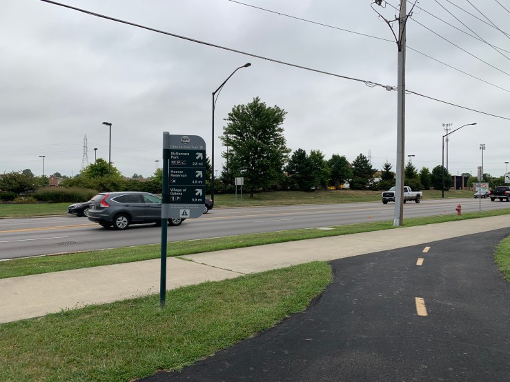

Once I departed from the Maxtown Road area it became much quieter. I took the Genoa Trail which parallels route 3 and ends around the north side of the Hoover Reservoir. The reservoir was pretty to ride next to. A older guy on a nice road bike zipped up next to me and asked where rode from and where I was going. I told him, he gave me a very enthusiastic handshake and wished me well with some encouragement before he zipped away. That made me smile.
The next town north on the route is Galena. I was told of a good restaurant there, but when I got close I decided that I was not hungry enough to eat my second breakfast yet. I knew that Sunbury was only about three miles further. I had eaten at a great diner there last time I came through.
Sunbury is a neat little town. It has a traditional town square, with a brick road. Shops dot the edge of the square.
In the middle of the square is some sort of government building or museum – but I did not take a good look. I did find a statue of Johnny Appleseed there, though. The plaque says he was a frequent visitor to Sunbury.


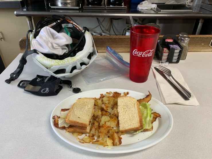
After making a slow loop around town, I decided that second breakfast was in order. I went to the Sunbury Grill and sat in exactly the same place I did last time. I ordered up a BLT and home fries. It was deeeelicious.
As I was waiting for my food, the music was playing a song by the Eagles. I was reading news on my phone and didn’t realize I was singing along to myself. The waitress payed me a compliment and said I should sing louder. It was funny since I had not realized anyone could even hear me.

Leaving Sunbury I had about ten miles of surface roads before connecting to the next trail. When I turned onto the first main road out of town, there was another cyclist going up the hill about a quarter of a mile ahead of me. At my normal pace, I caught up within the first mile and we struck up a conversation.
He is a plumber from Cincinnati and “got a wild hair to ride to Cleveland.” Without much notice or preparation, he just packed up a tent and a few belongings last week and started riding the OTET north. He’s never ridden farther than about 65 miles from his home. He’s on a single-speed bike which gives him some trouble on the hills. We rode together for the full distance to get to Centerburg – roughly thirteen miles. It was a very comfortable and relaxed pace.

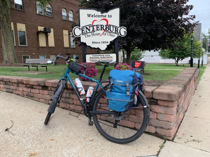
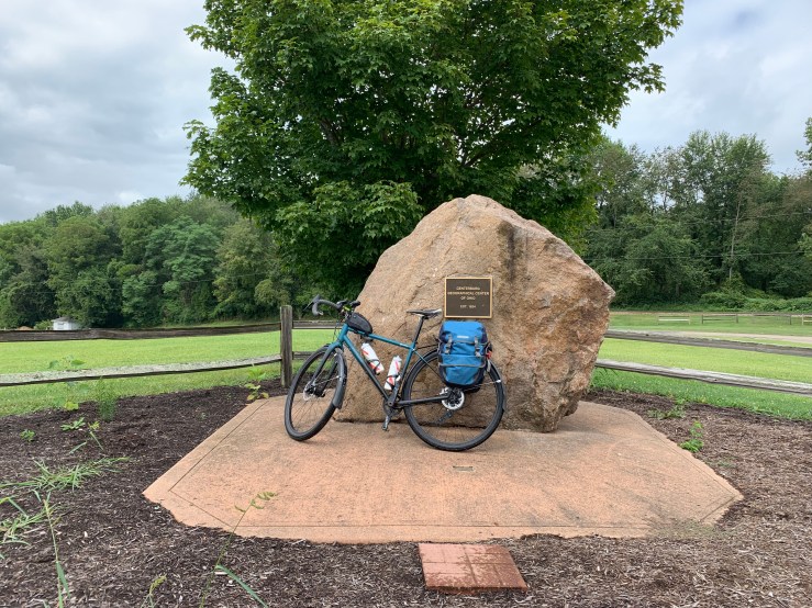
The next town is Centerburg. It claims to be the geographic center of Ohio – hence the name. My riding buddy went off in search of water and food. I decided to try to find the rock in the town that claims to mark the center.
After googling a bit, I still was not exactly sure where to find it, so I rode into town, and rode around and around looking. I found someone and asked. They had no idea. So, I just found a park and there it was!

The park was east of town a bit and turns out to be right on the side of the trail. If I’d gone back to the trail, I’d have found it easily.
The plaque on the rock says it is the center of Ohio. There ya go – it must be official.
The weather today was nothing short of perfect. It was overcast all day, just a few very minor sprinkles, comfortable temperatures, and I even had a bit of a tailwind for most of the day. That never happens.

I had seen this tower last time we came through but we did not stop to investigate. I had since read that it is part of the “Ariel-Foundation Park” built on the former site of a PPG factory. You can climb the 224 steps to the observation deck that is 140 feet above the ground. I decided I had to do it.
I’m not a huge fan of heights, but they usually don’t bother me. I will admit that about half way up, looked down at my feet through the grated steps and started to lose my nerve. But then I thought about how some kids I know with anxiety feel and I decided I would conquer the heights.
For people who deal with anxiety, everyday things that seem safe or easy can cause panic, fear, and real physiological effects. I knew there was no way I would fall through the steps, but it made me a little fearful and my heart raced. That’s the closest I can come to trying to understand what anxiety must be like: a perfectly safe situation felt very unsafe.
So I climbed and climbed to the top. The view of the surrounding area was breathtaking (for real). So after looking around and taking a couple of pictures, I decided to very slowly and deliberately climb back down, holding the handrail.


Overlooking the surrounding area of Mt. Vernon:

I can’t see it very well, but my bike is locked up directly below my feet one hundred and forty feet below.

Safely back on the ground, looking up:

The Heart of Ohio trail continues past the park and just south of Mount Vernon. I was planning on going into Mount Vernon, but the street traffic was feeling very aggressive and I was starting to run behind schedule. So I decided to just move on. Next time, though!

One of the very few signs that shows Cleveland – 148 miles to go!

Leaving Mt. Vernon, I picked up the Kokosing Gap Trail, named after the Kokosing River and the railway that used to run in this area.
The trail runs through the edge of Gambier, the home of Kenyon college. There was a very well restored steam train on the track there:


Right after taking this picture, I must have accidentally dialed my mom. I thought she had dialed me. We had a nice conversation for a few minutes. I think she has been a bit nervous about my solo travel, so it’s good to connect. Love you, mom! Yes, I’m being careful. (And yes, I’m talking to lots of strangers)
My next stop for the night before going to my B&B was to get dinner in Danville. The Kokosing Gap trail ends here. I stopped at “The Hangout” and got myself a steak, peaches, a salad and some fries. It was deliciously bad for me and I enjoyed it thoroughly. Going back to watching my diet is going to be very disappointing when I get home.
The last stop was the trip up to my AirBnB: Taigon Hills vineyard. I had to do a bit of climbing to get to it. My legs have been doing so much flat riding the last few days that it hurt to get back to the climb.
The owners decided to buy this property sight unseen in a bank foreclosure. They felt called to put in vineyards even though they did not know anything about grapes. This is their fourth season and things are starting to take shape.
They are also breeding Taigon dogs – a very rare breed and decided to name their vineyard after the dogs.
After a very heavy scrubbing, I’m settled in and I am going to bed early tonight!
Tomorrow I have a longer day, with a lot of hills. Weather looks to be rainy all day, too. Every pilgrimage has its challenges – just the way it is supposed to be!
I will arrive in Massillon tomorrow afternoon and complete the first major part of my pilgrimage, arriving at St. Mary’s church where the relic of St. Dymphna resides.
More tomorrow!
Peace!
St. Dymphna, pray for us.
